Summer 2007 Cruise – Leg 4
|
Date |
Safety
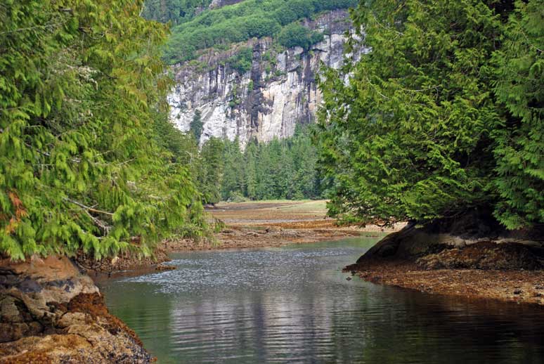
Boat Cove, Plumper Islands to Port McNeill, Vancouver Island |
Weather |
|
|
|
Sunny with cloudy periods |
||
|
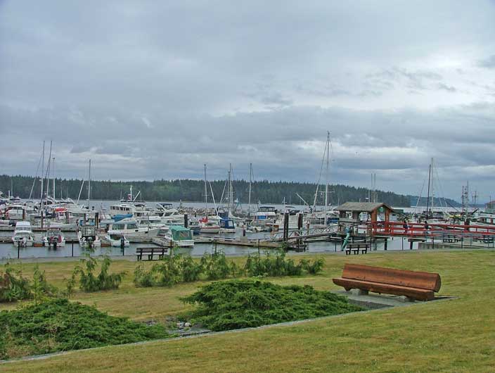
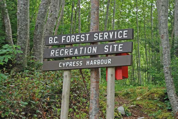
Park and Harbour
Laundromat and annexing Bill MacKay’s Whale Watching Business
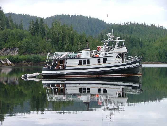
Sea Foam at Port McNeill Dock
Local Pub and Steakhouse Behind on |
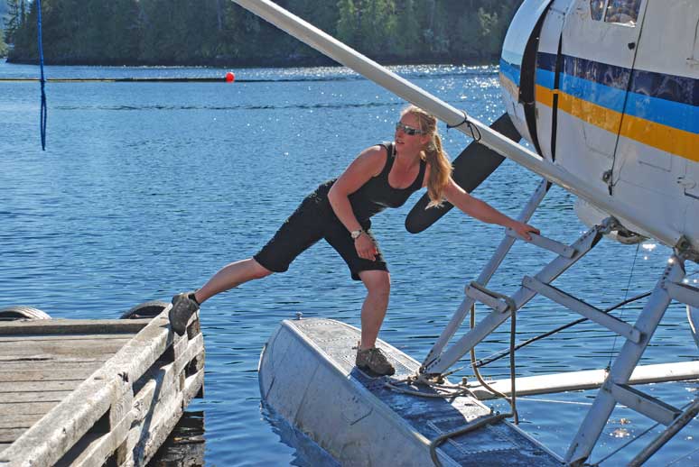
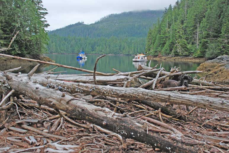
After breakfast we made preparations to pull anchor and move on to Port McNeill. Rick took Kona to shore and while he was out in the Catch-Up he untied our shore line from the tree behind us and we were ready to pull the anchor up. We said goodbye to Safety Boat Cove and pulled away heading north for Port McNeill. We were able to check our e-mail with a stronger signal as we came out of the cove. The day was warm and sunny and the sea was calm. After about an hour and a half we were approaching the
breakwater at Port McNeill. We radioed
ahead to the harbor on channel 66A when we were about ten minutes away and
asked if they had any space for us on the dock. We timed our arrival well as check-out time
is After we were settled we headed for the nearest, newest Laundromat. While I threw the laundry in Rick checked his e-mail on the computer set up in the Laundromat. It was an expensive Laundromat in comparison to others we have used in the past but the free internet access was a bonus. We thought we would use their wireless connection to upload our log but when Rick went back to the boat and tried to set it up with one of our laptops he determined we had a worm or a virus in our computer as it would not connect. He spent the rest of the afternoon trying to solve the problem. He decided to re-format the hard drive and he was rubbing his head and uttering bad words most of the afternoon. I decided to make tracks and get out of the way so after the laundry was stowed away I left to go grocery shopping. I also inquired about the location of the local dive shop while I was out. Rick needed a new pressure gauge as the all-in-one gizmo he was using stopped telling him how much air he had in his tank. This being important information he decided he better search out a new one while we were here. When I returned we had dinner and read until 2200. A long day of chores was over. |
||
|
Date |
|
Weather |
|
|
|
Sunny with cloudy periods |
||
|
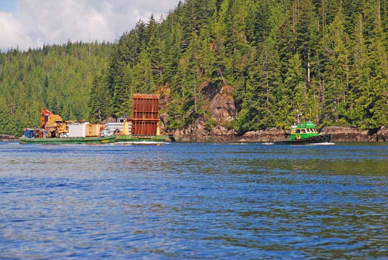
Sea Air Re-Fueling
Fuel Dock at
|
I had a 0900 appointment in town to get my hair cut. When I returned the Captain was preparing to install the new alternator. He had been told the phone numbers of the dive shop and had not yet made contact with the owners. He was able to leave a voice message and now was waiting to hear back from them. We had some people admiring the boat and wanting to have a look at it so we invited them on board and answered their questions. They owned a plane that they had to sell first and were anxious to switch from flying to boating. That morning we also met the people beside us who were
from Rick also met some folks on the dock that were from Later in the afternoon Rick got the return phone call from the dive shop and they picked him up at the dock and drove him to their shop. He returned $350 poorer with a new pressure gauge that has a compass, pressure gauge and depth meter all in one. I offered to give him back his wrist dive computer and he agreed he should have that as it indicates how long we have been down at certain depths and when and what rate we should ascend. I thought that seeing as he is the dive master he should have the device with the most information available. I now have the new gauge on my gear! While Rick worked on the alternator I read and relaxed the day away. He successfully installed the new alternator with little difficulty. My Captain can fix anything! After dinner we watched a DVD and retired by 2200. |
||
|
Date |
Port McNeill to Tracy Harbour, |
Weather |
|
|
|
Cloudy, rainy periods but flat calm seas |
||
|
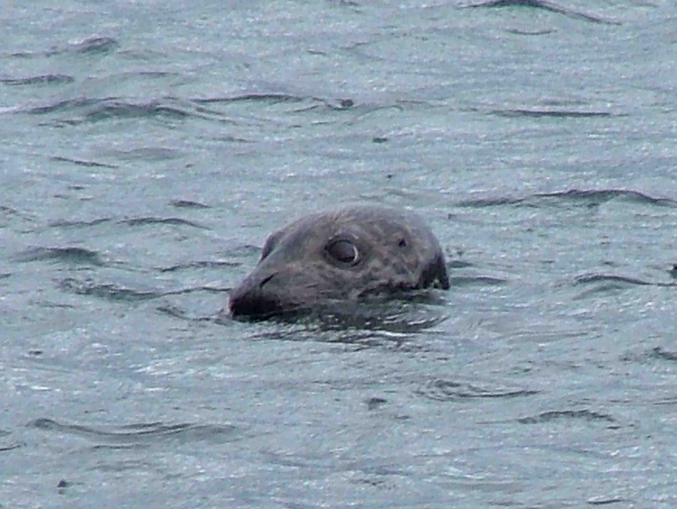
Seal Mooch
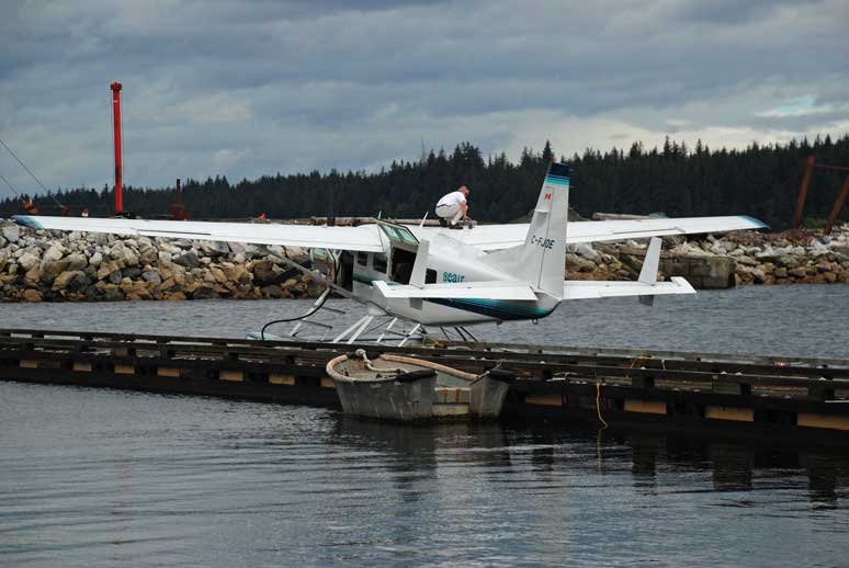
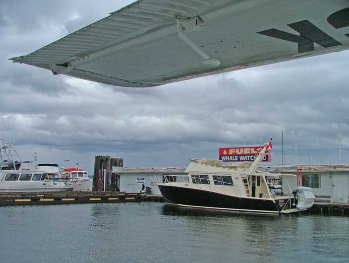
Sea Foam fueling up – view from float plane dock
Smooth Crossing –
|
We woke up today with a wind whistling through the docks. The winds are supposed to die down by this afternoon. Rick took Kona to shore and went to pay our moorage ($35.00 a night including 30amp. Power and taxes). While he was gone I started washing the boat, something I was suppose to do yesterday but I got carried away in my book. While I was washing the boat the First Mate from the MV Kittyhawk came by and we chatted about boating and their plans for the summer. She and her husband, Dick, have been boating for 50 years. She was a lovely while haired lady who looked to be in her mid to late 70’s. I am always amazed at the number of “elderly” boaters that we see when we are out. Last year we traveled for several stints with a couple who were 80 and 83 years old and still goin’ strong! Rick returned and started filling up our water tanks with
another hose while I finished washing the boat. We pulled away from the dock at 1230 and
headed for the fuel dock just across the way.
The price of diesel was ninety-eight cents including provincial sales
tax. We have used 550 liters since
filling up in I was somewhat concerned what the sea would be like when
we pulled away from the fuel dock because the wind was still blowing
strong. It seemed to be just a local
wind because as we motored away towards We saw only one humpback whale surface once as we passed We arrived at Wells Passage and it had started to rain hard making the visibility like fog. We wanted to anchor in Dickson Island’s little northern notch but when we arrived there were two other boats already in there and one had lines going out every which way to shore so there was little room for us to move in. We carried on another 3 miles to After dinner we relaxed and worked on pictures and the log and retired. The wind was gusting through the anchorage and sometime in the middle of the night it started to rain hard again. |
||
|
Date |
Napier Bay, Tracey Harbour to Richmond Bay, Drury Inlet |
Weather |
|
|
|
Cloudy with small sunny breaks |
||
|
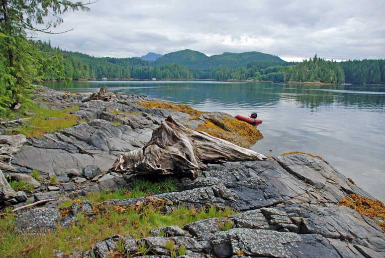
Dormant Log Skid at
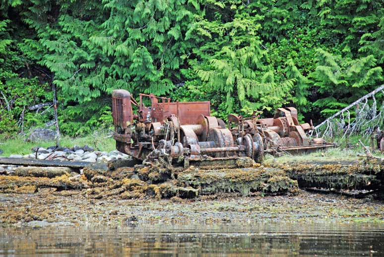
Abandoned Logging
Machinery at
Nitamat Chief in
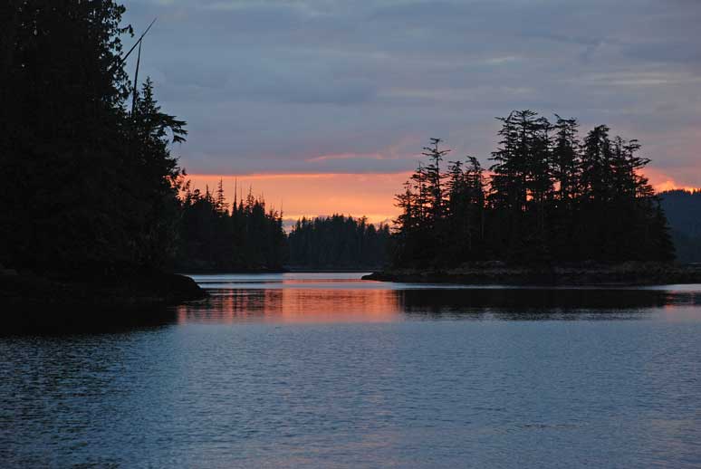
Sunset in
|
We woke up and made some calculations as to when we could
transit another set of narrows to get through to Drury Inlet, our next area
of exploration. The currents in Drury Inlet is much less traveled than other waters in this area. There are several narrows to negotiate before getting to the end of it and that puts many mariners off. This inlet is different from the other inlets in the area in that it is oriented with its head northwest of its mouth. Southeast winds can generate nasty conditions here consequently. While most inlets in this area have a steep shoreline Drury’s terrain is relatively flat with low lying hills. This allows the westerly winds to get in as well. After breakfast we pulled anchor and headed away. As we slowly putted out two other yachts slowly putted in. The one pulling up the rear had two dolphins clowning around in the stern wake from his boat. We were leaving early, 1230, so we decided to travel
slowly to our next destination, the mouth of Drury Inlet. When we arrived there after crossing into
Wells Passage and heading north a short way, we were still early for slack water. Because we have never transited these
narrows we wanted to play it safe, especially in that it was flooding into
the inlet. If we started in and the
current was more than we expected we would be committed to going forward with
the flood current carrying us in whether we liked it or not. At least with an ebb, and the water pushing
you back, you have more control over your bow and the decision to not proceed
is much easier. We decided to go past
the opening and carry on into The winds were light and the bay was deserted except for a string of crab traps left by commercial fishers. After enjoying a peaceful lunch we pulled anchor again and headed into Drury Inlet. When we arrived at Once settled we headed off in the Catch-Up to take Kona to shore and explore potential dive spots for tomorrow. My Captain thought that the rock in the narrows would be a good spot with the current swirling around it all the time. Only one side of the rock proved to be very deep and it would be tricky to dive there the way the current came around the island and the fact that it had no real place or shelter or back eddy to keep you safe from the current. It started to rain and we continued to motor around checking out dive spots as we slowly made our way back to the Sea Foam. The sun came out from time to time and a light rain came down just as often. After dinner we listened to our satellite radio jazz tunes and retired. We were looking forward to a peaceful nights sleep and more exploring of this inlet for tomorrow. |
||
|
Date |
|
Weather |
|
|
|
Sunny with cloudy periods |
||
|
The next day in
Off to Shore Duty
Commercial Business in Drury Inlet |
It was a quiet night and the morning was gorgeous. We decided to continue up the inlet today
and visit the marina at We explored the “Cook House” and the “Gift Shop” and took
Kona up to the main house to explore the grass area. Many logging roads surround this area as it
was once the site of a logging and shake operation owned by Allyson’s father,
Jerry Major. Tom will take you in his
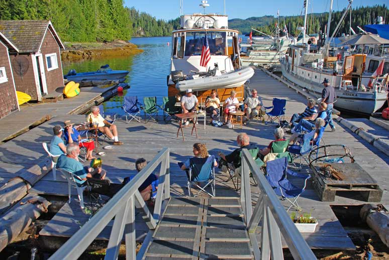
truck to We were told “happy hour” would be around 1700 so we had plenty of time to head out for a dive. We decided to go to a spot that Rick had scooped out early today just west of the narrows. It was reported to us by Allyson that Welde Rock was a good spot but it was only accessible for us at low tide and it was turning to an ebb at this slack. The rock would be underwater at high slack and there would be no where to tie the boat to. We got into the water late and the current was starting to move so we stayed low and heavy in one spot under the way and enjoyed looking at the life tucked into the rocks and crevices. We didn’t travel too far east or west as the current was prohibiting. As we slowly motored back to He told us there was good ling cod fishing in the Richmond Bay area and that he had caught a 45 inch cod just last week in this spot. The rocks around Leche Islet were his favorite spot. We returned to the dock in time to shower and throw together an appetizer and head to the cook house to get to know the folks on the dock. Rick and I don’t typically go to the dock as we prefer the privacy and quiet of remote anchorages. We decided that once it a while it’s good to go to the smaller marinas to meet new folks. We have found that the people we meet and enjoy are the ones we continue to run into year after year. After dinner we were invited to join the group at the campfire for Allyson’s famous “smores”, toasted marshmallows and milk chocolate squished between two graham crackers. Very rich and very yummy. |
||
|
Date |
|
Weather |
|
|
|
Foggy morning, sunny with cloudy periods |
||
|
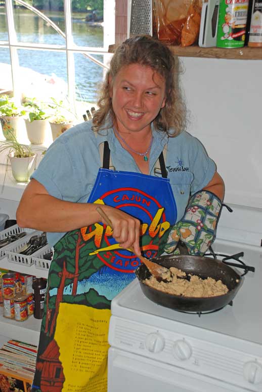
Allyson Happily stirring her Rue for Creole Night’s Gumbo
Captain Bill from the Sher-Shan Showing off his prawn catch
Sea Plan Pilot Heading Back to Port McNeill
Creole Night on the Dock
Tom Allo Workin’ Hard |
One thing I hate about being on the docks is that people all get up earlier then I like to and start chatting and laughing on the dock and waking me up! Coffee was served in the cook house and by the time I got around to getting some several of the boaters had returned from picking up their prawn traps. It was inspiring to see that several people had caught some really nice sized prawns. Bill, from the Sher-Shan came back with about 30 nice sized ones and another fellow from a sailboat came back with about the same number but they were shrimp size and a different species altogether. Today was a lazy day around the docks with plans to put out prawn traps, sand and oil the cap rails on the Sea Foam and help Allyson prepare the “Creole” night dinner. Marlene, Allyson stood by the stove, after chopping up onions,
garlic, peppers and celery for the jambalaya, and stirred her “rue” (flour
and oil) for 45 minutes for the base of the gumbo. As she stirred she told us the history of
her family in this area and her growing up in Kellogg When I came out of the cook house Rick had finished sanding the cab rails and I volunteered to rub the teak oil in while he went out with Kona to check our prawn traps. He returned with about thirty five good sized prawns for his efforts – pulling up two traps and two hundred and fifty feet of line! We were to take our own bowl for gumbo, plate, cutlery, and a vegetable side dish or dessert. Dinner was fantastic and there were eleven boats at the dock to enjoy the evening. One woman made the most delicious berry pie for dessert. |
||
|
Date |
|
Weather |
|
|
|
Foggy morning, sunny all day |
||
|
Didn’t You Know?!! Banana Peel makes great bait!
Scuba Diver O’Rion
Sun Fun Divers Crew
|
We spent the morning taking pictures of Allyson and her family and then watched as a dive boat from Port McNeill came in with barrels to sink under the docks to give them more buoyancy. It turned out it was the same dive company that Rick got his pressure gauge from while we were in Port McNeill. Trudy and her husband, Steve their two daughters and a friend, Greg, came to help put the barrels under the dock. The kids were suited up in wetsuits to snorkel around the docks. Orion and Charlie were happy to have friends to play with their own age for a change. Steve spent some time in our pilot house pointing out on the charts where many good dive spots are in the area around Port McNeill, Port Hardy, and the Plumpers. He and his family were very friendly and we hope to meet with them again next summer. All the boaters that we met on our first night here had left early this morning. We were the only ones to pull out at 1600 after buying a few things from the gift shop and settling our bill. We said goodbye to Tom and Allyson and wished them well for the rest of the season. We headed out into Drury Inlet again heading west to
anchor in My Captain navigated us easily through the rocks and the
current was still flooding slightly.
We anchored in After supper and shore duty for Kona we retired to read and relax. |
||


|
Date |
|
Weather |
||||
|
|
Foggy morning, sunny with cloudy periods until |
|||||
|
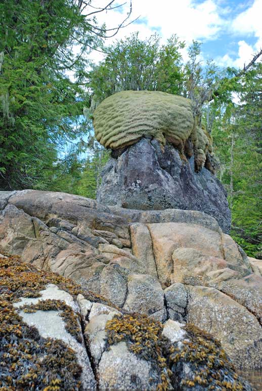
Angel Hair Moss Outside England Point
First-hand Sampling of Moss Hair
Beached Barge in Below England Point
Steam Barge in Creasy Bay
Entrance to Bond Lagoon Water Flooding In
Kayaker at Rest
Brain Moss on the Rock |
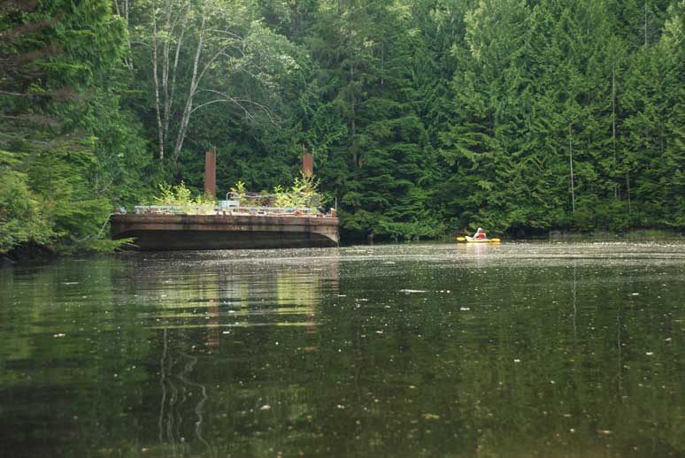
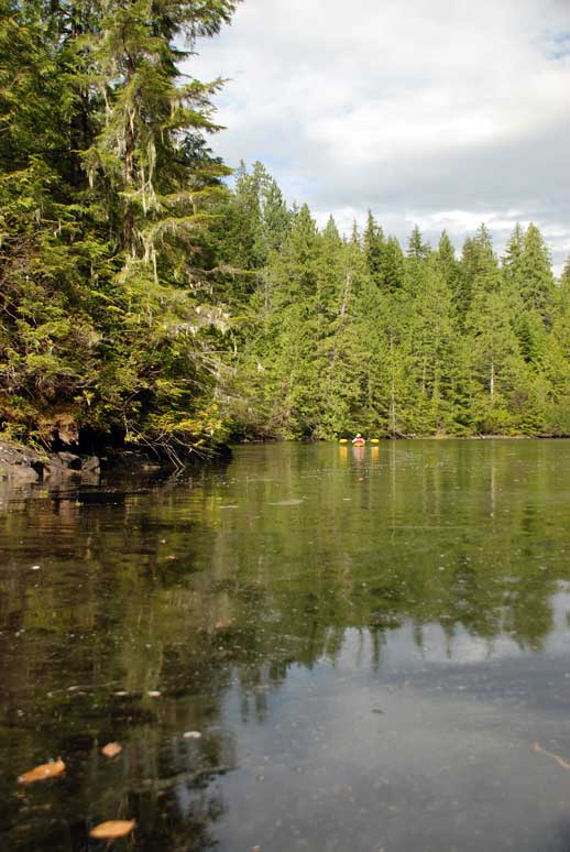
Once up and around we planned to spend the day kayaking to the end of Actaeon Sound to Tsibass Lagoon. The current would be in our favor until 1800 and then would switch and push us homeward. The round trip would be ten miles and a great way to explore. We left at 1400 and the narrows just outside our anchorage proved to be where most of the current was. We only had to steer the kayaks as the flood current was pushing us along at a good clip. I stayed near the shore where there was less current to deal with. We paddled up to Bond Lagoon that is only passable at high tide. As this was the middle of the tide rising, the narrow opening was filling into the lagoon and the water was rushing through. We padded as close as we dared so we didn’t get sucked in with no way out for several hours. We continued on along Actaeon Passage and next came to By now we were getting hungry and were looking for a place to stretch our legs. The area had little in the way of landing beaches and the trees came to the water line. We paddled into a mud flat bay just south of England Point and found an old barge beached at the back of the bay. The wind was whistling along the passage and we were able to see if this anchorage was protected from it. It had only a ripple in the area and did seem a good spot to get out of the wind. We climbed out for lunch just a short distance away from England Point and around the corner was a building that we thought was either a fish farm or logging quarters. Just beyond that was Tsibass Lagoon where, when the water ebbs outward, there is such a rush of water that the water outside of it is covered with foam. As we munched on our lunch a tug was heading toward the lagoon, the Fraser Yarder, pulling a small log boom. Within about twenty minutes he was coming back down empty and slowed down so his wake wouldn’t bang our kayaks against the shoreline. Rick called him on our handheld VHF to thank him for his courtesy and they had a nice little chat before signing off. When we climbed into our kayaks for the return trip home the clouds had rolled in and the wind had picked up. As we paddled along we were pushing against a one foot chop. I paddled closer to shore in an attempt to get out of it. It was at its worst at Creasy Bay where it was more open and the wind slid down off the rocks and out from the opening of Bond Lagoon. When we turned the corner at Bond Lagoon and headed west
the wind did not slow as we had hoped and the ebb current was not helping as
we had predicted. We continued
paddling and it wasn’t until we were almost at our anchorage that the current
made itself known. Just as when we
left, the current was really only noticeably at the bend in the road at I was glad to reach the boat and climb out and Kona was equally glad to have us home again. We ate a late dinner at 2130 and retired after a good paddle on the water. |
|||||
|
Date |
Skeene Bay to Dickson Island to Cypress Harbour, Broughton Island |
Weather |
||||
|
|
Sunny with cloudy periods and windy |
|||||
|
Dinghy Rescuers
Tugboat Captain Memorial At
Entrance to Old
Logging at
Trail through Alder Trees |
The wind continued to blow through the night and was weaker this morning. We decided to go through the narrows before high slack as recommended for this narrows. High slack would not be until late this afternoon and we didn’t want to wait in there another day. It was still ebbing so my Captain took the Catch-Up through the area and determined that it would be fine. He would rather see the “alligators” at low tide as long as the current wasn’t too much which it wasn’t. We motored through the tricky parts without
difficulty. As we were approaching We came out of Actress Passage without any difficulty and
noticed that the same yacht was still anchored in the We stopped back into When we arrived at this narrow section the current was flooding in at about two knots. As can often happy near such waterways some boaters get panicky and power up to get through. We had a boater come up beside us doing just that. I slowed down to meet his wake and he left a standing wave from his wake in the narrows as we transited through. While at We were tossing around the idea of crossing We decided to head south in Wells Passage and head for The sun was shining brightly but the wind was blowing up
the Passage. We tucked into the anchorage
on the north side of We headed back out to Wells Passage and answered some
e-mail. We would be picking up Rick’s
sister, Gale and her two children, Nikki and Ali, at We plotted our course to head to |
|||||


|
Date |
|
Weather |
|
|
|
Cloudy but warm |
||
|
Captain John and Mate Jeanne from the MV Hyacinth
View of Laura Cove From NW |
Once we were up and around we wanted to explore the inner basin at low tide to see where the rock was and what the area looked like at low tide. It would be more protected place to anchor and more secluded and private as well. Changes of seeing wildlife along the shoreline would likely increase as well. We should have dropped a crab trap last night but too late now. As we headed into the back bay, We stopped and spoke to the people on the Ocean Mist and they told us they had been coming to his bay for years and they believe the rock is of no particular hazard to them either. We continued on into the head of the bay and it was seven to eight feet in the middle and likely a great place to catch crabs. We took the Catch-Up to shore, put out the long anchor as the tide was rising, and started to hike into the woods. Just as you enter into the forest there are picnic tables and fire pits. I was surprised to see many huckleberries on the bushes around the area as well. I determined with my own logic that there can’t be bears in the area or all these berries would be gone. Either that or the bears can smell humans in that area and stay well away. We walked through the trail and there was a rock face on
our left and the head of the bay on our right through the trees. One of my guidebooks said that the trail
leads to cabins and a marsh not too far along. We walked for about twenty minutes along an
even alder lined trail and eventually it became thick with alders and too
difficult to walk any further. We turned
around and met two other travelers along the trail that decided to turn and
walk back with us is there wasn’t anything exciting at the other end. They were off the SV Shadowfax from the We headed back to the Sea Foam and made ready to head to Laura Cove just up the road about six miles. We arrived in Laura Cove to find friends we had met in We invited John and Jeanne over for Happy Hour and chatted away the evening. Dinner was late tonight – 2100! We retired after a full day of boating activities. |
||
|
Date |
|
Weather |
|
|
|
Cloudy but warm, sunny in the afternoon |
||
|
Fresh Landslide Debris In Simoon Sound
Captain and Crew Of SV Northair in
Preparing to Prawn |
After breakfast and shore duty for Kona we packed up our prawn traps and headed for Simoon Sound. We dropped our two traps (condo prawning) just across from the fish farm at the entrance to the Sound. We carried on in the Catch-Up to explore Simoon Sound. As we turned the corner to the west we saw on the south shore a recent landslide. The trees were still green and the debris was piled thick. We motored over and took some pictures and then carried on into McIntosh Bay. We found three boats anchored there and stopped to chat
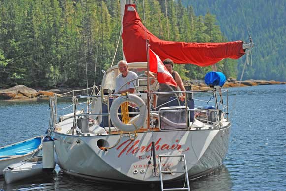
with a sailboat, the SV Northair. The
folks were from We found fresh bear scat on the mud flats and took pictures of the small sandpiper like bird pecking at the small insects on the beach. We headed for home after about two hours of exploring and
got back to Laura Cove and explore the western most basin, We settled down in the Sea Foam and enjoyed our evening meal and a relaxing evening on the water. |
||


|
Date |
Laura Cove to Watson Cove to Wakhana Bay to Kwatsi Bay |
Weather |
|
|
|
Cloudy but warm |
||
|
Happy Hour at
Waterfall at
Scenic Views From |
After breakfast we decided to take the Sea Foam across to
Simoon Sound to collect our prawn traps.
We said goodbye to the Hyacynth as they made ready to head to When we reached the prawn traps, Rick switched off the Sea Foam and jumped in the Catch-Up and Kona and I waited and watched while he pulled the traps up. On his return I was pleased to discover that he had pulled up twenty-four large prawns and about the same number of the smaller variety. Prawn dinner tonight – yippee!! We decided to head off up to Tribune Channel to
explore. I radioed We then stuck our nose into Watson Cove, just behind the fish farm by the waterfall. It was a small, high granite walled cove but open to the west winds that would blow up Tribune Channel. We decided it wouldn’t do for an over night anchor spot. We next headed for Wakhana Bay and found it to be a very pretty spot but very deep. In fact, all the anchorages off this channel are deep, sixty feet being about the best you’re going to get. Our guide books told us that the southeast side was the best spot and we could see that would be where the least amount of wind could get at us. Just as we were getting ready to drop anchor we got a call
on the radio from Anca at We arrived on the dock at 1600 just in time for a quick walk for Kona and Happy Hour on the dock at 1700. Delores and Frank from the MV Encore were the only boaters
we knew from meeting them at I got speaking with her and she has been boating since she was five years old. She gave me a few pointers on her docking methods and admitted that having twin engines makes things a lot easier. She told me to throw my bow line to people on the dock, tell them to tie it forward, not aft and go into reverse. If the boat moves away from the dock go a little forward and then back into reverse again and let the bow line pull your stern around. Sounds simple enough. I’ll have to give it a try sometime. We returned to the Sea Foam for our prawn dinner and retired early to read and relax. |
||


|
Date |
Kwatsi Bay to Bond Sound to Maltilpi |
Weather |
|
|
|
Cloudy |
||
|
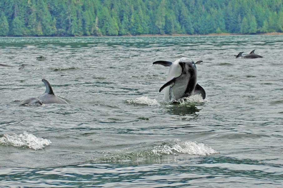
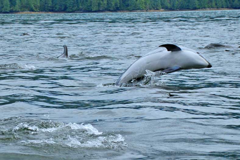
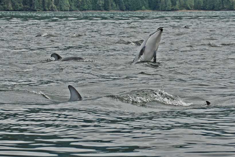
Dolphins at Play In
So Close You Could Also Reach Over and Touch Them
Another
Close-Up of Above
Maltilpi Sunset
Tribune Channel
To Knight Inlet
|
We had a peaceful sleep but as always, noises on the dock roused us out of bed early. After breakfast we took the Catch-Up across the way to the trail that leads to a waterfall. Before we left I visited the gift shop and paid Max for our overnight stay. Before we left for the walk he gave me an air horn and asked that if we see the bear that hangs around the area, please blast the horn. He doesn’t want the bear to get used to humans without associating them with some level of discomfort. This made me nervous but he assured me that the bear would run off if it heard us coming. We followed the trail to the waterfall which was only about a five minute walk for us. The site was beautiful even though I kept looking over my shoulder for Mr. Bear! The water on the dock is plentiful and we were invited to fill our tanks which we did. After seeing the water pouring off the rocks it was understandable why they would be able to share their water supply so freely. The water is filtered and when we filled a glass with it, it was clear and tasted fine. As we were preparing to leave we had a short chat with the
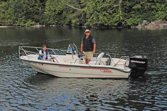
folks from the MV Northern Conquest, a 30 foot Boston Whaler from Soon after we shoved off and headed for Max from We motored in and noticed two small fishing boats at the mouth of the river. Two men were fly fishing and standing in the water about knee deep. We could quickly determine that the Catch-Up would not likely make it in there. As we prepared to anchor Rick went to the stern of the boat to pull the tender in close to the boat. By the time he got back to the helm we had drifted into five feet of water!! Yikes! We were on the edge of the mud flats just as quick as that. He slowly eased us out of that problem and we anchored in fifty feet of water instead. We had spent too much time chattering at As we were anchoring I noticed a commotion off our starboard bow and to my great delight it was about fifty dolphins playing around along the shore line. We jumped into the Catch-Up and motored over to them to see if we could get them interested in playing in our wake. They were interested and we put the boat at about six knots and threw up a deep wake for them to play in. They jumped around in and out of our wake and seemed to be having a great time. Kona on the other hand was very distressed. They came so close to the boat and blew through their blow holes that she thought we were under attack. She was barking and growling and standing up on the pontoons trying to get a bite at them. One guy came right to the back of the boat and I could have reached over and touch him except I was hanging onto Kona’s collar to keep her from jumping right in after them! Several of the dolphins had little baby guys close by their sides as well. We saw several leap right out of the water and twirl in mid air. They were having as much fun playing around as we were watching them. After about twenty minutes and four hundred and fifty
three pictures we decided to leave them along. We took Kona to shore and talked to a
couple off the SV Angel Wings who kept their boat down the We climbed back into the Sea Foam and headed off down
Tribune Channel for It was indeed a pretty passage and there was a float home at the narrows with miscellaneous this and that spread around. One boat was anchored on the south side of the narrows and he appeared to be quite comfortable. The wind was blowing on his burgee but there were no waves to speak of. I marked the anchorage on our charts for future reference. When we turned westward into Knight Inlet the wind was
waiting for us. The wind and current
were opposing so we had steep three footers coming on our bow. The Captain wanted to travel through slowly
so the salt water would not spray over and salt up our windows. We motored comfortably along for a time and
then turned south again into Chatham Channel at We poked into Cutter Cove, across from the Blow Hole, to see if that was a possible future anchorage and we both decided almost immediately after entering into the cove that it was exposed and open and not a spot we would choose for an overnight stay. We headed into the narrows at Chatham Channel and had timed our entry well as we had no trouble with the current there. We got through the narrow spot without incident and turned south into Havannah Channel heading for Burial Cove. Our friends, Mark and April, from the MV XXIV VII had anchored in this cove on their way north and said it was a nice anchorage. When we arrived there it was very windy in the cove although there was only a slight chop on the water. Being the fussy one for a flat calm anchorage and asked the Captain to cross Havannah Channel and head into the Indian Islands were we could tuck in behind at Maltilpi. There was one other large boat in the anchorage and it
really only has room and good depths for two or three boats so we were lucky
to get in there and comfortable. The
night was calm and we had a relaxing supper and retired early for tomorrow
morning’s early transit of the potentially hair raising and tenuous |
||