Summer 2008 Cruise – Leg 3
|
Date |
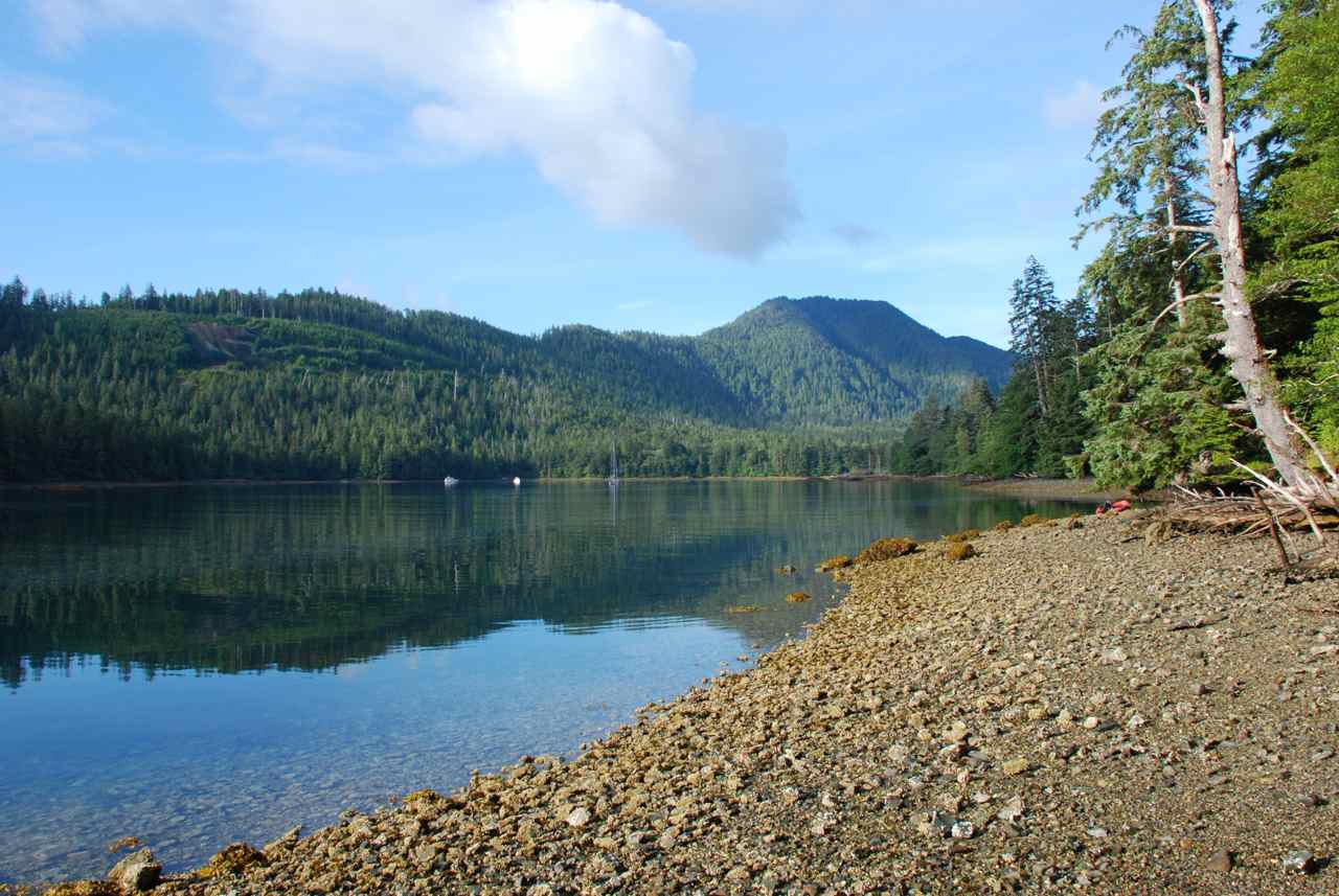
Gordon Cove, Cumshewa Inlet |
Weather |
|
|||
|
Monday, July 14 |
Cloudy with sunny periods. |
|
||||
|
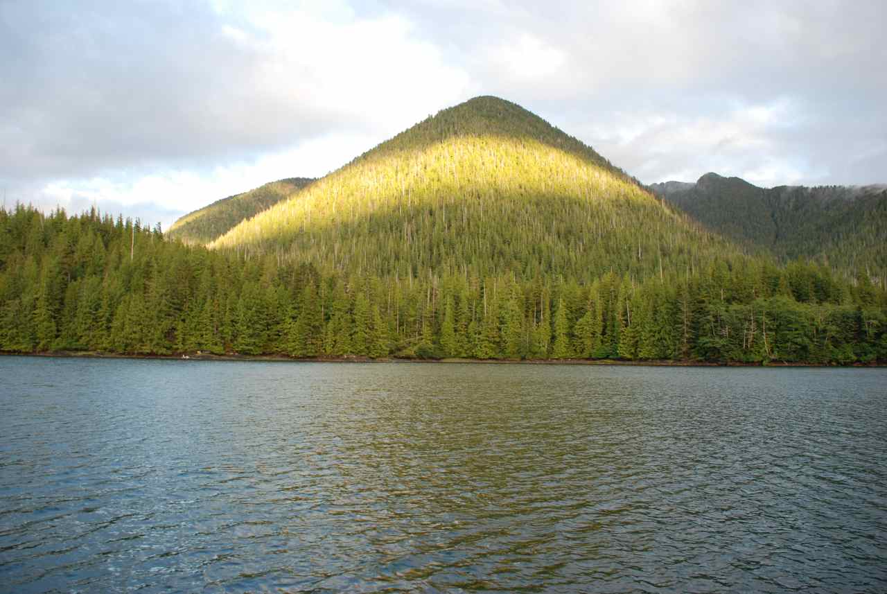
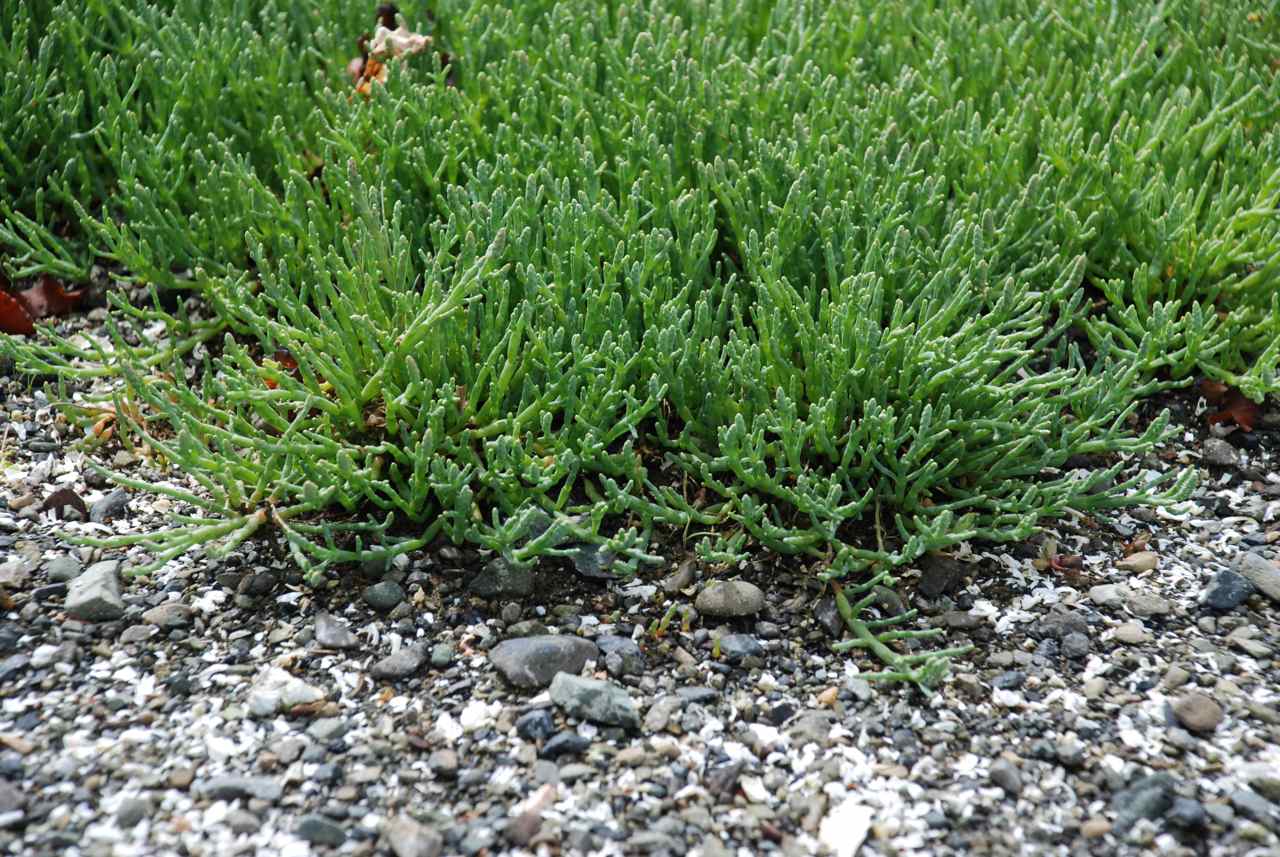
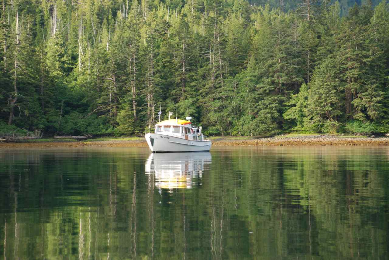
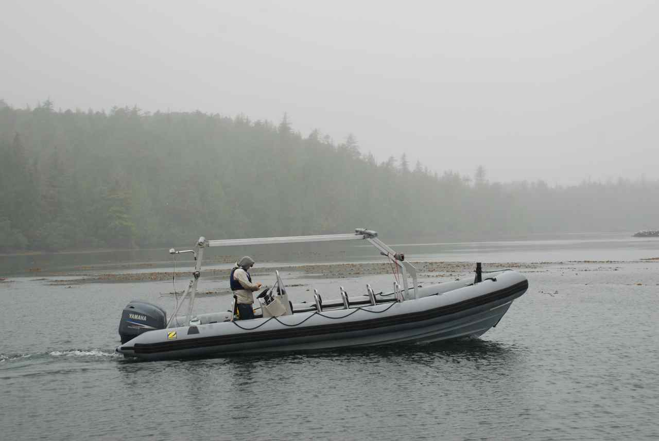
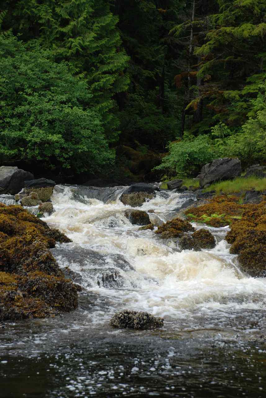
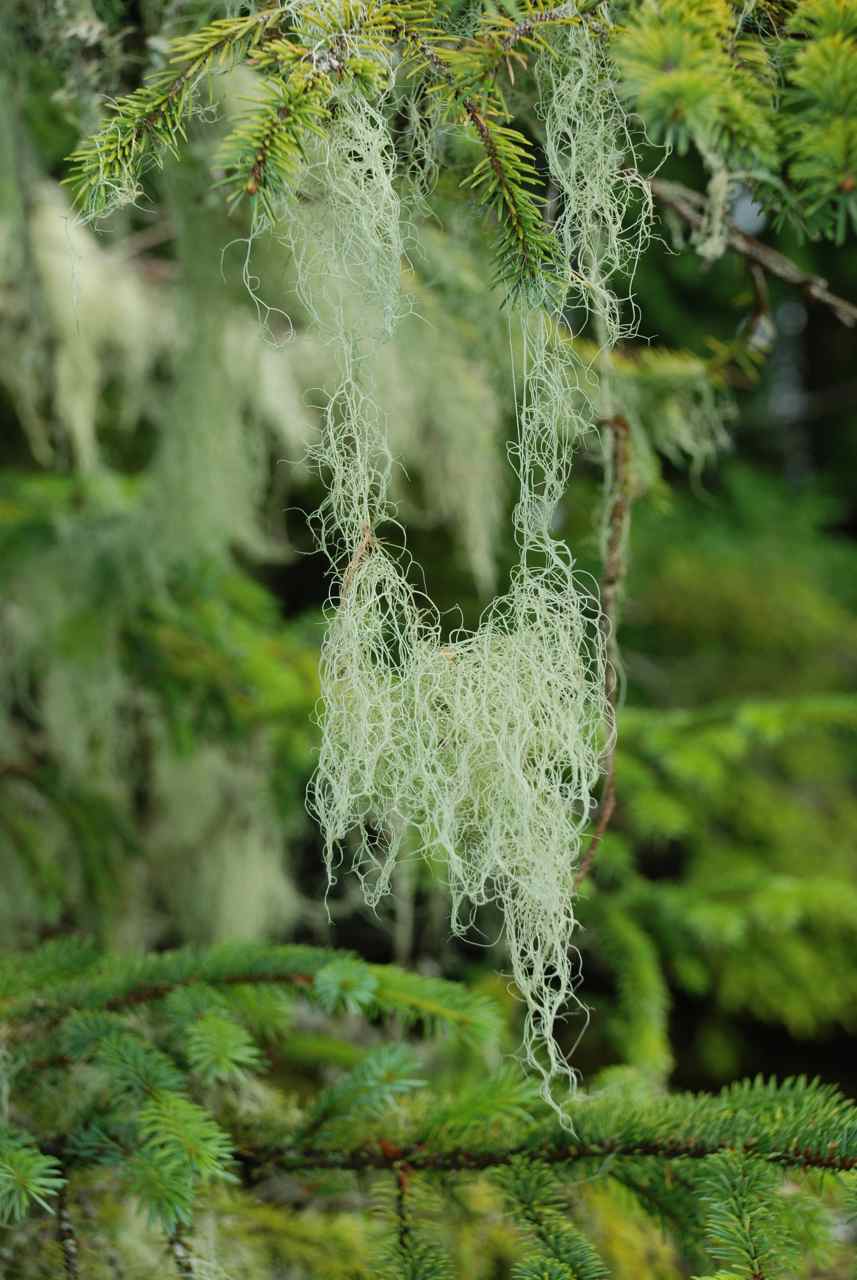
Sea Foam in Gordon
Cove |
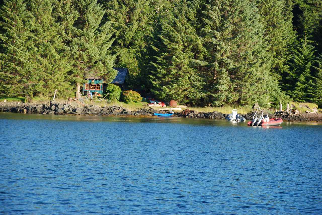
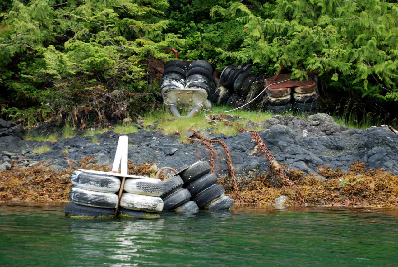
Had a lazy start to the day after waking up for tides and sea conditions for the last two weeks. The mooring buoys indicated on the chart and in the Douglass’ guide are not in the water. From Beattie Bay to this anchorage the buoys are on the shoreline, either blown in by storms or removed by DFO rather than maintain them.
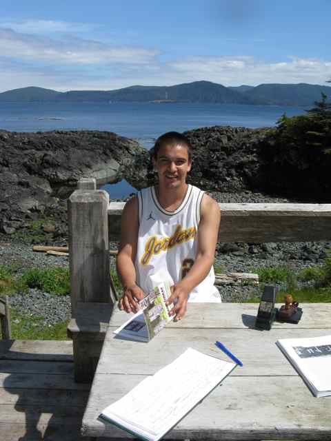
Took the Catch-up to Moresby Camp and had a walk around. Large area at the back of the camp being cleared for something. Campsite clean and appears new with gravel and picnic tables. Two sites on the waterfront – one a nice trailer and the other a small cabin. A covered picnic area with tin roof and large log beam supports and a gravel boat launch complete the scene.
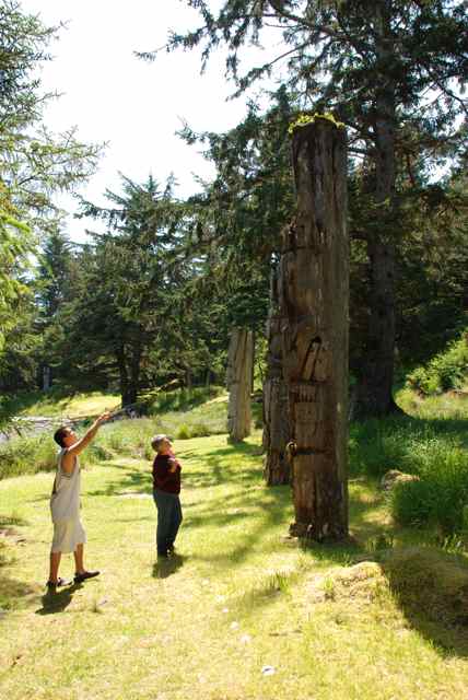
Fished along the north shore by the ruins and caught a mud shark for bait. Had lunch along the shore and enjoyed the fox glove flowers all along the logs. Fished back to anchorage and enjoyed a relaxing evening. The northwest 25 knots lapped against the Sea Foam gently throughout the night.
|
|
||||
|
Date |
Gordon Cove south into Carmichael Passage through Louise Narrows to Rockfish Harbour, Louise Island and anchor in Cecil Cove |
Weather |
|
|||
|
Tuesday, July 15 |
Cloudy with sunny periods |
|
||||
|
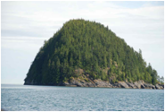
Typical Island Terrain
Louise Narrows
MV Giraffe in Cecil Cove
Beach in Cecil
Cove |
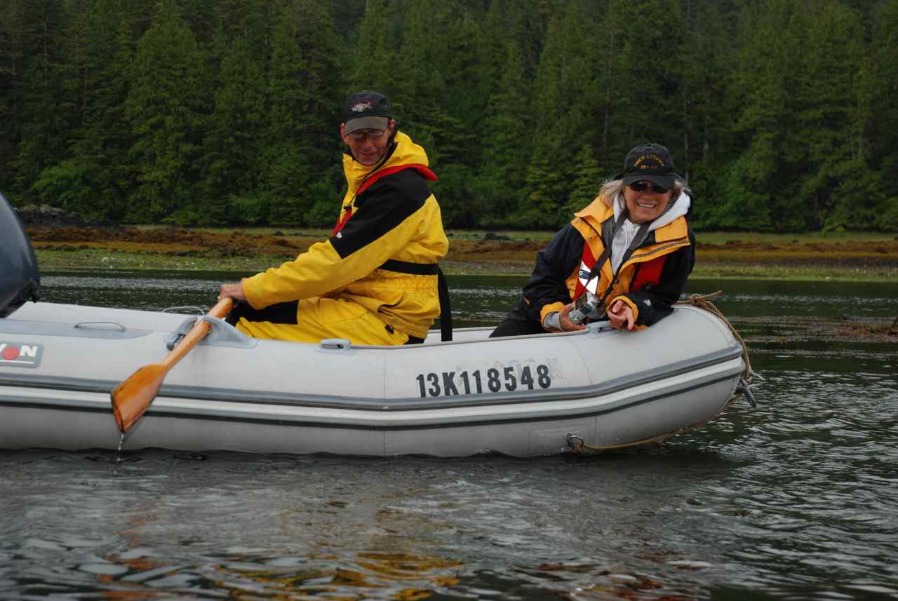
Today we need to transit Louise Narrows at high water slack which is 1315; another day to sleep in and take morning easy. After checking our crab traps from last night and again finding only small Dungeness we weighed anchor at 1030 and headed east on Cumshewa Inlet and turned south into Carmichael Passage with Moresby Island on our starboard and Louise Island to port.
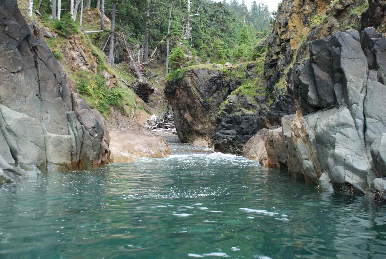
About one mile from the narrows we anchored Sea Foam in 50 feet of water and took the Catch-Up in through the narrows. We wanted to reconnoiter before taking Sea Foam through this narrow passage. It had been dredged in 1967 and the Douglass’ have a detailed drawing of it on page 446 of their guide book but once inside there’s no turning back so we wanted to be prudent and check it out first.
It was still flooding about a 3 knot current when we headed in at 1200. As we traveled through, it had depths of 9 to 17 feet and the channel was easy to see through the clear water. As we were video taping the event a Haida Watchmen boat came up behind us and waved. Our sounder started acting up towards the end of the channel and it was determined that the gain and the range needed adjusting.
As we turned around and headed back to the Sea Foam we were surprised to see a 67’ Nordhaven approaching, the Giraffe, from Vancouver. They had not given a security call, which would have been advisable in such a narrow spot. I was glad we weren’t meeting them in the Sea Foam to be sure!
We climbed back into the Sea Foam and made the journey through the narrows without incident. The sun was out in full force and we were greeted with a blue sky, snow capped mountaintops and a crystal sea as we safely exited the narrows and headed on to Selwyn Inlet.
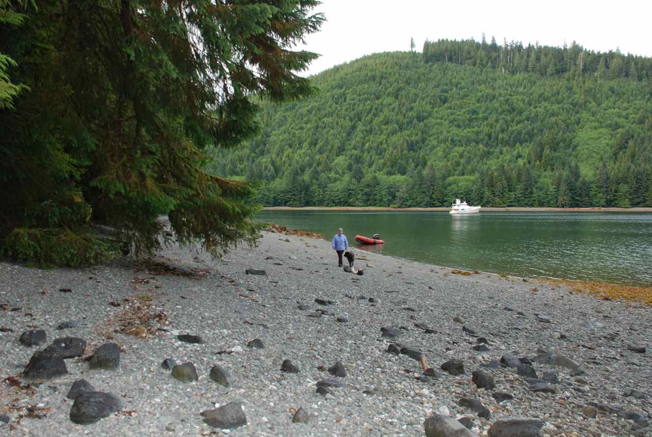
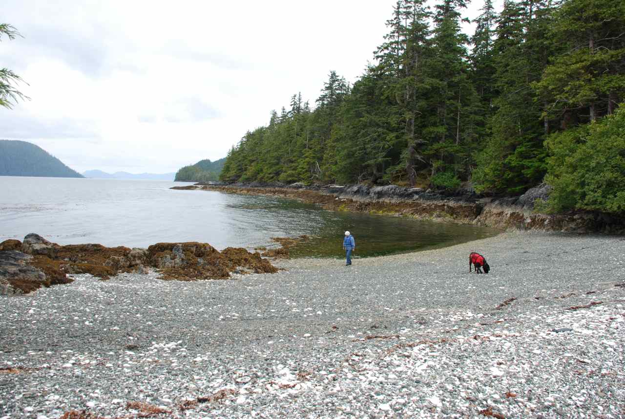
As we motored along and turned east further along Selwyn Inlet we noticed that the wind was coming from the east, creating a one to two foot chop. We hoped that when we turned into Rockfish Harbour it would diminish but we realized after motoring to the head of the bay that this was not the case. We anchored anyway, and took the Catch-Up and went to the beach to stretch our legs.
The wind was blowing about 20 knots and the sun was shining. The beach was not sand but gravel and large rocks and not easy to walk along. We enjoyed the forest edge for a time, remarking on the deep moss characteristic of this area due to the large amounts of rain. We decided when we returned to the Sea Foam that we would weigh anchor and head out of this bay. The logging scars along the south shore did nothing to add to the attraction of this harbour.
A check of the Douglass’ guide book and we decided to head 4 nautical miles (nm) to Cecil Cove hoping that this east wind would be absent there.
I noticed yesterday while we were fishing in Cumshewa Inlet that, although the forecast was northwest winds, the wind was coming in east along the inlet off Hecate Strait. Today we notice the same condition.
When we rounded Selwyn Point we saw the MV Giraffe anchored in Cecil Cove as well. The wind was still in the anchorage but the chop was less then what we experienced in Rockfish Harbour. We anchored along the north shore away from the drying mud flat in 40 feet of water and settled down at 1700.
After supper we took a trip to shore and walked through the forest along an animal trail. We could distinguish deer tracks but repeatedly find some “scat” from an animal that we’re not sure of. It looks like it could be wolf only because it resembles “dog do” in formation. We found it along the forest edge at Rockfish Harbour and along the grass line at Gordon Cove as well. Whatever creature it’s coming out of they are everywhere. I thought deer droppings were more like small pellets or peas. These droppings resemble something Kona would do but in larger amounts. I think beer scat looks more like cow pies but maybe if they’re eating different food – like fish – the droppings are different then when they are eating berries. I don’t have any literature onboard to look it up either so I’ll have to wait and ask an expert, likely one of the Haida watchmen.
The winds died down to nothing by evening so we decided it was the typical afternoon winds that were affecting us today in Rockfish Harbour. We neglected to take any pictures while we were there which is disappointing.
|
|
||||
|
Date |
Cecil Cove to Tanu to Crescent Inlet |
Weather |
||||
|
Wednesday, July 16/08 |
Sunny in the morning clouding over by 1030 |
|||||
|
Crescent Bay
Helmet Island
Coming around Tangil Peninsula
Steve shows Rick the temporary Beaver burial box (note beaver teeth lower front)
Steve shows Rick the New Watchmen Cabin
Barge Poles and Structural Fittings
Picture of Tanu (earlier 1900's) from book by George F. MacDonald “Haida Monumental Art”
|
We heard the Giraffe pull away at 0900 and decided it was time to get up ourselves. The wind was calm although the NW wind had blown lightly through the anchorage through the night, again lapping the hull around our stateroom. We made a route to visit the Tanu site on the east side of Tanu Island.
We traveled down Dana Passage and along Dana Inlet with Talunkwan Island to port and Tangil Peninsula opposite. Once past Helmet Island we turned south heading for the Tanu site between Tanu Island and Kinga Island through Klue Passage. We decided to call in to the Watchman once we had rounded Helmet Island to see if we could go ashore. Only twelve people are allowed at any one site at a time.
When we arrived there was no mooring buoy as predicted. Giraffe was also here. Aside from this boat and one sail boat yesterday we have seen no other pleasure boats since our arrival. As we proceed south we expect to see more.
There was a group of kayakers from Kinga Island that had stopped at Tanu for lunch. There were two young women who ran the camp out of Kinga taking folks on tours around the area. After they completed their lunch they had plans to circumnavigate Kinga Island, as this was their last night at the camp.
Our watchman, Steve, introduced us to an older watchman, Paul. We suggested he might like to take a break after his last tour so Steve wandered back to his cabin for lunch and a coffee and we chatted with Paul and one or two of the kayakers as we sat on a log on the beach.
I asked about the unknown animal droppings and was happy to be told there were no wolves on the islands and the droppings were likely from deer.
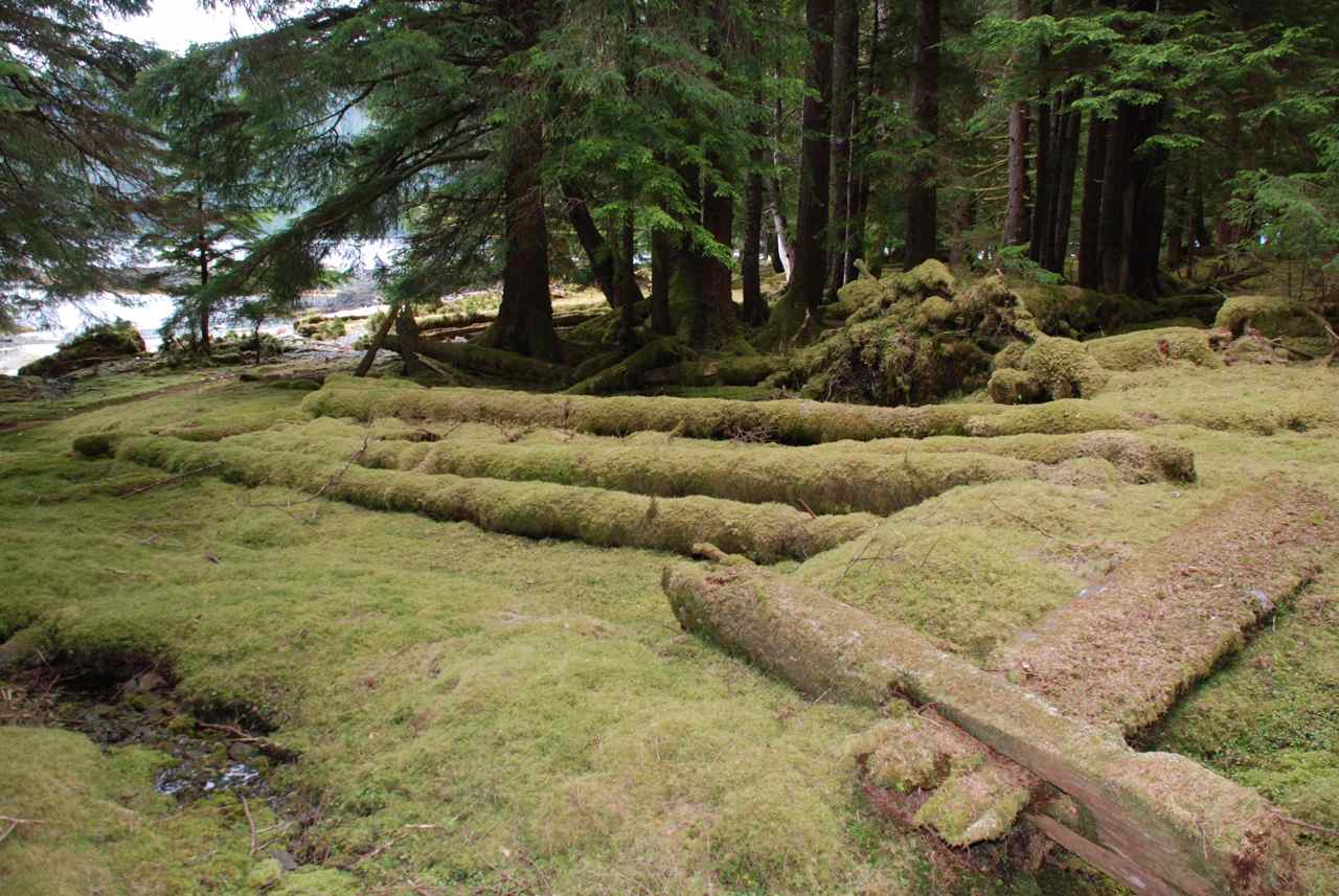
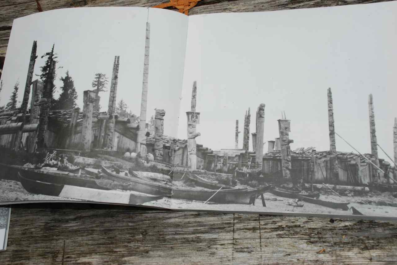
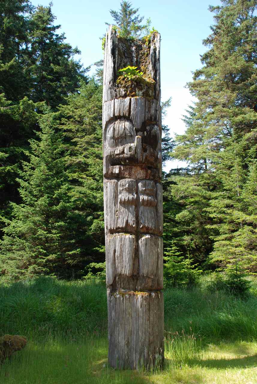
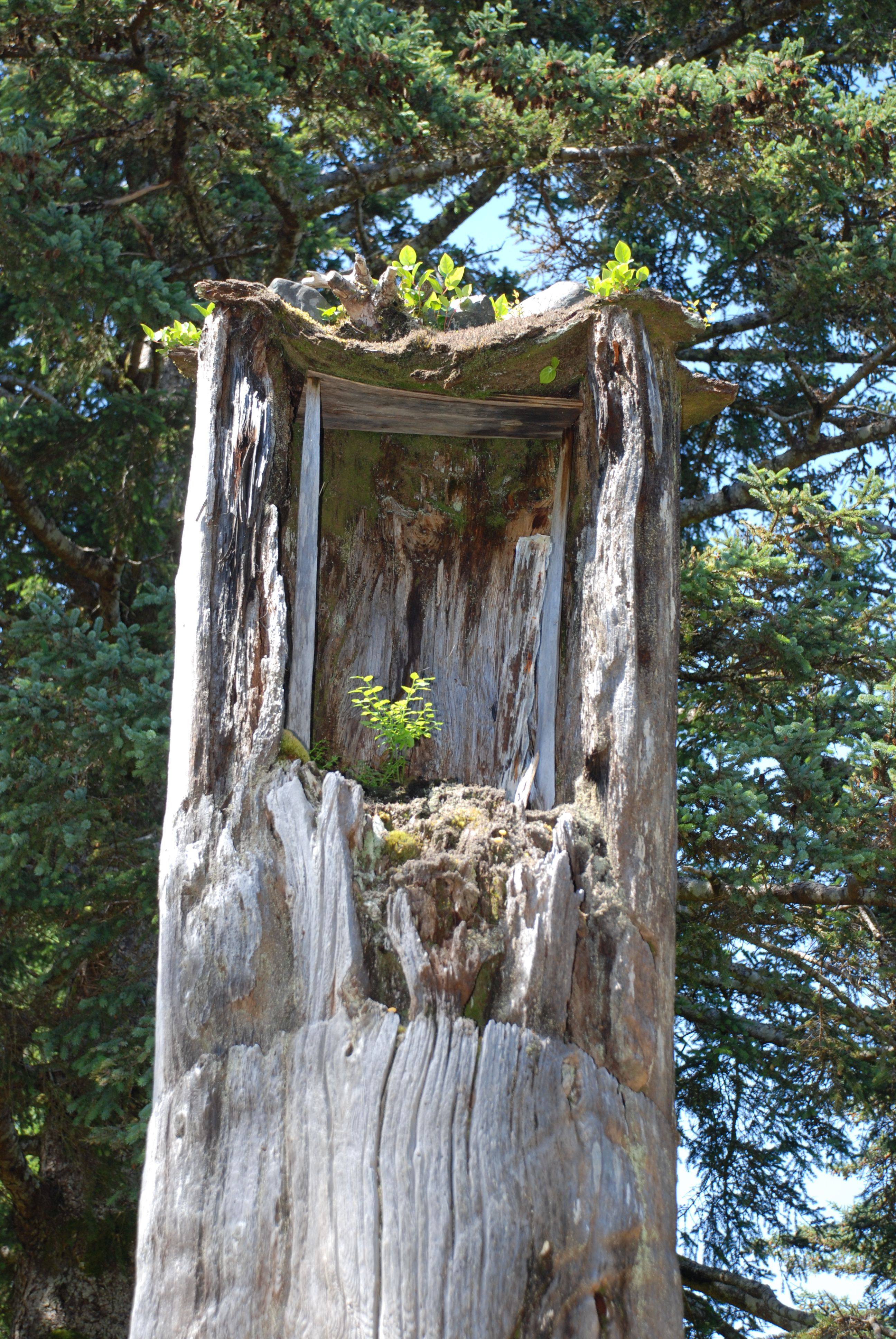
Our tender, Catch-Up, was tied to a clothes line pulley to keep it floating as the tide went down so as not to have us high and dry when the tour ended. When Steve returned from lunch we began the tour of the village of Tanu. He was very informative and knew much about the ancient chiefs, buildings, memorial poles and mortuary columns. The visitors guide states, the name “Tanu” refers to a type of sea grass found nearby. At one time, there were between 25 to 40 longhouses in the village, along with 31 mortuary columns and 15 mortuary houses. The house depressions and fallen, moss grown house posts give a vivid sense of the layout of the village.”
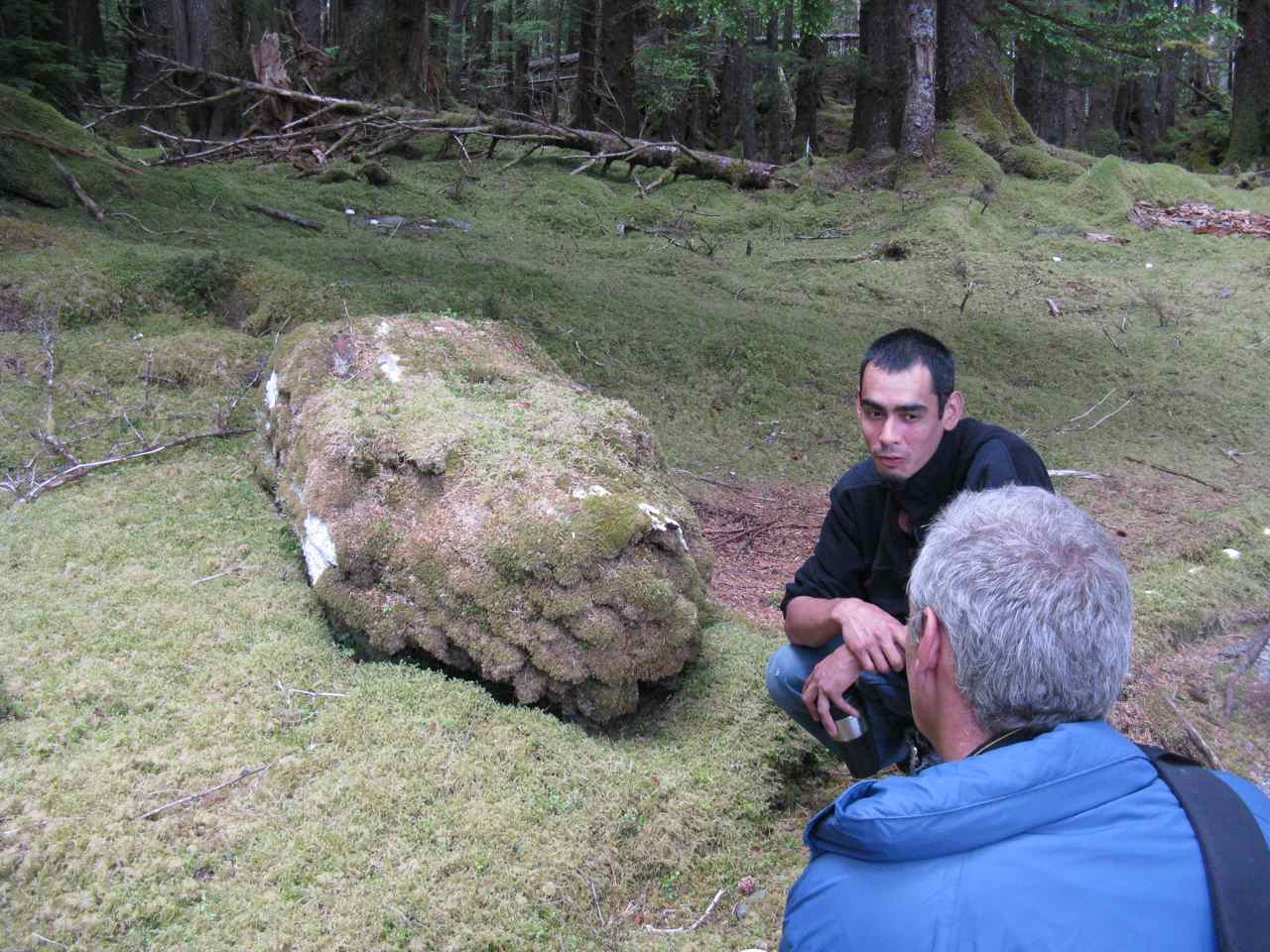
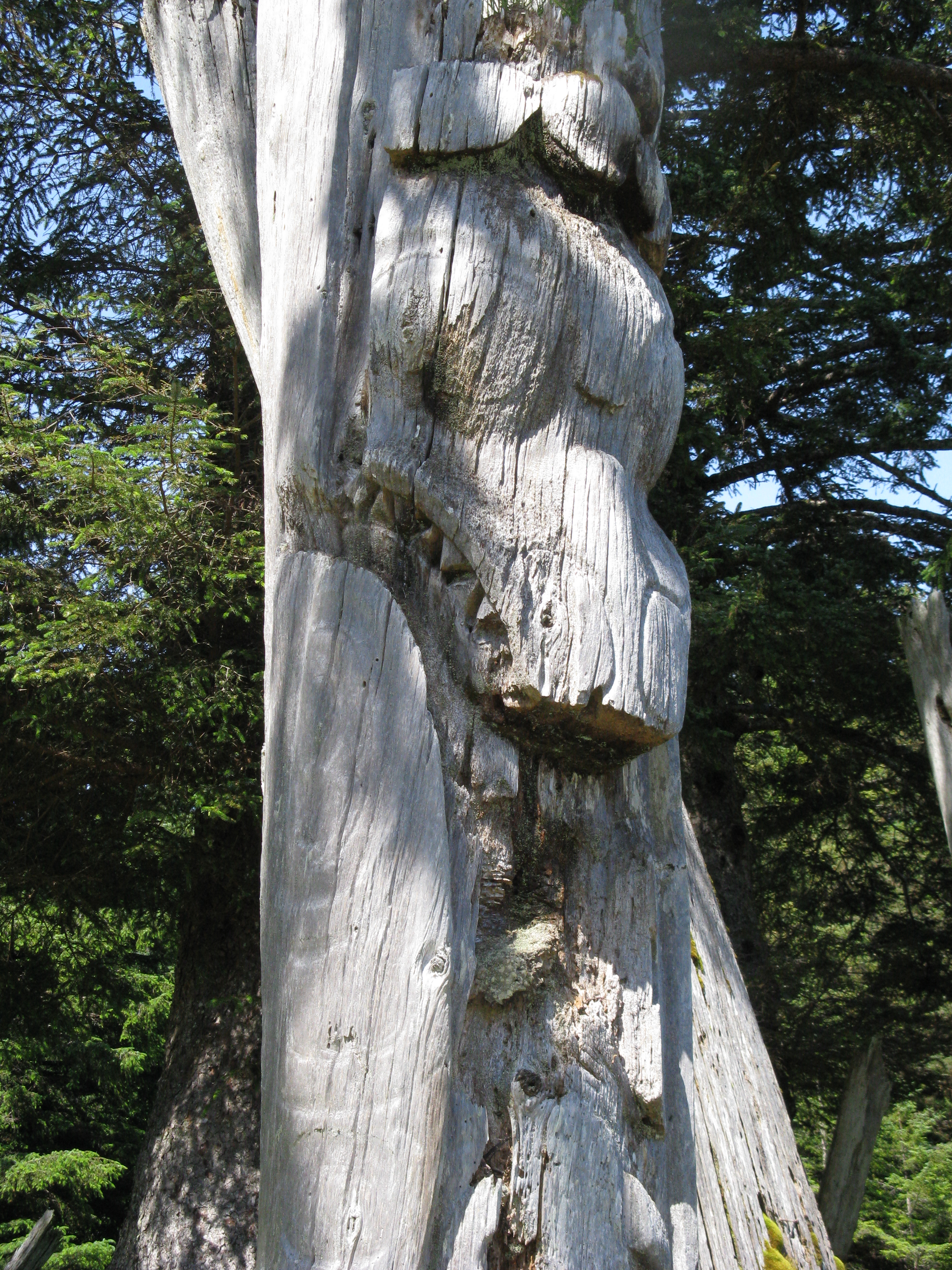
Steve informed us the south end of the village was the Eagle Clan and the northern end, the Raven clan of which he is a member. He pointed out the “barge poles” that once were the roof structures that are now covered with moss and decaying. The corner beams for many of the houses are still evident. He explained that the dead were housed in the tops of the mortuary poles in boxes and while they waited were often placed in a box on the ground until the pole could be carved. He showed us one such box that was a beaver and once he pointed it out you could see the shape quite clearly. He showed us the totem holes in front of each house where the poles had been dug out and removed to either the museum in Victoria, BC or the Museum of Anthropology at the University of British Columbia in Vancouver. He was glad on the one hand that the poles are being preserved but disappointed that some of the mortuary poles may contain the remains of the ancestors of the village and many of their clan who are alive on the islands today should be in possession of them. The poles were removed from the site shortly after the end of the small pox epidemic when the people were still very much afraid of returning to the villages because of the possibility of still coming into contact with the germs.
Steve showed us the new watchmen cabin that is under construction that will be made to replicate the look of the village houses from over 160 years ago. We stopped to chat with the builders and look through some books showing pictures of the village as it looked when it was in its prime. We met a Mexican woman who was on site to cook for the builders and she had spent eight years in Montreal, several in Toronto and was involved in the film industry in Vancouver. She was on the set for a movie that was filmed in Mission, our hometown, near the hydroelectric plant at Stave Falls dam.
Steve gave us an extended tour of the burial grounds beyond the watchmen’s cabin and pointed out the memorial for Bill Reid who apparently died in his mid 80’s. One of the houses in the village here belonged to Bill Reid’s grandparents.
We weighed anchor and headed for Crescent Inlet. Once settled, Rick focused the binoculars on the grassy meadows at the head of the bay and found three black bears and three deer grazing there. We headed off in the Catch-Up in the hopes of getting some good pictures of them. The grass is tall and the terrain sloped away from the shore so at times all we could see were their backs. If you didn’t look closely they looked just like a large log sticking out from the ground. It is a long drying mud flat at the head and we motored along with the motor up and the prop barely in the water in 2.5 feet of water. The wind picked up and was trying its best to ground us along the shoreline. We threw out our anchor and sat and watched the bears from a distance through the binoculars.
When we returned to the boat I was reading through the log of the SV Sirius from June 2007 and read when they anchored in this bay they too spent the evening watching four bears and three deer grazing in the tall grasses.
|
|||||
|
Date |
Crescent Inlet to Kostan Inlet |
Weather |
||||
|
Thursday, July 17/08
|
Sunny and Warm |
|||||
|
Water Dock at Hoya Passage
Bread Rock makes passage into Kostan Inlet a Challenge
MV Bountiful in Kostan Inlet |
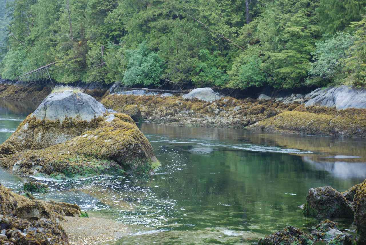
Our only sure plan for today was to travel into Darwin Sound and into Hoya Passage to take on water from the continuous running hoses set up off a dock there. We weren’t sure after that where we might anchor today. The sea was calm and the sun was shining and we enjoyed a pleasant millpond cruise through the Sound.
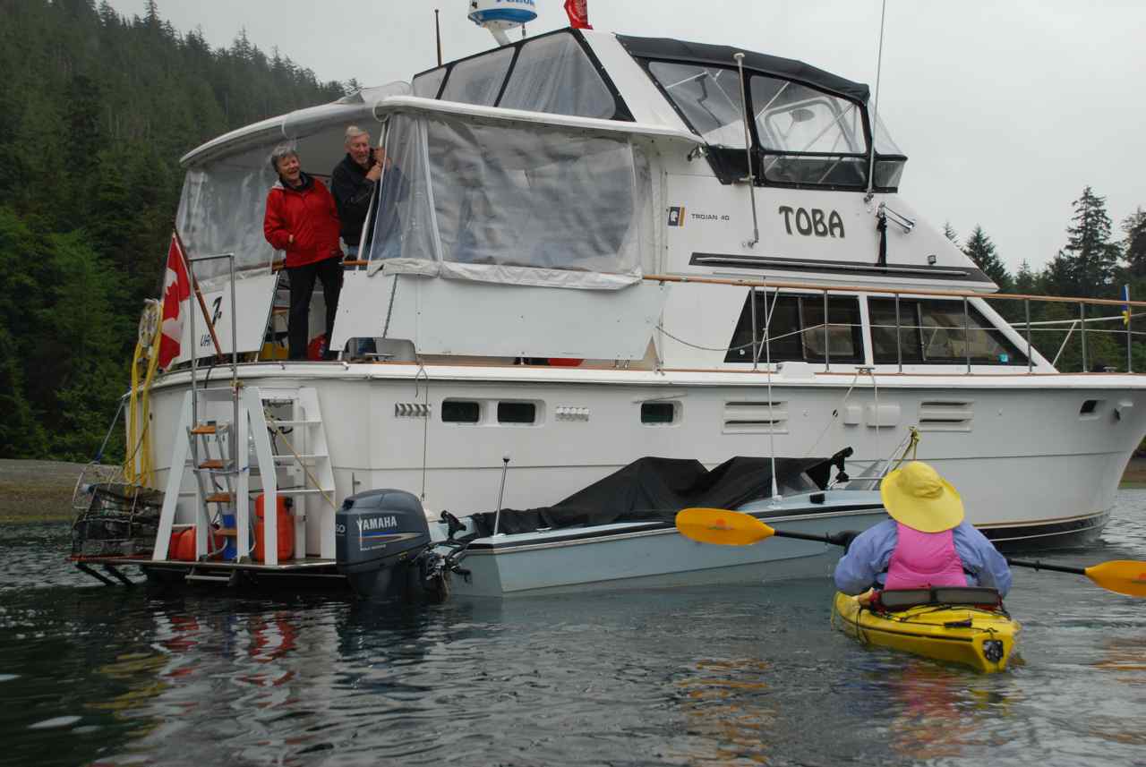
We heard the MV Toba hailing another boater on the VHF and Rick remembered that was a boat we were told to keep a look-out for by our friend Dennis Carter, or Kodiak, his better known radio handle. Toba was coming into Richardson Passage just ahead of us after having spent the night in Thurston Harbour. They were also heading to the watering hole.
We slowed our boat down knowing that they would need time to take on water and by the time we approached the location they were pulling away from the concrete water dock. We spoke with them briefly, introduced ourselves and they too had been told to watch out for us by Dennis. First mate, Barb, invited us to join them, along with one other boat, in Kostan Inlet.
We washed the boat off, filled our tanks and headed on south to Kostan Inlet. The narrows into the head of the inlet are tricky and it is recommended to transit at high water slack. The Douglass’ guide has a clear drawing of the entrance. We timed it well and entered without difficulty keeping a close watch on the sounder and the screen of our Garmin. We find the electronic charts very helpful showing our boat icon on the screen. The little Garmin screen with Blue Charts is better suited for close ups when we’re coming into an anchorage. The tracking feature that is left on the screen also helps for going back out of the anchorage again. On the other hand, Nobeltec charts that we use on both our lap tops are better suited to view the “big picture” of where we’re heading with the added feature of being able to zoom in on any area for a closer look. We also carry paper charts of the areas we are in.
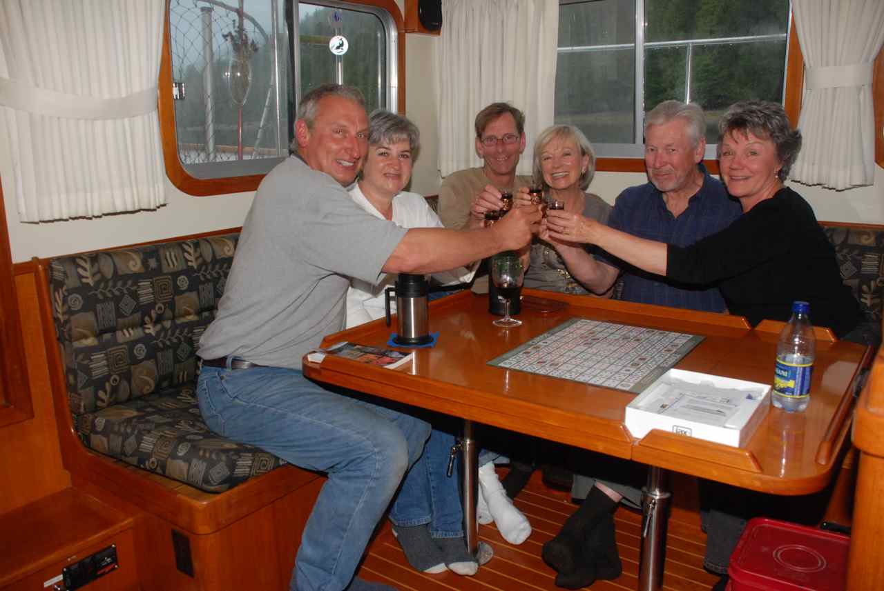
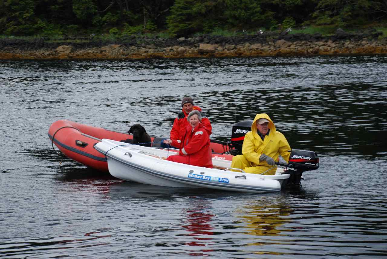
The head of the inlet is beautiful and we arrived to find Toba and the 42 Grand Banks, “Bountiful”, anchored and settled for happy hour. We anchored, took Kona to shore and joined the group on the Bountiful. Brian Morris and Judy Knauf were very welcoming hosts and we were pleased to meet them as well as Tom and Judy from the Toba. We spent several hours telling boat stories then returned to our boats for dinner and later would meet again on the Sea Foam for a board game of “Sequence” – guys against the gals.
After a pleasant evening of games and gossip we all
retired for the night. Everyone was planning to spend one more day in the
anchorage.
|
|||||
|
Date |
Kostan Inlet |
Weather |
||||
|
Friday, July 18th/08 |
Cloudy with heavy rain overnight. |
|||||
|
Large Red Rock Crabs in Kostan Inlet
From left to right: Barb, Tom (MV Toba), Judy and Brian (MV Bountiful) with the Game of Sequence in Hand
Decorated Warbonnet taken with Tom's Camera off Bigsby Point (Staring right at you just right of the scallop
shell)
|
We all emerged the next morning none the worse for the heavy rain and wind that pelted us through the night. All the Captains were up at least once in the night to check their anchors. These inlets all seem to have steep sides and valleys where the winds can come whistling down into the anchorages.
When Rick took Kona to shore this morning it was low tide and he was able to get a good look at the rock formations that choke the narrow entrance into the head of the inlet. The Douglass’ have a diagram of the area but we noticed there is another “alligator” rock just off of the rock they call “Bread Rock”. We made a note in our book to favor the starboard side on entering and Rick took pictures of the rock for future reference.
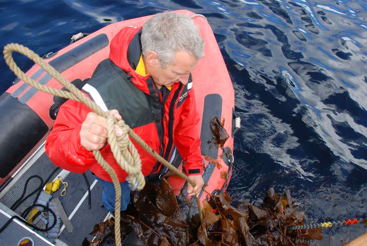
Rick checked his crab trap from yesterday and found two rock crabs, one very large and the other just large. When we showed the big one to Tom he remarked he had never seen a rock crab that big. It had claws the size of a Dungeness!
Rick and I prepared to dive off of Bigsby Point and Brian and Judy came out in their dinghy when we were suiting up. They wanted to see where we were going to be and then left to go explore the shoreline. Tom had given Rick his underwater camera to take some shots while we were down.
When we returned we were invited for a pot luck dinner on the Toba. Sea Foam provided homemade barley soup, a loaf of fresh baked bread and today’s crab catch. Bountiful brought barbequed steak and Toba provided barbequed lamp chops with greek salad. We sure do eat well on this trip. Rick brought along the photos from our dive and some video footage from last year’s cruise. |
|||||
|
Date |
Kostan Inlet to Hotspring Island to Burnaby Narrows
North Entrance |
Weather |
||||
|
Saturday, July 19/08
|
Cloudy Heavy Rain overnight |
|||||
|
Hot Spring Pool No 1
Hot Spring Pool No 2
Our Japanese Friend that we meet in the Pool
Rick and Carol-Ann in Pool No 1
|
After a very rainy and windy night, all three boats woke up to a much-improved day. Although the sun wasn’t shining the wind had calmed and after breakfast and a higher tide in the narrows leading out, we all pulled our anchors up and headed off. Bountiful was headed for Burnaby Narrows straight away and Toba and Sea Foam headed off for a soak in the hot tubs at Hotspring Island.
The sea was only a one-foot chop as we moved into Juan Perez Sound. We motored past Bishof Islands off our port side and past Ramsey Rocks and anchored between Hotspring Island and House Island. Another charter sailing boat was anchored in the small cove as well as the Toba who had arrived before us. We radioed on channel 6 to ask permission of the Watchmen to come ashore. They asked us to wait about fifteen minutes as one large group was about ready to depart.
Kona was not welcome on the island so Rick took her to shore on House Island and returned to pick me up and off we went. We wanted to tie Catch-Up to the clothesline as it was a receding tide but two of the Moresby Explorer zodiacs were tied to it already. Rick always wears his almost knee high black rubber boots to shore and he deposited me on the beach first and left the Catch-Up anchored as far out as his boots would allow and off we went through the bark mulch trail to the watchmen’s cabin and the waiting hot tubs.
The trail to the hot springs is lovely; lined with shells along a bark mulch path surround by towering trees. We noticed buildings through the trees and checked in at the watchmen’s house before going down to the hot tubs and bathhouse. We found Barb and Tom happily soaking while having an interesting chat with a young man from Japan who had arrived in the Queen Charlotte islands and was paddling his way from the north end of Moresby to the south at Rose Harbour. Once returned to Sandspit he planned to fly to Prince Rupert and then board a train to Whitehorse in the Yukon. He had plans to work at a sled dog camp and paddle some of the water up in those parts before winter set in. From there he would travel to Vancouver to winter in the city and return to Japan in April when his working visa ran out. He had already met Judy and Brian at another location and was happy to meet more friends from Vancouver. Brian had given him his card and told him to get in touch when he arrived in Vancouver. We encouraged him to visit the Gulf Islands in the spring before returning to Japan.
We took our gear to the bathhouse and changed into our bathing suits. Brian and Judy had told us the tubs were very hot but because of the steady and hard rainfall yesterday the tubs were a very comfortable temperature. Barb and Tom left the tubs to get back to their tender as the tide was falling and said they would give our tender another push into deeper water so we could stay awhile longer without worrying about being left high and dry on the beach.
We climbed into the pool closest to the bathhouse and later after a good half hour soak we walked along the trail to the tub overlooking the ocean on the west side of Hotspring Island. The view was spectacular and could only be improved by the sun coming out in full force. We said goodbye to the watchmen and signed the guest book. Rick forgot his passport book to have it stamped. As we returned to the beach the Catch-Up was in a perfect position for reboarding and a seaplane bringing in more soakers arrived on the beach.
We weighed anchor and I bobbed around in neutral while Rick took the Catch-Up into the beach in front of the bathhouses to get his book stamped. He ran into a reef-invested area on his way out and had to paddle the tender around the obstacles to get back to the Sea Foam.
We motored on south in Juan Perez Sound headed for Burnaby Strait a distance of one half hour away. We arrived at 1930 and ate a meal we prepared on our way over. Once we were finished supper we took Kona to shore and then over to the Bountiful for a competitive game of Sequence. We called it a night at 2300 and looked forward to an early start to the morning to catch the sites in Burnaby Narrows at low tide 0930.
|
|||||
|
Date |
Burnaby Narrows North |
Weather |
||||
|
Sunday, July 20/08 |
Raining, very windy in the afternoon |
|||||
|
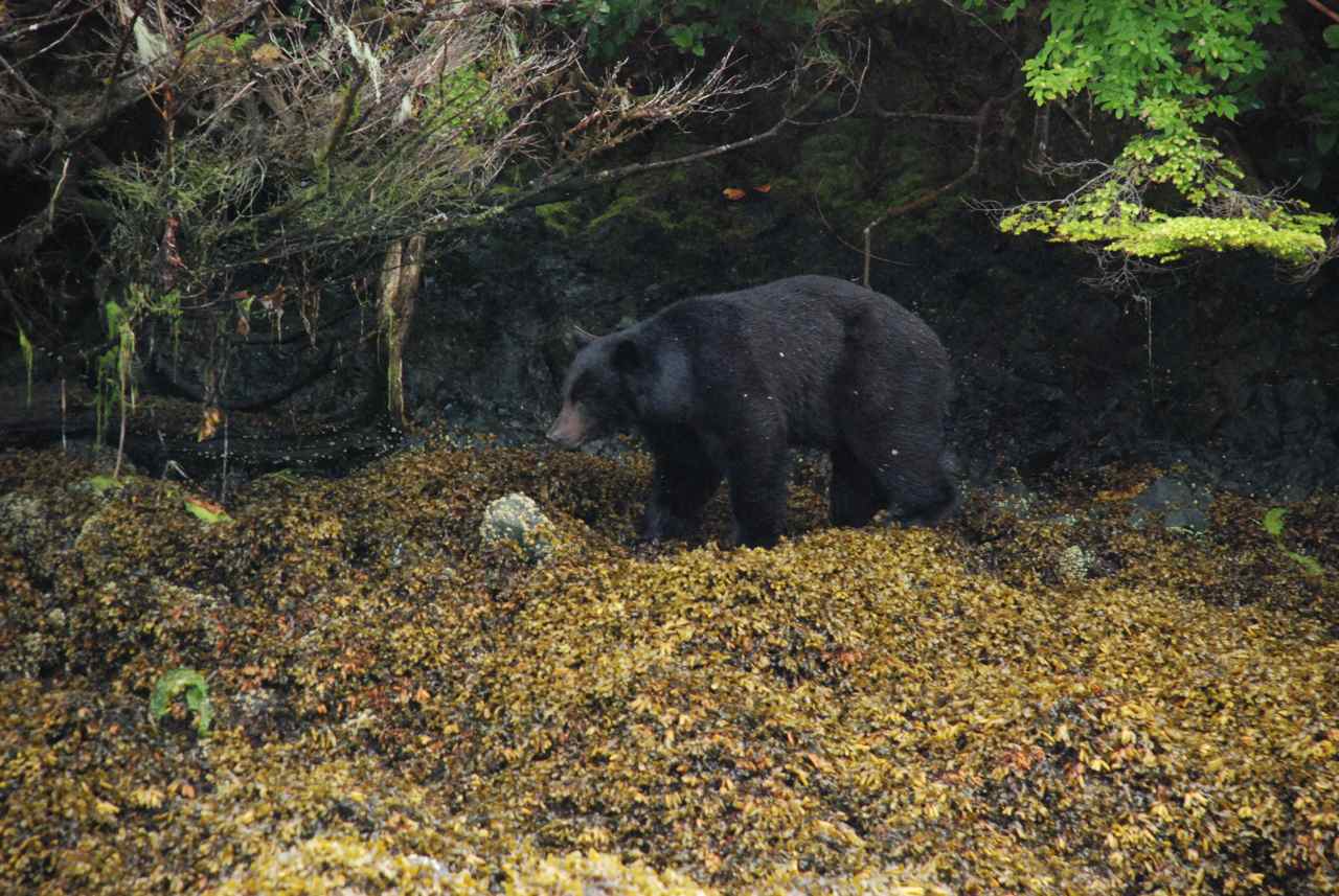
Black Bear in Burnaby Narrows
CA visits Toba in the rain
Cheers to the Safe Voyage of Bountiful across Hecate Strait
CA paddles through Burnaby Narrow - Bear in Background
Brian and Judy on the look for Bat Stars |
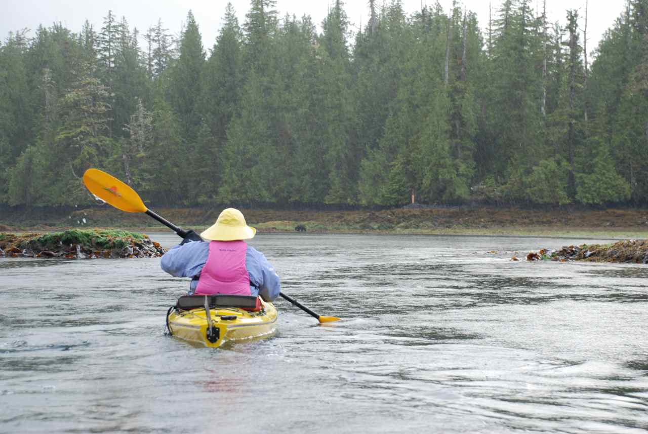
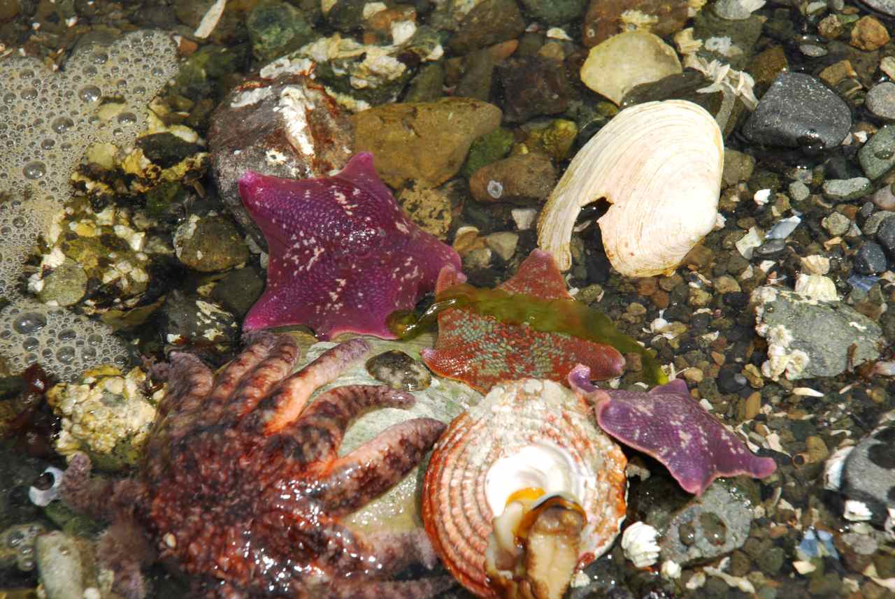
We woke up early so as not to miss the low, low tide in Burnaby Narrows - 0.9 feet today at 0930. Rick off-loaded the kayaks from the pilothouse roof and we proceeded to float into the narrows to view the undersea life that is said to have the highest concentration in North America. The water pushes through a narrow channel here that is about 50 metres wide. The incoming tides provide a constant flow of food bringing in plankton and nutrient rich water. In the guidebook for the park they state one survey found 74 bat stars per square metre here compared to 7 found on Vancouver Island over the same area.
To preserve the area there is no camping permitted and you are asked not to walk or wade through the water at low tide but rather float through in a kayak or row in a dinghy so as not to crush the organisms.
When we arrived here last night at low tide there was a black bear overturning rocks along the Moresby Island shoreline behind our boat. This morning he was back and feeding on the delicacies he turned up under the rocks. With an effortless pull of his front paw he would turn over a large boulder and then you could here him crunching on something he found.
As we paddled through the narrows the flood current was already moving through even though the water under us was only about one foot. You could easily see the colorful bat stars, sunstars, anenomies, turban snails, moonsnails, ascidians, sea squirts, large rock crabs and more.
On the chart this narrows is green, indicating it goes dry at low tide. There are range markers on the shoreline that guide a boat through at high tide but there have been several boats that have gone aground while transiting. The current that runs through the narrows can push your boat into the rocks as you try to turn and weave your way through the rocks and reefs. In the Douglass’ guide book there is a picture of a 92 foot vessel, the Texada, that went aground here in August 2000. The captain of the Bountiful told us a boat went aground last year and spilled diesel fuel into the area as well.
The Douglass’ have a great diagram showing the narrows and the depths as you go through. From our kayaks it would appear the most difficult part, or should I say the shallowest, is at the north end as you first enter the narrows. In John Alexander’s log he called this area “the jaws”. He took the Sovereign through the narrows from the south to the north after carefully looking it over by dinghy first. We decided for a savings of 10 nautical miles we would rather not chance going through.
Tom and Barb, Brian and Judy and several kayaks were in the narrows with us at the lowest tide for the next several days. Three deer watched from the Burnaby Island shore as we slowly drifted through the area looking over the side at the life below. A group of kayakers lead by a guide also came through to enjoy the views.
It drizzled rain throughout the morning with a steady and increasing southerly wind but everyone was dressed suitably and enjoyed themselves none the less.
We all eventually had our fill and returned to our boats to prepare our offering for a potluck Bon Voyage dinner aboard the Sea Foam for Judy and Brian who will be crossing Hecate Strait tomorrow morning. The Sea Foam prepared sushi with fresh crab for an appetizer, Toba arrived with a tray of lasagna and fresh sea asparagus and Bountiful brought dessert – Apple Pandowdy. We enjoyed great company, a game of Sequence, and several toasts to the Bountiful with two different types of port. A wonderful day on the ocean once again. Preparation for
Sea Asparagus: Soak asparagus in fresh water one to two hours to reduce salty taste. Blanch for 30 seconds and plunge into cold water to stop cooking. Sautéed onions, garlic and stir-fry asparagus. Sprinkle with lemon juice.
|
|||||
|
|
|
|||||


|
Date |
Burnaby Narrows North |
Weather |
|
|
Monday, July 21/08 |
Sunny in the morning then cloudy with sunny periods |
||
|
Stream running into Burnaby Narrows at low tide
Entrance to
Burnaby Narrows looking North
Ready to Run
Three Bat Stars |
Rick woke up at 0630 and noticed the Bountiful had her engines running and Brian on the bow bringing the anchor up. We wished them Bon Voyage and safe travel over the radio as they pulled away.
Another day spent at this lovely location and the sun is out today with little wind. Looking through the water at the sea life is much better today without the ripple from the wind and a brighter sky to light up the water.
Low tide was around 1000 this morning and after having coffee on the stern enjoying Mr. Bear munching on the shoreline, Rick and I headed to shore with Kona to explore the sandy beach and the sea asparagus meadows. Tom and Barb were out in their tender, Bateau, poking around as well.
We were careful where we walked as the shoreline is teaming with life. Huge beds of black mussels line the shore and varieties of snails; bat stars and rock crab are in the water as well here, but much more so in the narrows proper. Several kayakers arrived to see the sights with charter boats dropping them into the water at either end of the narrows and arranging to pick them up later in the day at the other end. Three women paddled past that were picked up at Moresby Camp outside of Sandspit in Cumshewa Inlet, taken by high speed zodiac to the southern tip of the island to Rose Harbour and they are paddling back to Moresby Camp. Along the way, Moresby Explorer, one of the bigger charter groups, will stop and deliver them food and water as needed or pick them up again in areas where the paddling is too open or too far and drop them off again in an area of interest. These women were from the Sunshine Coast of B.C. and Hamilton, Ontario.
I picked sea asparagus for supper after trying it yesterday when Barb brought it to our potluck dinner. The shore is covered with it and the meadows are as well. Three deer were feasting on it as we walked southward. Rick and Kona sat quietly and the deer actually walked over toward Kona, curious to investigate what she might be. Because she is so obedient she sat quietly and watched them as they approached. Rick was able to get several very close photos of them. After picking my asparagus I joined up with them and we were able to get even closer to them. The deer happily munch and scratch as we watch.
Tom fished out several large rock crabs with his oar as he and Barb floated around looking over the side of their tender at the sea life in the shallows. All the while Mr. Bear is on the shoreline munching and crunching. Tom saw him eat a whole rock crab himself, shell and all. Tom gave us four crabs to cook up and noted that the shells are soft – likely because the crabs are preparing to molt. The crab grows through a series of moults, discarding its old shell and hardening a new one by extracting nutrients from the water and sometimes by eating the old shell. We chatted with Barb and Tom and agreed to have supper together on the Sea Foam as they made away to go put out a prawn trap at the south end of the narrows. We returned to the Sea Foam and prepared to go diving further north up the narrows around a kelp bed. On our return we started supper preparations – barbequed Steak Neptune (fresh crab in hollandaise sauce) with stir fried sea asparagus and baked potatoes and yams. Tom and Barb arrived with single malt scotch for a before dinner drink and port for after supper. We had a lovely meal together and great conversation about our boating experiences while in the Queen Charlottes and elsewhere. |
||


|
Date |
Burnaby Narrows North to Ikeda Cove |
Weather |
|
|
Tuesday, July 22/08 |
Sunny in the morning then cloudy with sunny periods |
||
|
Ikeda Bay
Sea Foam in Ikeda Bay
Ashore at Ikeda |
This morning the winds are light in the narrows and the sky is cloudy with a few blue breaks in the sky. Barb called us on the radio asking us to rescue Tom from the beach. He had taken some paper garbage to burn on the beach and didn’t watch his boat and the ebbing tide left him high and dry. Rick took Kona to shore for her morning constitution and returned Tom to the Toba. The tide would begin to rise in the next 45 minutes so he will be floating again by noon. Tom was glad he didn’t have to wait on shore for three hours for the tide to pick his boat off again. We’re glad to have kayaks aboard if that should happen to us so we could paddle over, towing one of them and bring the stranded crew member back to the boat to wait the tide out. You could set your watch by Mr. Bear’s timing. At the low tide mark he is back on the shoreline, slowly making his way back to the narrows turning rocks over and munching along the way. Yesterday at high tide a charter boat came through the narrows from the south and anchored north of us. This morning they off-loaded their kayaks and paddled into the narrows to have a look. Two women from Vancouver stopped and chatted with us about their trip so far.
They flew from the Vancouver Airport to Sandspit in a 30 seater jet and spent one night in a bed and breakfast. The next morning they traveled by float plane to the south island of Kunghit Island to Rose Harbour. There they boarded the charter boat with Captain Rob Pettigrew of Archipelago Ventures and will travel with him for one week. They prepare their own meals with supplies he has on board for them. They will visit several of the native sites on their travels back to Sandspit where another crew of folks will climb onboard the boat and proceed southward to Rose Harbour again.
Rick washed and oiled our teak cap rails while he waited for the tide to rise and return Tom to his beached tender. At 1245 Tom was able to get his boat off the beach and we prepared to make away around the north end of Burnaby Island to Ikeda Harbour on the outside of the southeast portion of Moresby Island. Tom and Barb plan to travel through the narrows today at high tide.
As we motored out and around the north end of Burnaby Narrows the swells from Hecate Strait were on our port beam and until we were out past the rocks and reefs it was a bit uncomfortable. Sea Foam handles better when the speed is increase in a beam sea. Once around the outside of Burnaby Island we had a following sea with about six foot swells. We were happy to have them on our stern and when we reached the entrance to Ikeda Cove the sea was smoother and the entrance was easy to negotiate. Several sources have made mention that the entrance in a southeast wind can seal off the exit making it difficult to get out because of the waves.
We spotted Toba off our starboard beam as we were entering the cove and they told us later at supper on their boat that the transit at Burnaby Narrows was “a piece of cake”. There was little current to speak of and they had five feet of water under them at the shallowest section and that before high tide was even reached.
There were two other sailboats in the anchorage as we entered, Windy Spirit and Moonbeard. We took Kona to shore and decided to try our luck at fishing just outside the entrance. Within minutes we caught two bait fish – a greenling and a rock fish. We were expected on board the Toba for supper so we returned, set a crab trap and joined our friends for another lovely meal of halibut and prawn pasta and tales of our adventures from the day. |
||

|
Date |
Ikeda Cove to Anthony Island World Heritage Site
(Sgang Gwaay) to Rose Harbour |
Weather |
|||||
|
Wednesday, July 23 /08 |
Sunny |
||||||
|
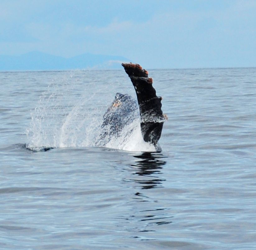
Humpback Breeching
Friendly Wave
Rick returns to Anthony Island by Kayak – Note dinghies
anchored and not on shore and surf
Girl
Jason
Trevor
Mortuary Pole
Mortuary Pole Box
|
We were up and off and out of our anchorage at 0915 and found a one metre swell in Hecate Strait but no waves or wind to speak of. The current was with us and as we got closer to the Rankine Islands - an ecological reserve, we were getting 10 knots as we headed south. The guidebooks and Sailing Directions say to transit Houston Stewart Channel at slack, which today is 1115. The weather is not as settled as we hoped but the sea is okay and Sea Foam is handling the swells well.
Rick spotted a humpback whale breeching off of Langtry Island heading north toward Rankine Islands. We slowed the boat to take pictures and some video footage. The whale came out of the water at least six times with a crash and huge splash of water. Then he would lie on his back and flap his pectoral fins (like his arms) on the top of the water like he was waving at us. It was difficult to hold the video camera steady as the swells rolled in on our beam. After a great display the whale disappeared and we carried on.
We motored past Rose Harbour noting there were two mooring buoys in front of the bed and breakfast establishment, both occupied. There was one other mooring buoy to the east behind a small island that was available.
We were still getting the benefit of the current through Houston Stewart Channel and as we came to Hornby Point, just past Ellen Island we could see the current and its effects on the water. There were small rips here, wind over current making small steep waves with white caps on tops. As we travel southward we could see Flatrock Island and the Gordon Islands and Anthony Island lying behind them. There was about a one foot chop as we headed over to Anthony Island. We approached from the south to avoid the rocks and bull kelp and saw the sailboat Windy Spirit anchored there. We loaded up Kona and ourselves into the Catch-Up and headed for the small opening of landing beach where Windy Spirit had pulled their dinghy up onto the beach. One fellow was tied off the shore tending to two small tenders while the rest of his crew was on the island. As we slowly motored into the beach we realized why the guy was out in the kelp and not sitting on the beach. The beach had surf coming in and as the wave came in it sucked the boat back out with it again as it went out. I tried to jump out of the boat while the water was headed out and tripped over the bow line and landed in the drink. Luckily my camera in my pocket was okay. I took Kona to shore with me and Rick got the boat the heck out of there and waited off shore until Kona had some time on the beach. We loaded her back on the boat from the rocks this time and did it quick and Rick returned Kona and the Catch-Up to the Sea Foam. He off-loaded a kayak and came into shore with it. We picked it up and carried it up the beach where we wouldn’t have to worry until our tour of the island was over. Watchman Tyler came down to the beach to greet us. He lives in White Rock, B.C. but was born and raised in Skidegate. He has lived in White Rock for four years and works with his father there. He gave us the full tour of the island, showing us the standing poles and telling the significance and history of each one. We walked to the cabin and met Jason and Girl as well. I recognized girl from John Alexander’s log several years previous and she told us she has been a Haida Watchman for fourteen years. Tyler stamped our books and we signed the guest book and then Tyler led us through more forest to the caves on the northwest side of the island.
Rick paddled the kayak back to the boat and returned with Kona in the Catch-Up to pick me up. We munched on sandwiches as we carried on to Louscoone Inlet to take on water from another continuous flowing hose located due west of Skindaskin Island secured to a mooring buoy. There may not be any fuel in the park but it sure is nice to be able to get fresh running water. I boil the water for drinking just to be on the safe side.
As we passed Etches Point on our starboard side we saw the Toba tied to a mooring buoy there, a float plane, and several people climbing into a zodiac. We determined that this is where folks are flown into for pick-up rather than in Rose Harbour. The charter companies pick up their people and goods from the float planes here and then boat the short distance to Rose Harbour where they either outfit them with kayaks for their own excursion or bring them to waiting charter boats to carry them to anchorages as they head north back to Sandspit where they can again climb in a plane for home. Rose Harbour is the southern most spot for people to start or end their tour of the islands.
There are two bed and breakfast facilities there and between the two houses sits Susan Cohen’s home where everyone meets for meals prepared by her and her helper, Christine. Her food is from the sea and folks are always talking about how delicious her menu is.
After getting our water and a short chat with the Toba crew, we decided to head back to Rose Harbour and tie off to a mooring buoy. The weather was changing to southerlies and the wind in this inlet was coming in from the west so we opted for more protection from Rose Harbour. We also thought we would give ourselves and the Toba crew a break from each other. Tom had mentioned he wanted to go to the west side of the island and explore Flamingo Inlet. We said farewell but not good-bye as we would likely run into them again as we both travel northward to Sandspit to re-fuel before crossing back to the mainland.
We arrived back in Rose Harbour around 1800 and took the mooring buoy on the west side of the bay. The yacht Wild Blue was on one of the other buoys and two other large boats were rafted together on the second buoy. The sailing vessel Moonbeard was anchored in the bay as well.
Rick took Kona to shore and we relaxed over dinner after
an eventful day in the southern Queen Charlottes.
|
||||||


|
Date |
Rose Harbour |
Weather |
|
|
Thursday, July 24/08 |
Cloudy with sunny breaks |
||
|
Rick Holds his Halibut (small one is
called a “chicken”)
Sea Foam and Moonbeard
Moored at Rose Harbour
Susan Cohen's House at Rose Harbour
Gortz House at Rose Harbour
Remnants of Rose
Harbour |
We did some beachcombing this morning in Rose Harbour and met Susan Cohen and her assistant, Christine in Susan’s home. We asked to be included for dinner and she told us there would be upwards to twenty people eating there tonight. The charter boat Ocean Light and folks from the bed and breakfast would be in attendance. She asked if we liked sea food as the planned menu was going to be a crab dish. The cost per plate would be thirty dollars.
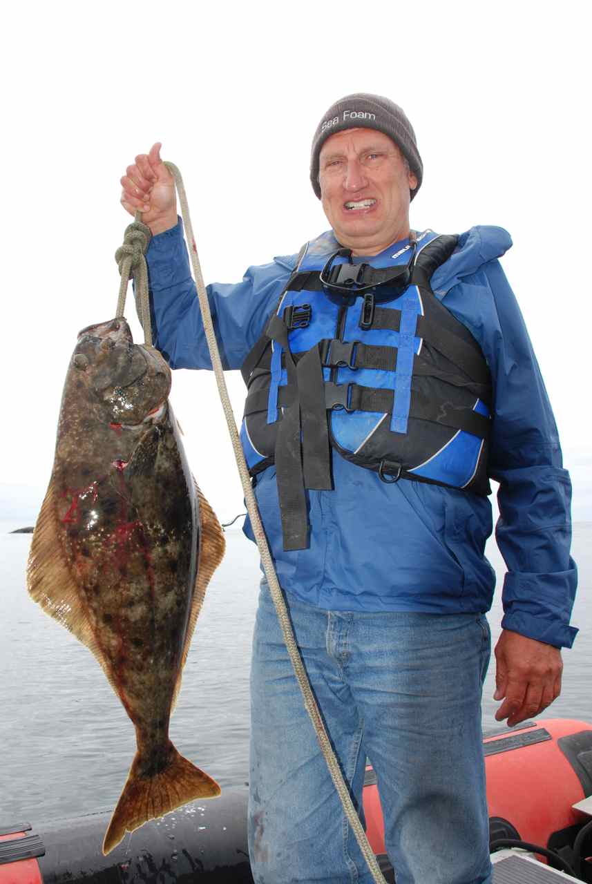
Captain Rick is determined to catch a Halibut today. He checked over the charts and determined there is a shelf on the west side of the Gordon Islands between Anthony Islands and Kunghit Island. We left the Sea Foam secured to her mooring buoy with Kona on watch and headed off in the Catch-Up. The sea was very calm and it was a great day for fishing. Once the rod was geared up within two minutes at the most of putting down the line there was a fish on – no kidding! In came a twenty-pound halibut. We tried out our new spear pole and while I held the rod Rick stabbed the fish just behind the gills and the fish was securely in our grasp. Rick removed the hook from his gapping mouth and brought him on board after several blows to the head to try to kill him. The fish was a perfect size for us to handle – not big enough to cause any calamity thrashing about in the boat if he wasn’t quite dead. The limit is two for halibut so down went the rod again. This time it took ten minutes and up came another one about the same size as the first. They do love herring! You can image the Captain’s delight at his fishing success. Now that we knew there were fish below we tried the fake octopus lure and didn’t get even a nibble. Nothing like fresh bait – a bloody herring is a treat for a halibut.
We brought in the gear and slowly motored over to Flatrock Island to look at the bird life there as we munched on our picnic lunch. We saw one puffin in the water but he flew off before we could get a close photo of him.
When we reached the Sea Foam Rick took Kona to shore as well as four commercial fishermen who had come in on the Wind Drifter to visit with Susan and stretch their legs. Susan was going to pull in her boat clothesline and pick up the men but Rick saved her the trouble by bringing them in with Kona. Rick also informed Susan that we would take a rain check on dinner as we had plans to feast on our fresh halibut tonight.
Once back on the boat we began cleaning the fish. The sun was shining and we used the stern deck as our cutting board. Rick set up our deck wash and we got busy. Catching two halibut is like catching four fish. From each halibut you get four fillets, two on each side of their body. When all was said and done we put sixteen packages of halibut fillets in the freezer each package enough for two people as well as the feed we planned to have tonight. We determined that the amount of fish we caught has paid for the cost of gear to catch them with.
The Moresby Explorer zodiac appeared and took passengers off the Moonbeard to motor them by zodiac four hours north to Sandspit to catch a plane back to Vancouver.
Gale force winds are predicted for tonight so we are glad to be secure behind Kunghit Island and on a mooring buoy. |
||


|
Date |
Rose Harbour |
Weather |
|
|
Friday, July 25/08 |
Rain |
||
|
Kayak Mother ship in the rain |
What a difference a day makes. Today the clouds are socked in low and the rain is falling in a steady mist. Today is an inside day to be sure. Rick took Kona out and I started to clean up the boat and make bread. Another load of people were brought in by Moresby Explorer and off loaded all their gear and kayaks on the beach. Moresby Explorer motored away and left six people and two kayaks to arrange their gear and the next time I looked out they were gone. Meanwhile, Gortz from the bed and breakfast returned in his red zodiac from taking his guests to Anthony Island for a tour of Sgang Gwaay. He also brought in two of the watchmen that will be spending the night here and then changing to a different location to watch tomorrow. The watchmen rotate through the various sites to enjoy the change and take a break from repeating the same information over and over again.
We enjoyed a lazy day and finished the evening with a video and an early night. |
||
|
Date |
Rose Harbour to Section Cove, Burnaby Island |
Weather |
|
|
Saturday, July 26/08 |
Cloudy |
||
|
Section Cove - CA and Kona
Herring Farm Raft in Section Cove
Rick and Kona on a Island near Section Cove
|
We had planned to go back out to the Gordon Islands today to catch another halibut but after listening to the weather forecast we decided to go while the going was good. Northwesterlies were to arrive by noon but it seemed from the automated buoy reports that they had arrived early so we wanted to get out on Hecate Strait as early as possible and have the ebb going southward giving us the wind and current in the same direction, helping to keep the sea flat.
We motored away from our mooring by 0830 and the sea was very comfortable. We enjoyed a better ride today then we did on the way over but noticed that in both cases the swell was on our stern most of the way.
We rounded the north tip of Burnaby Island at Scudder Point and again stayed close to the shoreline. The sea here was much better than it had been when we came through here the other day. The beaches along Burnaby Island along the north side are littered with driftwood which is an indication of storms pummeling against the shore. As we approached Burnaby Narrows the west wind made itself known on our burgee. It seems that these high mountains funnel the winds down their slopes but by the time they reach the open water they have diminished with lots of room to spread out. The ridge of high mountains that line the length of Moresby Island contribute to this strong wind action. I think they’re called williwaws. |
||
|
Date |
Section Cove to Marco Island to Haswell Bay, Moresby
Island |
Weather |
|
|
Sunday, July 27 /08 |
Cloudy with two sunny breaks |
||
|
Before the Storm
Storm Beginning
Waterfall After Rain Storm
|
The south winds were mild throughout the night and this morning the sea is calm. The forecast is calling for gales tomorrow so we decide to move off while the going is good and try a dive off of Marco Island across from Ramsey Island off Juan Perez Sound.
I was initially apprehensive about anchoring on the south end of Marco island as it appeared exposed to the prevailing winds but Captain Rick said, “Wait and see.” When we arrived the small cove was protected and we were able to anchor in sixty feet of water, deeper then the chart indicated, and make ready for a dive off the northeast tip of the island.
When I next checked the weather forecast it had upgraded from a gale warning to storm warning – wind speeds of up to fifty knots were expected tomorrow morning.
Rick took Kona to shore and checked out the intended dive spot. If the life in the tide pools were any indication this looked like it would be a good dive. Rick found similar species in the rocks here as we found in Burnaby Narrows – bat stars galore. The sun even came out as we were suiting up in the Catch-Up.
After our dive we headed back to Sea Foam, had lunch and noticed an American Tug motoring by in the direction we would be heading. As we made our turn into Haswell Bay at Hoskins Point and moved deeper in towards the head we could see the American Tug, Good Vibrations, had the same idea we did. This would be a good spot to hunker down for the night.
Rick took Kona to shore and met our neighbors – Hal and Ellen Farley from Sequim, Washington. We had heard Windy Spirit’s crew – Bob and Mo, speaking to Good Vibrations yesterday so were glad to meet up with them in person. There are so few boats in the area it’s nice to meet up with other humans once in a while.
After supper Rick and I watched a video and retired at 2300. The heavy winds are expected to arrive tomorrow morning. I set the barometer and noticed that it hadn’t moved at all since yesterday. I will be interested to see where it lies tomorrow morning. |
||

|
Date |
Haswell Bay
|
Weather |
|
|
Monday, July 28 /08 |
Gusty wind and steady rain all day |
||
|
Hal and Ellen depart after Dinner aboard Sea Foam
Hal and Ellen onboard Good Vibrations |
We were uncertain how protected this anchorage would be with the way the winds can come shooting down off the mountains. Rick had predicted that we would be well protected here and he was right. When we got up at 0830 the water was millpond flat even though the wind was blowing 30 knots in Hecate Strait. The mud and shell bottom here was also reassuring as we had read in the Douglass’ guidebook and when we dropped the hook yesterday it grabbed well when we reversed on it.
When Rick took Kona out he stopped by Good Vibrations and invited them to join us in a celebration dinner tonight – we had chosen a good anchorage to wait out a storm in the Queen Charlottes. The weather synopsis was calling this storm, “an unusually low front coming from Alaska”. Our barometer dropped 14 millibars since last night at 2300. The wind did not begin to disturb our anchorage at all until about 1300 when gusts would ruffle the surface of the water and flap out burgee. Our neighbors were as glad as we were that we had a good spot. It was even better that this storm took place during the day when you could watch what was happening rather than experience it in pitch darkness and wonder what might happen next. The forecast indicates that the winds will drop off to 25 knots this evening and stay that way through Tuesday. Another inside day to catch up on reading and boat chores.
Our guests arrived at 1600 and we enjoyed a nice evening together getting to know each other and telling of our travels. Hal and Ellen started sailing 20 years ago and spent 8 years going around the world. They sold their home before they left and haven’t seen any reason so far to buy another one. They have been living on a boat for the past twenty years. They now cruise on a 34 foot American Tug.
|
||
|
Date |
Haswell Bay
|
Weather |
|
|
Tueday, July 29/08 |
Very windy with heavy rain at times. |
||
|
34 ft American Tug “Good Vibrations”
|
The wind did not diminish over night but instead seemed to increase. I was kept awake by the gusts and the lapping of the small waves against the hull. Rick assured me we were well stuck. I woke up at 0230 and heard something on the bow scratching and a high-pitched squeak like a mouse. I got up and opened the pilothouse door to see what I think were bats diving around our anchor light for bugs. I think one of the bats may have bashed itself somehow in the high winds and was unable to get airborne again. When I woke up this morning I expected to see one on the bow but it must have survived because I found nothing on the decks.
Spent the day again indoors baking bread and reading. The winds continued to gust through the anchorage all day with heavy rain at times. The barometer was rising but very slowly. At 1350 it was 1005.1 from 994 last night at 2300.
We have been asked to dinner onboard the Good Vibrations tonight and threw on our rain gear for the short dinghy ride over. The rain and wind have been strong all day but we are welcomed by the Good Vibrations’ crew and enjoy a tour of their lovely boat.
We chatted happily over a steaming pot of salmon chili with cornbread, Hal-style – no sugar added. Delicious food and great company on a rainy cold night.
Hal gave us a demonstration of his Skywatch program that includes Weatherbuoy.com. With this program he can use 2200 characters of e-mail via satellite and get a read out of the weather sent to him from ten minutes to two hours of asking for it. The fellow that sends the information on is located in Hawaii and apparently is well reputed and used by major shipping companies as well. Hall walked us through the steps of his preferred method of asking for a seven-day view of the weather forecast. With the new and improved (although a long time to listen through) Environment Canada weather forecast Skywatch is another way of checking the weather before making major crossings like Hecate Strait, or around the west coast of Vancouver Island. Skywatch gives the wave heights, intervals and wind direction and speed throughout the day over several days allowing a close examination of the trends and a look toward the best weather window to make major crossings of potentially dangerous seas.
Hal told us the unit cost him $1100 several years ago to install and $40 per month for the services. When not in use your account can go into “dry dock” for $6 per month until you need to activate it again.
|
||
|
Date |
Haswell Bay
|
Weather |
|
|
Wednesday, July 30/08 |
Rain, rain, rain and more rain. Windy but less than days previous |
||
|
Rain has its beneficiaries
Kona and Rick wait out the storm |
The wind overnight was just as strong as last night with gusts blowing over the San Cristobal mountains and down onto us most of the night. I was more comfortable sleeping knowing that we had weathered the stormy weather these many days and not moved on our anchor.
Rick said he was up through the night and noticed the “bats” around our anchor light. He decided they weren’t bats but birds because he saw the shape of their tail feathers in the shadows. This afternoon when he went out onto the stern to turn our dry suits over from a good washing off with rain water he found a little swallow-like bird under one off the suits. He picked it up gingerly in his hands to show it to me but it flew off. This must have been the little bird (bat) I heard the other night. The little guy had been resting under our dry suits for a day to recover from his trauma. I love happy endings.
On the Good Vibrations’ recommendation I cleaned the deck and left our water tank cap open all night with a tea towel surrounding it to dam up the rainwater flowing down the decks. This morning the tanks were again full from the constant rain overnight.
The weather is predicted to ease overnight tonight and be light northwest tomorrow and continuing northwest until the weekend. The barometer has almost reached the same spot it did before this big storm hit us.
We had thought we would move off this anchorage today and head north around the corner just two miles into De La Beche Inlet and anchor either in Sac Bay or De la Beche Cove. We’ve decided to sit tight knowing we are secure here and tomorrow get up early and move off. We want to kayak around the inlet and into Skittagetan lagoon exploring the rocky area. The next day we may move into the Bischof Islands to dive while the winds are mild.
Good Vibrations was in communication with Windy Spirit today and found they had been anchored in Crescent Inlet and had dragged anchor during these heavy winds. They were on their way to Thurston Harbour today and on to Skedans tomorrow to visit the site there. As they were rounding Porter Head off Tangil Peninsula they reported the sea was good and the wind calm.
The wind continued to blow in our anchorage and during dinner with the Good Vibrations crew aboard the Sea Foam, Captain Rick declared the storm was over. The conditions had stabilized with no rain and a minimal wind. The barometer had returned to the same position it was when we first arrived in Haswell Bay.
We enjoyed a pleasant evening of sea stories with Hal and Ellen and retired with plans to move off in the morning for more adventures in the Queen Charlottes. |
||

|
Date |
Haswell Bay to Bischof Islands to De la Beche Cove |
Weather |
|
|
Thursday, July 31/08 |
Cloudy with sunny periods in the afternoon |
||
|
Rick removes kelp from Sea Foam's anchor rode – we find a bread knife handy in cases like this
Captain Hal has the same problem
De La Beche Entrance (narrow but deep)
|
We had the first sound sleep in three nights now that the storm had passed. We woke up to a flat calm anchorage and a very low tide – 0.9 feet. The crew of the Good Vibrations wanted to leave early to get down south to Rose Harbour and Anthony Island while the winds were minimal but after sounding the anchorage with his portable sounder Captain Hal decided to wait an hour or so for the tide to rise. He found depths of only five feet over the bar that were too close for his comfort.
We noticed Captain Hal pulling up his anchor and finding a huge pile of kelp all over it. Rick went out in the Catch-Up to see if he could help and take pictures at the same time. The bottom here was definitely mud and shells with much kelp that held us in tight over the last several days.
Once free of the kelp Good Vibrations did a drive by the Sea Foam to bid us farewell. We had all enjoyed each others company through the dark, rainy evenings in Haswell Bay.
After breakfast we too pulled our anchor and Rick took the Catch-Up under it and armed with a serrated bread knife cut the massive clump of kelp off the anchor before we could pull it up completely. Once free we motored away out of the bay and on to the Bischof Islands for a dive.
The day was shaping up to be very nice and it was good to be on the move again. We cross the short distance to Bischof Island over Juan Perez Sound and carefully found a place to anchor surrounded by the islands and their reefs. The bottom was rocky but the winds were mild so we were comfortable with the arrangement for the time it would take us to dive.
We got all our gear into the Catch-Up and dove just around the corner from our anchorage. The conditions were better when we returned to the Sea Foam, just as the forecast had predicted – light winds in the afternoon. It was now 1600 and we weighed anchor and headed for De la Beche Cove, a small almost landlocked cove, formed by a bight in the south shore at the entrance to De la Beche Inlet.
As we motored along the sea was barely a ripple in Juan Perez Sound and the sky was a lovely blue above us. Rick decided to install a swivel on the anchor as we went along after noticing the anchor did not turn the way it should when we pulled it up.
It took only about 20 minutes to cross back over to Moresby Island from the Bischof Islands and the short trip was very enjoyable. There are two openings into the anchorage but only the eastern one is passable for a boat. The other passage on the west side is good for a kayak passage only. We pulled the Catch-Up in tight and proceeded into the opening cautiously. Just outside the entrance is a 1.3 fathom pinnacle that I wanted to avoid. Rick went in dead slow and I was on bow watch. We had twenty-six feet under us at a nine-foot tide and as the Douglass’ book described the southern shore was better to favor then the north. We noticed the visibility was good and there were plumose anemones clinging to the rocks as we motored through. We think we may explore the area for a dive tomorrow.
As we made it safely through the narrow entrance it opened up to a beautiful anchorage with a fast running stream the only sound as we slid in. We anchored in 35 feet of water near the west entrance at 1730 and called it a day. Now it was time to relax and the sun was out and shining which made everything that much better.
|
||

|
Date |
De la Beche Cove |
Weather |
|
|
Friday, Aug. 1 /08 |
Sunny with cloudy periods in the afternoon |
||
|
Morning Calm in De La Beche Cove
CA sights an Eagle
CA's Eagle takes flight
|
Today was a low low tide (.6 feet) and we took off in the Catch-Up to check out the narrow opening that we went through yesterday. Still deep and steep going through with lots of sea life clinging to the rocks. We took Kona to shore near a waterfall and enjoyed the peace and quiet as well as the sunshine.
After breakfast we made a picnic and Rick took the kayaks off the pilot house roof for a tour of De la Beche Inlet and Skittagetan Lagoon today. We left using the western exit and crossed over De la Beche Inlet to the lagoon. We had a lovely paddle through the area and noticed many very large sea blubbers. An eagle was hunting in the quiet waters at the head of the lagoon and several seals found us a curiosity.
We came out of the lagoon and followed the north shoreline of the inlet and a west wind became strong over the mountains making it tough to paddle against and the windcaps were intimidating. We pulled off behind a group of islets just before the head of the inlet and decided to have lunch. After lunch we crossed over to the south shore and explored Sac Bay.
The bay had two lovely streams pouring over the rocks at the head and did not have the west winds blowing through it. As we paddled away we saw a sailboat making its way for the head of De la Beche Inlet.
It was an easy paddle back to the cove with the wind on our stern. It was now 1730 and we had been out since 1230. Once back into the cove the water was again calm and we enjoyed a barbeque and a relaxing evening while watching two videos.
CA Paddles away from a Creek in Sac Bay |
||
|
|
|
||


|
Date |
De la Beche Cove to Ramsey Island to Reef Island to
Thurston Harbour |
Weather |
|
|
Sat, Aug.2 /08 |
Cloudy with light wind |
||
|
Ramsey Island - Hard to get to shore with surf
Ramsey Island - Trees grow where they can
Reef Island Anchorage
Reef Island Shore Access |
The forecast today is for light winds throughout the day and picking up tomorrow afternoon. Rick wanted to take advantage of the calm weather and visit some of the outer islands. We pulled anchor at 0830 and went through the narrow opening at a 0.6 foot tide and had a least depth of 13 feet.
We headed for Ramsey Island to attempt to catch some halibut. We anchored off the south side off Crombie Point and the water was flat. We fished with no luck but did enjoy the peace and quiet and watched a minky whale feeding around a nearby reef. We did catch a sea bass but put him back.
We returned to the Sea Foam and Kona at 1330 and after a quick trip to shore we weighed anchor and headed for Reef Island where Rick remembers a rookery of Stellar sea lions from his Queen Charlotte trip fifteen years ago.
The sea was calm and the sun came out to make for a great cruise northward in Hecate Strait. We had the flood current with us for an hour and then it turned to ebb for the last two hours of the trip.
We hailed the Toba just before we got to Reef Island and they answered they were just leaving Tanu and would be going to Reef Island to fish for halibut and would talk with us later.
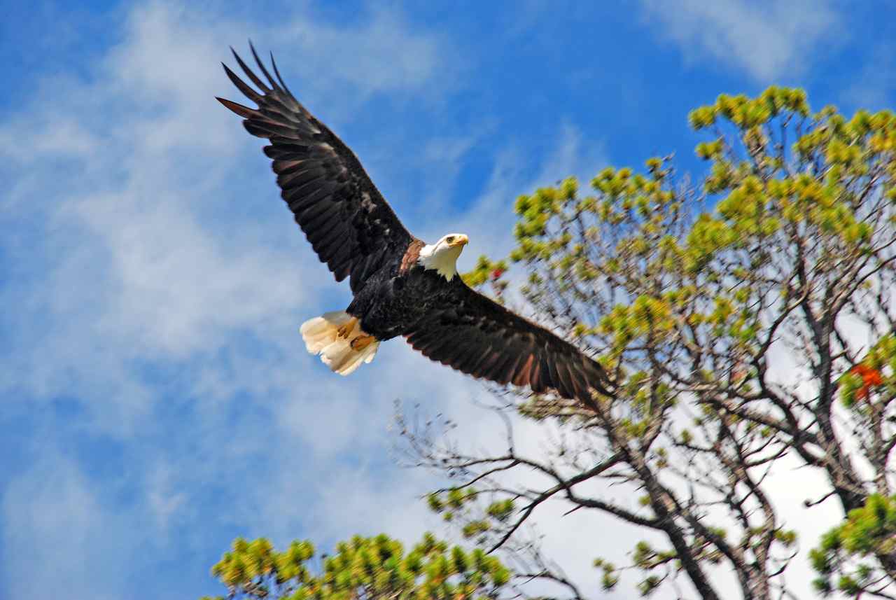
We pulled into the anchorage Rick had decided on and got into the tender to see if we could find the rocks where Rick had seen all the sea lions many years ago. We searched around the islets but to no avail. The sea lions had moved elsewhere in fifteen years. There was one island that was the farthest east from Reef Island that we didn’t explore so that could be the only possibility. We approached one island that we thought appeared to have some large items on top and as we got closer it was a large bald eagle.
We returned to the Sea Foam and had supper and then I requested we relocate to Thurston Harbour. The winds were predicted to be light but I was uncomfortable with the anchorage and the fact there was no suitable place for Kona to go to shore. My Captain was disappointed but agreed to my request.
As we motored toward Talunkwan Island we saw the Toba anchored on the west side of Reef Island and when we spoke to them on the radio they were on their way to Thurston Harbour for the night as well.
Thurston Harbour had one other sailboat anchored and two deer on the south side and three at the head. The sun was setting as we settled down after a short trip to shore for Kona. The Toba anchored beside us and Rick stopped on his way back from shore to talk over plans to visit. They were enjoying a late dinner after fishing with no luck off of Reef Island.
We enjoyed another pleasant evening aboard the Toba and met Tom’s daughters, Rachel and Amanda from Toronto. They had flow in from Vancouver airport to Sandspit and took a floatplane to the Toba on a mooring buoy in Louscoone Inlet where they had ridden out the same four-day storm we experienced. They had planned to have the girls fly into Rose Harbour but this location was also where float planes often off loaded passengers rather than land in Rose Harbour where there is more current and less of a runway.
|
||


|
Date |
Thurston Harbour to Gordon Cove, Cumshewa Inlet |
Weather |
|
|
Sunday, Aug. 3rd/08 |
Foggy morning with light rain, sunny afternoon |
||
|
Tom and Barb bring over Amanda and Rachael for a visit
Gordon Cove Buoys are no longer available
Gordon Cove Log Bridge
An attentive walk across is possible
|
We got up early with plans to go to Sandspit Harbour today. As we motored out of the harbour the fog was evident with only about a mile of visibility. As we passed Skedans Islands the sea was rough. We thought if we traveled past Cumshewa Inlet at slack and rode the flood tide to Sandspit it would be reasonably comfortable but it wasn’t shaping up to be so. Rick motored behind Skedans Islands and when we got to Cumshewa Inlet we decided to turn in; better safe then sorry is my motto.
Once into the inlet the water was fine and we noticed that the red buoy C8 was out of position, likely after the four day storm barreled through here. Rick called the Prince Rupert Coast Guard to report it on 83 Alpha and they appreciated the call and broadcasted the message throughout the rest of the day.
It was three weeks to the day that we arrived in Gordon Cove and we enjoyed the anchorage once again.
Once anchored we took Kona for a hike along a service road at the south end of the bay. We walked to the left and once across a bridge made a decision to go the right. We walked a time and saw a clearing ahead. It turned out to be a recent clearing of brush and trees and a newly erected hydropower line was there. We aren’t sure where or for whom the power is for. This area is out of the Gwaii Haanas park area so who knows what plans are underway to ruin this area.
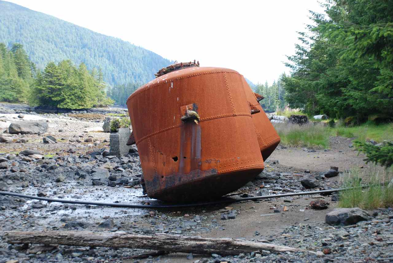
After our hike we returned to the Sea Foam and not long after Toba pulled in after a day exploring the Mathers Creek area on the south side of Cumshewa Inlet just west of Fairbairn Shoals and east of Kitson Point. According to Tom this was the site of a logging operation during World War I when they used the spruce trees found here to build planes. Once the war was over, everyone packed their bags and left everything behind. Tom said you could still see the tires on metal rims with the word “Firestone” readable on the walls of the tire.
The Toba had a very nice “glassy” sea when they traveled the same water we had this morning. They were surprised to hear we had turned into Cumshewa Inlet. When we checked the weather throughout this day it did appear that all was well. We aren’t sure why the water was so lumpy and unsettled. Maybe the bottom of an ebb tide in a low low isn’t the time to cross Cumshewa Inlet. We discussed traveling to Sandspit tomorrow with the Toba and thought we would give it a go in the afternoon.
The Toba crew visited on the Sea Foam and we said our farewells to Amanda and Rachel. Tomorrow a taxi will come from Sandspit and pick them up at Moresby Camp to return to Sandspit. From the Sandspit airport they will fly back to Vancouver Airport, do some family visiting in Vancouver and fly back to Toronto. They had a very eventful and nature filled four days of adventuring in the Queen Charlottes. They brought the sunny weather with them too. |
||


|
Date |
Gordon Cove to Sandspit Harbour |
Weather |
|
|
Monday, Aug.4th /08 |
Sunny cloudless sky |
||
|
Heading out to Sandspit
Bob and Maryanne from the So'Easter
Early Morning Sandspit
|
I got up at 0700 to listen to the weather and heard there were 17 knot winds from the northwest at North Hecate Strait. I went back to bed. This was not a day for us to go to Sandspit. After breakfast the Toba crew came by in their tender to have their girls say their last goodbyes. When they returned we discussed the weather pattern for the day; the winds were dying down and it would be high slack at the mouth of Cumshewa Inlet at 1600. We decided to leave and planned to arrive at the mouth at slack tide. They rest of the travel would be wind and current together – ebb tide going south with the wind from the northwest. When we arrived at the sandbar to cross over to Sandspit there would be a seventeen-foot tide, which would allow us to cut across much sooner, lessening our exposure time in Hecate Strait in one of its shallowest areas.
There was an east inflow wind coming along Cumshewa Inlet and there was a two foot chop with whitecaps. As we approached Fairbairn Shoals we could see smooth water ahead and assumed it was the wind calming there. When we hit the area it was not the wind but the still flowing flood current. We went from 7.5 knots to 5.6 as we crossed the line. You could feel it instantly and we better appreciated the current flow in this inlet. Not only did our speed slow but the water flattened out as well. We really noticed here how much of a difference it makes to have wind and water going in the same direction. The east wind was coming in and so was the flood current. As we rounded Cumshewa Head and were out in Hecate Strait the swells were about two metres and steep. I went below immediately to lay down and as the flood tide ended, (we were about 45 minutes early), the water became smoother as the ebb tide began. We enjoyed the rest of the trip with a sunny sky and a comfortable enough sea. We didn’t take any water over the bow - that was a good indicator for us. We cut across the blue water section about one mile off the green section of the spit with a least depth of thirteen feet for a short time.
We tried hailing the Sandspit Marina on 73A and on the telephone but to no avail. We pulled right into the marina and the Wharfinger saw us and assigned us a slip. Toba went to the fuel dock and there met up again with the So’Easter, Bob and Maryanne from Salmon Arm. They keep their boat in this marina all year round for $1200 and come up in the summer to travel the islands. The Wharfinger, Kathy, takes good care of their boat throughout the seasons. This year they had many guests on board and enjoyed very successful fishing.
Once tied up we prepared a halibut dinner and had Toba crew, and Bob and Marianne over to the Sea Foam. We shared sea stories and retired by 2330. |
||
|
Date |
Sandspit Harbour |
Weather |
|
|
Tuesday, Aug.5th /08 |
Sunny all blue sky |
||
|
Moresby
Explorer visits (truck can
be seen with water level up to axle at this time)
Fishing Charter Boats head out Skidigate
Weigh-in at Sandspit Marina
Kathy - Wharfinger at Sandspit
Heading Out East
to the Mainland |
Today is chore day. We slept in until 1100 and once up and around we got active. Tom and Rick drove Barb and I to the beach in their tender, the Bateau, near the Sandspit Airport to go grocery shopping at the Super Value there. A liquor store is inside as well. We were lucky in that the shelves had been stocked the day before.
Tom and Rick went to the chandlery up the road to buy a leg oil pump for our outboard. It is leaking leg oil and will need to go in for service when we get home. Meanwhile the Captain will keep the oil level up with his new gizmo. He also bought more fishing gear and reported that it was a good store that included a Mercury outboard centre.
Once we finished shopping we asked the storekeeper if they provide a service back to the marina and we were disappointed to learn they do not. They offered to call us a taxi. There was a young woman who pulled into the parking lot with a large passenger van with “Eagle Transit” written on the door. We asked her for a ride home which she happily provided for ten dollars. Tom met us at the dock and we loaded a wagon and restocked our cupboards. Rick had taken a second trip to the chandlery to get more fishing bait – herring and anchovies.
As I was unloading my groceries a young fellow on the Moresby Explorer inflatable came by my stern and I remarked that we had the same boats – both made by Polaris. We chatted a while and it turns out he is the son of Susan Cohen from Rose Harbour. They have four hurricane boats and are looking to sell the Polaris and get another Hurricane. He said he has been doing the kayak transport since before the Park was formed and has a license to continue to work in the park. I asked him if there was any competition and he said there are very few licenses issued for others to operate in the park. He went on to say that the “council” for the Park is made up of two Haida persons and two Parks appointed people. Depending on who is in these positions determines how well the park is managed.
As we were chatting Rick returned to the boat and joined in on the conversation. Another man on the dock shouted out, “The rear axle is getting close to the water.” We didn’t pay any attention to him and continue on chatting. As it turned out, he was referring to the truck and trailer that was on the boat launch ramp. The Moresby Explorer fellow (didn’t ask his name) was on his way to load the inflatable onto the trailer when he stopped to talk to me. All of a sudden we noticed that the truck was almost up to the doors so it was time to end our conversation. Another man was on his way down the ramp to get the truck pulled forward as the Moresby man motored over there. All was well as the truck’s motor was not in the water yet.
I filled our water tanks and sprayed down the boat. Kona had a third bath after rolling in dead fish last night when the Captain wasn’t looking during a shore patrol. A fishing boat pulled in next to me with three persons on board. They had two blue tubs full of salmon and one monster fish weighing in at 52 pounds. Three older fellows came by after an unsuccessful day of fishing and asked if they could take a picture with the fish and tell their friends they caught it. The successful fisherman agreed to be party to their plan and let them take a snap shot. I wonder how the imposters will explain where the fish went.
We next untied and pulled over to the gas dock to fill our tanks. The fuel dock is only open in the morning from 0700 – 0900 and evenings from 1800 – 2100.
We chatted with Kathy about the weather and she agreed that tomorrow would be a good day to cross Hecate Strait. She also said the weather had not been this sunny all summer in Sandspit. “You picked the best two days of the summer to visit us!”
After fueling we went back to the Sea Foam for supper, had dessert and after dinner drinks with the Toba crew, discussed tomorrow’s travel plans and retired. Tomorrow we cross Hecate Strait. |
||
|
|
|
||


