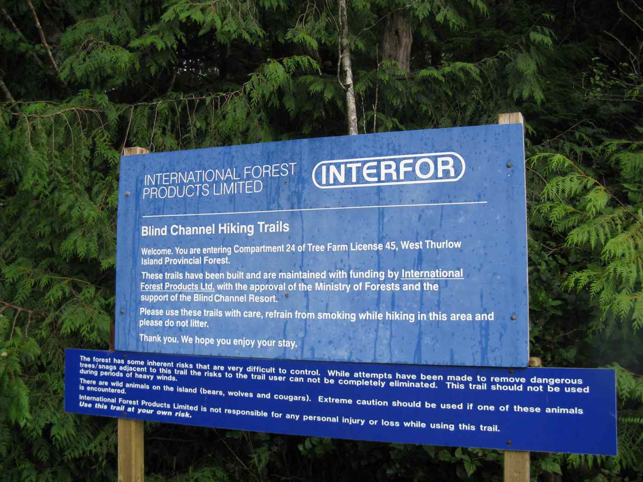
Summer 2008 Cruise – Leg 4
|
Date |
Sandspit Marina to Dunn Passage, Weinberg Inlet,
Campania Island |
Weather |
|
|
Wednesday, Aug. 6th/08 |
Sunny start, fog half way across the Strait, Sunny at anchorage |
||
|
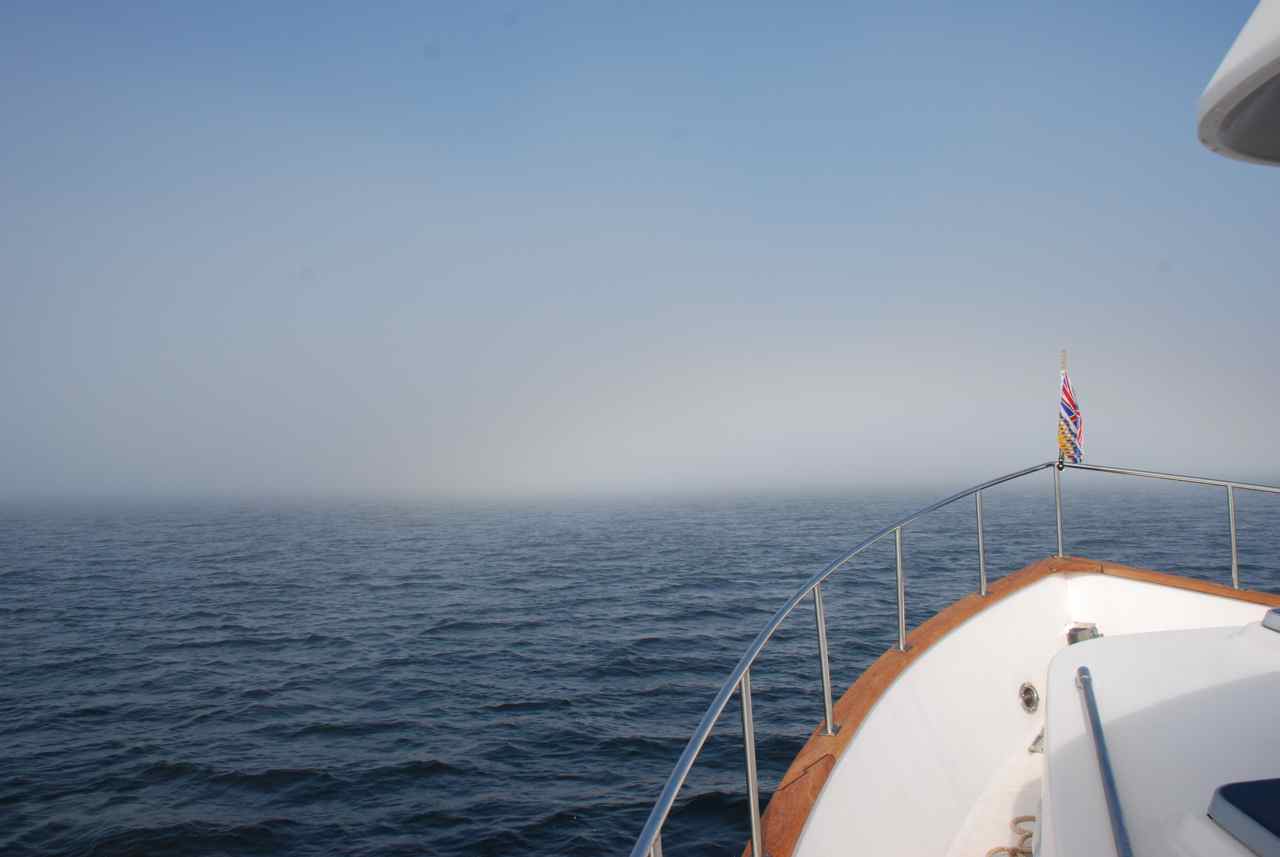
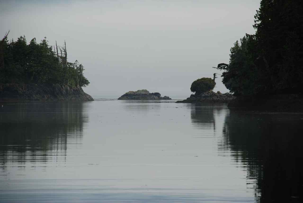
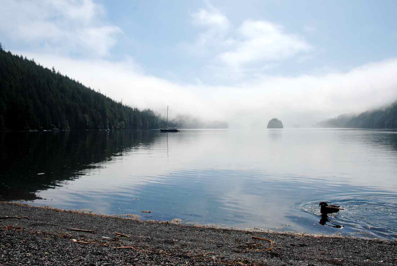
Fog in Hecate
Strait
Coming out of the fog and looking back at Hecate Strait
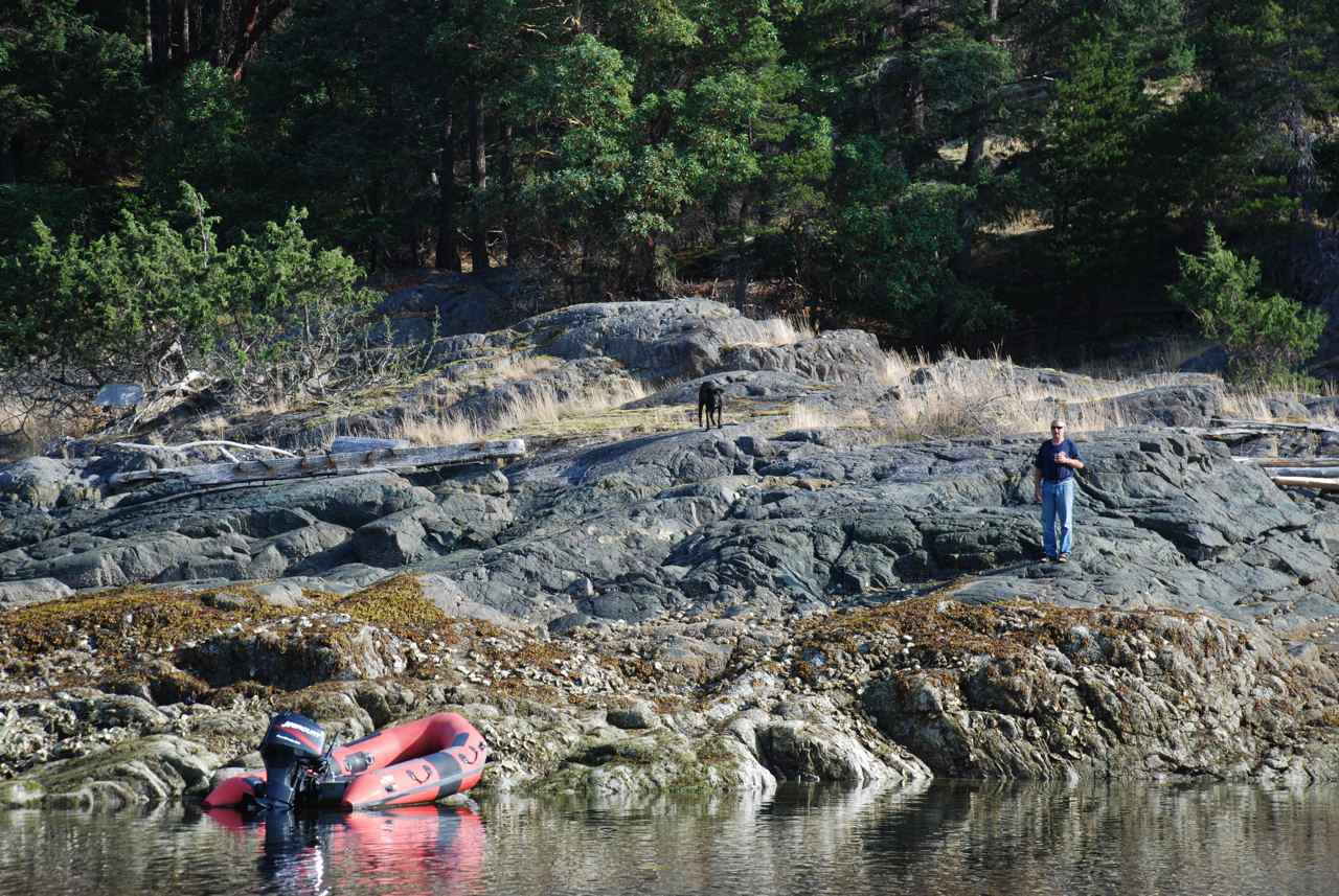
Toba at anchor in
Dunn Passage |
We left at 0700 with a forecast of NW 15-25 going to 5-15 in the afternoon and SE 10-20 overnight. The sky was cloudless and we started out fine but by a third of the way we were in two foot swells on our beam. We changed course from 099T headed for Otter Passage, between Banks Island and Trutch Island (Estavan group) to 108T. We put the sea to our stern and headed instead to the bottom of Dewdney Island with plans to cross over Camano Sound and into Clarke Cove on Princess Royal Island. This decision would add two more hours to an already very long trip but at least we could handle the sea with a higher comfort level.
I checked the weather again around 1300 and was pleased to hear it had now been updated to NW5-15 easing to light. Two hours off of Banks Island we were able to return to our original course and shorten the trip back two hours. Banks Island had helped to shield us from the winds and also changed the direction of the swells.
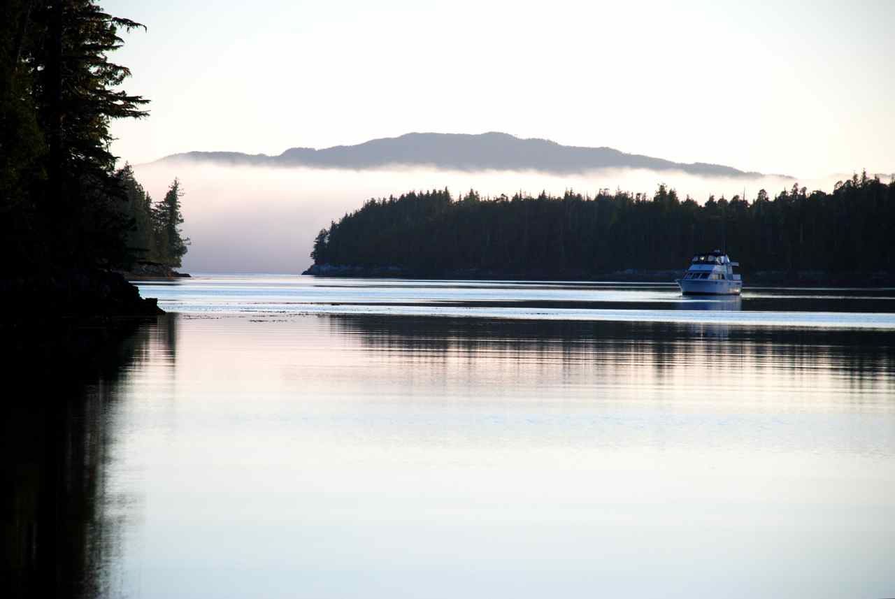
We were glad the sea had quieted enough that we could go back to our original, shorter destination but now we were dealing with fog along the western shore of the mainland. With radar on we continued the rest of our journey knowing that the sky was blue above us but the fog was keeping us from it. What a difference the fog makes to your whole psychological mind set. When the sun is shining, a “snarky” sea is much easier to take. As soon as you add the fog, lessened visibility and a dark gray sea it seems to put a damper on in more ways than one.
Toba was ahead of us and assured us that the fog had lifted and there was blue sky on the other side of Otter Passage. When we reached Otter Passage it was high slack, which is the best approach as the water here can flood at six knots according to the charts. There are small islets and reefs around which add to the tension after having already crossed the dreaded Hecate Strait.
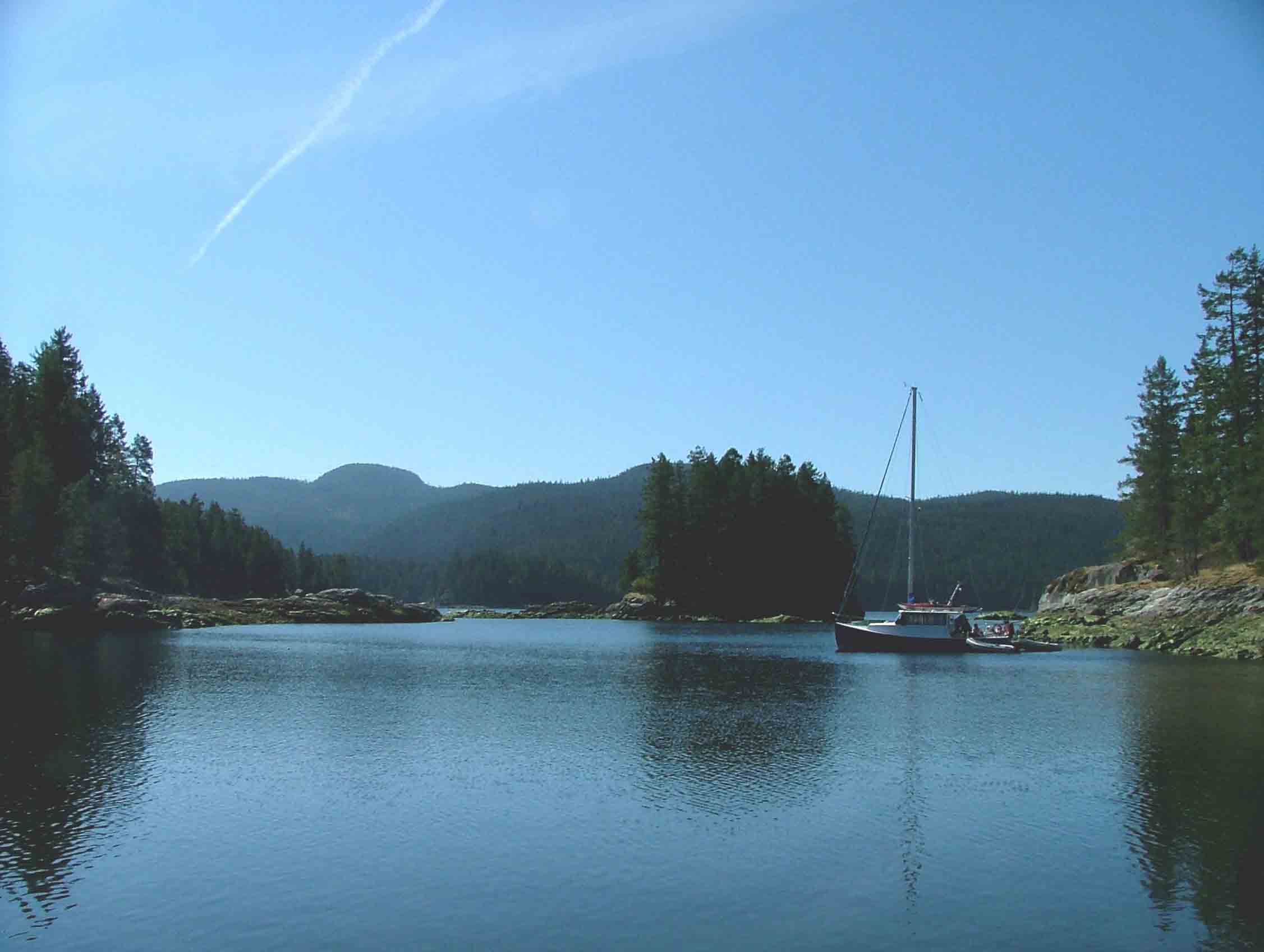
As we reached Estevan Sound and turned southward we could see blue sky overhead but a layer of fog still hovered over the water. As we motored into the inlet we were free of fog, the sky was brilliant blue overhead and there were two other boats already resting at anchor.
Our hook went down in Dunn Passage 1830. It had been a very long day. Barb and I had been preparing dinner since entering Otter Passage so all we needed was to barbeque the steaks. We got together on the Sea Foam, toasted our successful crossing, albeit uncomfortable at times, and enjoyed another night in each other’s company. Tomorrow the Toba will fish off Campania Island, known for its good fishing, and the Sea Foam will continue south along the outside of the Inside Passage before the predicted southerly winds make the travel too rough.
We said our goodbyes with heartfelt hugs and retired at 2330. |
||

|
Date |
Dunn Passage, Weinburg Inlet, Campania Island to Higgins
Passage |
Weather |
|
|
Thurs., Aug.7th/08 |
Foggy early morning, clearing by noon, low clouds most of the day |
||
|
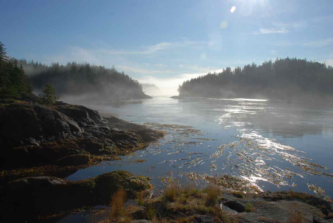
Campania Island in
the Clouds
Campania Island Beach
Higgins Passage narrowing
Our anchor spot
east of Higgins Passage next morning |
We slept in today and when we woke up at 1000 Rick decided we were headed for Meyers Passage, a distance of 49 nautical miles. After listening to the weather we could expect a reasonable day of winds today but the southerlies are moving in and by Sunday they are predicted to be up to 35 knots. We would like to be in Shearwater by then not only to sit out the weather but also to do our laundry. The laundry there is right up the ramp from the dock making it very convenient, unlike Port McNeil where you have to lug your sac of dirty clothes three blocks up the road and back from the dock.
We said a quick goodbye to the Toba crew as we passed their boat and wished them safe travel to Hartley Bay tomorrow and good luck fishing today.
Earlier today, when Rick got up, the Toba was obscured by fog but it had lifted in the anchorage and outside in Estevan Sound. As we motored out of the inlet we saw three other boats heading north along Banks Island. This is a change after seeing few boats in the Queen Charlottes.
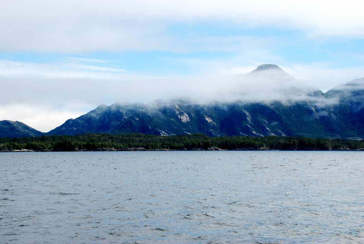
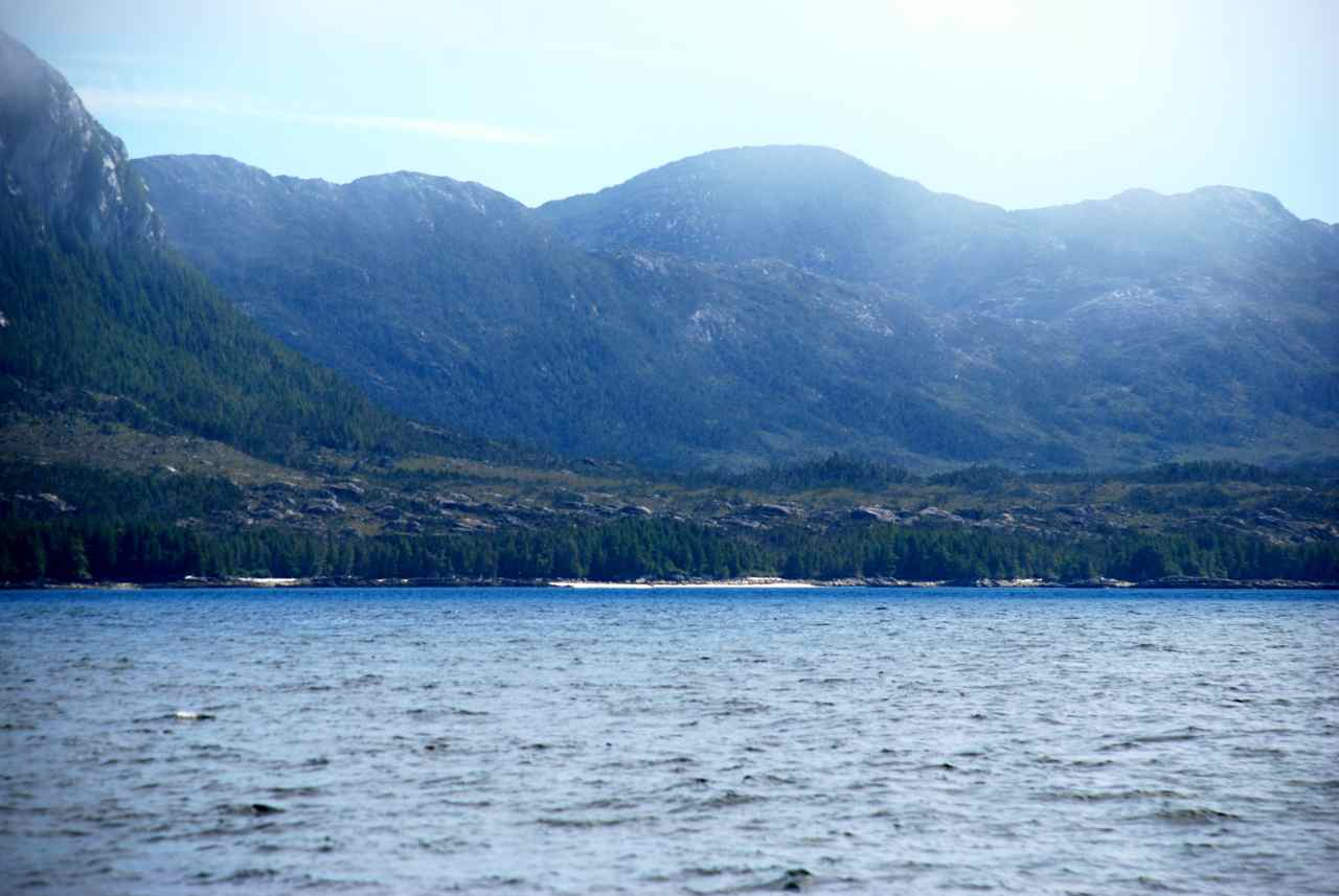
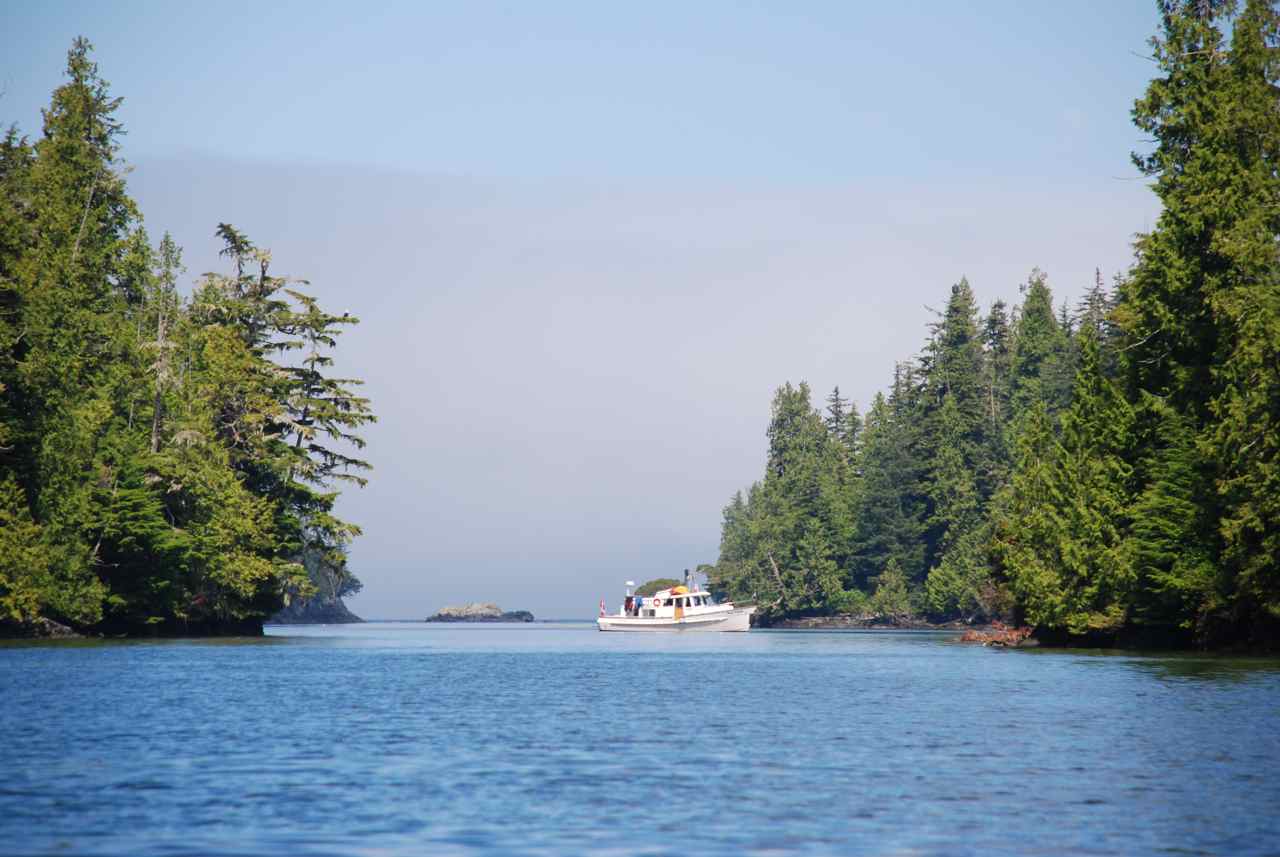
Once out in Estevan Sound we admired the low cloud over Campania Island and noticed what appeared to be beautiful sandy beaches along the shore line just south of Jewsbury Peninsula. The anchorage found there at McMicking Inlet looks like a good one too. John Alexander, on his trip to the Queen Charlotte’s five years ago, reported that this was a lovely spot to anchor and explore. Maybe next year for us.
As we approached Caamano Sound we could see the tide line ahead of us. We were experiencing small swells from Hecate Strait and were glad the winds are light today. We again were surprised and reminded, as we approached the smooth water tide line, of the effect the tide has on smoothing out the water. Although it slowed us down almost instantly on crossing it by almost a knot, the water was smoothed out flat and we enjoyed the more relaxing ride.
We had set a course to go to Meyers Passage but when reading the Douglass’ book we decided to give Higgins Passage a try. It would put us closer to our destination for tomorrow, Shearwater, and looked like an interesting place. The Douglass’ described it as a challenging navigational exercise and only to be transited at high water slack. We would have to cross over a bridge of land that dries at 5 feet to get through the worst of it. We had it timed to arrive at high water slack with the water being 14 feet high. Douglass’ warned that the flood tide runs through the narrows at five knots with a one foot overfall complete with foam.
As we neared the entrance tension mounted. We had the chart that the Douglass’ recommended on Nobeltec but when we started to enter in the boat icon on the computer screen had us going right over an island. The blue charts that Rick used at the helm with the portable Garmin showed the area accurately, thankfully, and we were able to navigate through the worse part of it. It seems the quilting was not accurate from Nobeltec. When we went to the course we plotted on the older chart from Nobeltec the way was clear and useful.
We had a least depth of eight feet and no trouble going through the tight right angle turn after the land bridge. Very large herring (or so I thought) jumped at the surface of the water. They appeared to be very surprised to be disturbed by a boat. These fish had to be at least eight inches long.
We anchored at the east end of Higgins Passage and were comfortable through the night. The anchorage was protected and peaceful with only curious seals to interrupt our solitude. |
||


|
Date |
Higgins Passage to Wigham Cove |
Weather |
|
|
Fri, Aug. 8th/08 |
Foggy morning with low lying clouds in afternoon |
||
|
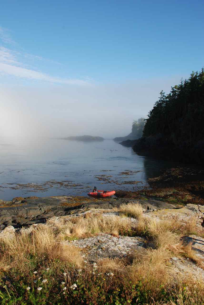
Wigham Cove
|
Good anchorage. We want to explore again entering from the east side with time to examine the water when rushing through the narrows. A herring school hit up against the hull of the Sea Foam in the early morning and woke me up. I got up to look and there was another strike against our hull.
Seas very calm for transiting this area when we left. Very nice travel to carry on off the “outside” of the Inside Passage. We had a great trip to Ivory Island with a humpback sighting and fishing boats around the lighthouse at Ivory Island. We turned into Rescue Inlet area and anchored in Wigham Cove.
Once anchored we took the Catch-Up out and went fishing. We didn’t catch anything but I think it is more because of our lack of experience. We put down a prawn trap before we went fishing and when we checked it later it was empty. We plan to return to Rescue Inlet to explore next year. We heard there was good fishing and some hiking trails farther up the way. |
||

|
Date |
Wigham Cove to Shearwater Marina |
Weather |
|
|
Sat., Aug. 9th/08 |
Cloudy with Sunny Periods |
||
|
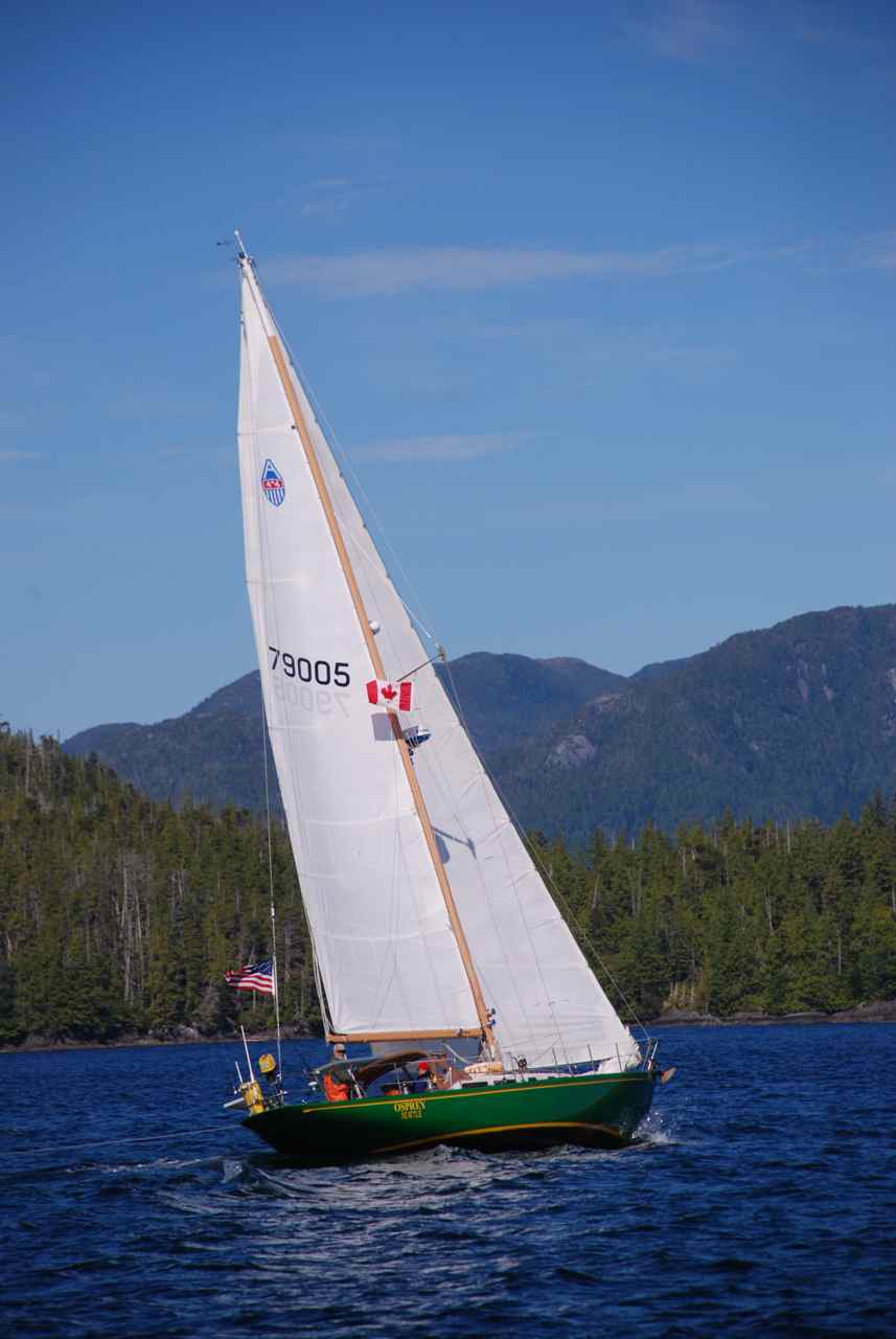
SV Osprey
|
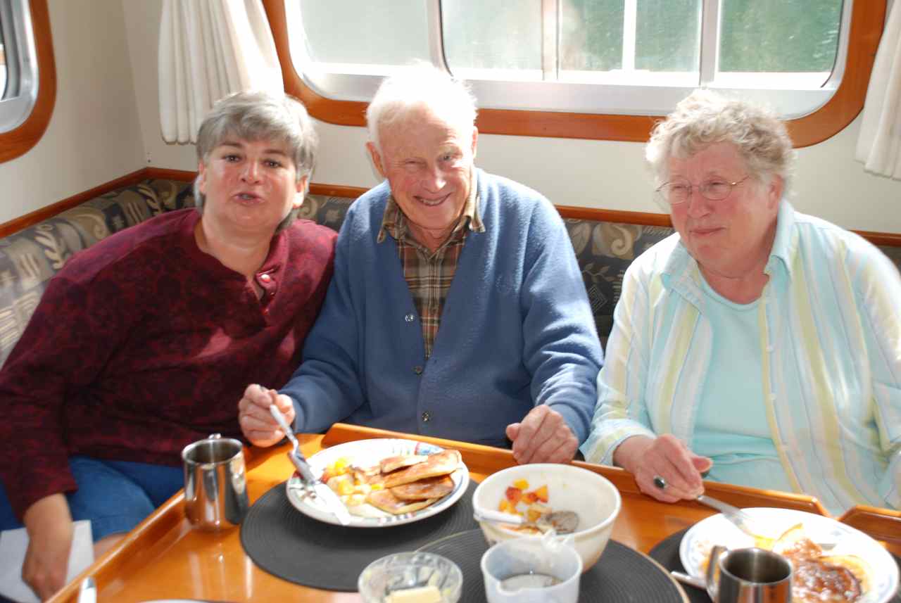
Laundry day. Talking with folks around the dock and listening on the radio it was determined there is good fishing in a large bay off of Idol Point around the small islands at the opening. We met the crew from the MV Reel Estate, a Krogen from California, and the MV Lady Laura, an older 50’ Fleming. We also met Elsie and Stephen Hulsizer, from the SV Osprey. We took pictures of their boat while underway yesterday and copied the shots to a CD for them. Elsie has written a book, “Sailing to Windward”. We also met the crew of the SV Casablanca from San Francisco. We had seen both these sail boats in Caamano Sound and took pictures of them undersail. We copied the shots onto a CD for the Casablanca as well. Both boats were also returning from the Queen Charlottes and had met our friends on the MV Good Vibrations. We had dinner at the pub on the dock with Lady Laura crew, Garth, Laura, and their two children, Molly and Brian.
|
||
|
Date |
Shearwater Marina, to Bella Bella, to Foughner Bay |
Weather |
|
|
Sun., Aug.10 /08 |
Cloudy with rainy moments |
||
|
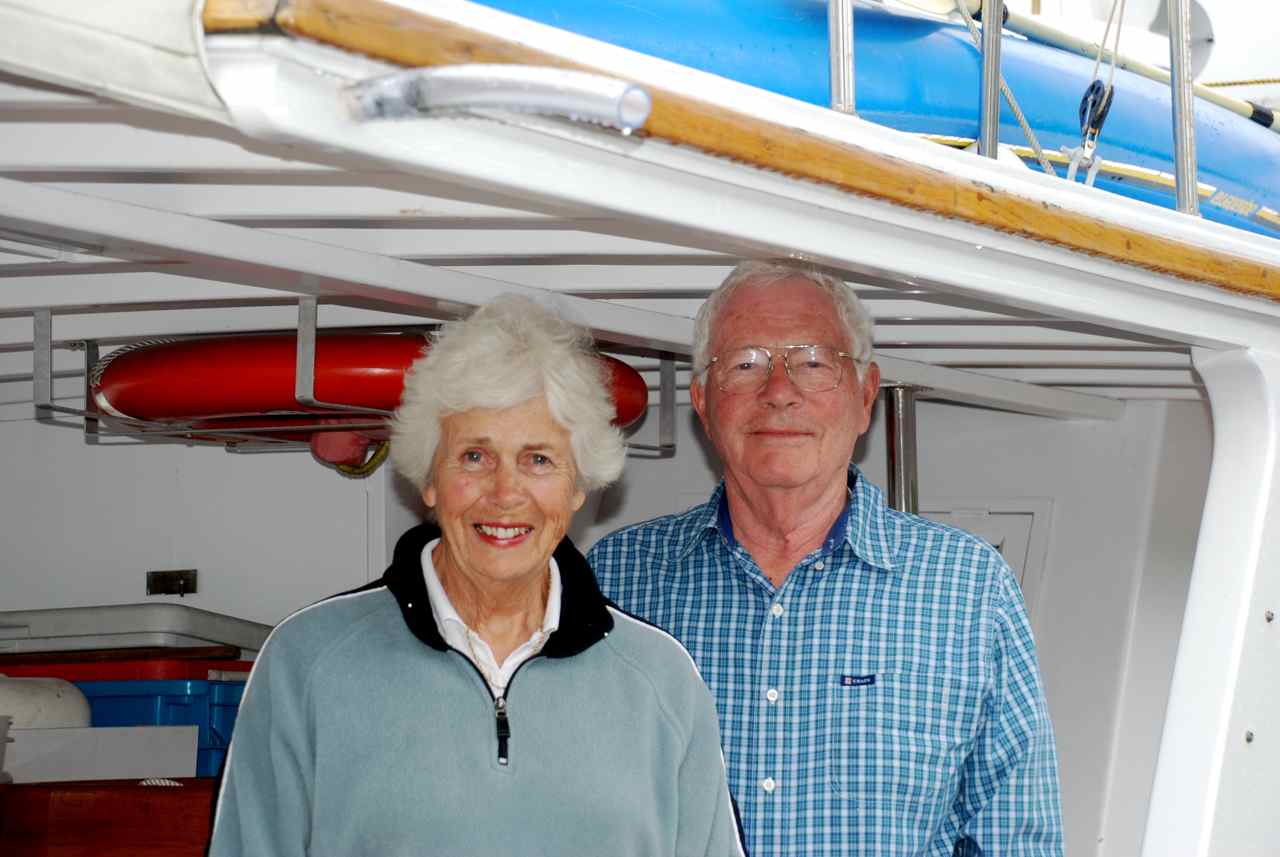
CA with Elsie Hulsizer and husband Stephen
|
We bought a book off of Elsie for a pending trip around the west coast of Vancouver Island. They typically travel clockwise as far as Brooks Peninsula and then turn around. They suggested if going from Sooke to Barkley Sound to go across to Port Angeles, then Neah Bay and then across to Barkley Sound. Makes the going easier and shorter. Check in at Port Angeles customs. We said our goodbyes on the Shearwater docks and headed for Bella Bella for water.
Shearwater water is not as good – have to boil it and it is a light brown color, which isn’t appealing when your ice cubes have brown centres.
We had a phone call from our friends Andrew and Janet Gunson (MV Maiatla) while watering up in Bella Bella to meet up in Clam Bay, off Browning Passage to scuba dive together. After watering up and grabbing a few groceries from the co-op store we carried on into Llama Passage where we spotted a humpback. As soon as we turned to port in Llama Passage cell phone reception from the tower at Bella Bella was lost.
Last year we stopped in Namu to anchor as we heard there was good crabbing at the back bay. This time we went into Foughner Bay and found it a very nice anchorage. Tricky only in the narrow area with a rock almost in centre. It looks like you should favour the starboard side on entering because there’s more room but it shallows on that side whereas if you go far to port the depth is good very close to the shoreline. We were there at an eight foot tide with 20 feet of water under us just thirty feet from the shoreline. A Krogen, the MV Bolero, anchored for the night as well. No radio reception to get the weather forecast.
We went fished out in the inlet but to no avail. We spent a quiet night and had a restful sleep. |
||

|
Date |
Foughner Bay to Big Frypan Pan |
Weather |
|
|
Monday, Aug. 11/08 |
Cloudy warm with a minute or two of sun |
||
|
Addenbrooke Island |
Had the ebb tide giving us an extra knot today. Cruise ship passed us and we had several humpback whale sightings. Such a smooth sea that we thought we’d make a run for it and go around Cape Caution or be weathered in until Friday. When we reached the south end of Addenbrooke Island the sea was flat calm. We had planned to go around the north side of Penrose Island if this area was lumpy or uncomfortable but instead we decided to go to the south end of Penrose and if the water seemed good go on around Cape Caution. The Captain was cautioning this decision in light of the gale warnings but it seemed the winds hadn’t arrived yet. As we got closer to the time when we would turn to port and into our intended anchorage we checked the automated buoy reports and the lighthouse reports and it was blowing SE24 at Egg Island, which was not good. Off to Penrose Island we went.
Big Frypan was a great looking anchorage. We backed into the anchorage at the southeast corner in 24 feet of water and put a stern tie to shore. Predicted gales showed up at 1730, or so it seemed, judging by the light ruffle of wind from our burgee from that direction. Tonight we monitored the weather forecast in Queen Charlotte Sound and Queen Charlotte Strait as we would be leaving the sound and traveling south into the strait and would need the information for both places to make a good decision about going around Cape Caution tomorrow.
|
||
|
Date |
Big Fry Pan Bay, Penrose Island to Clam Bay, Nigei
Island |
Weather |
|
|
Tues, Aug.12 /08 |
Rain, cloudy by late morning, fog in Queen Charlotte Strait |
||
|
CA on the Weather Channel
Big Fry Pan Bay
Leaving Penrose Island for Cape Caution
Cape Caution
Sea Lions on Bright Islet
|
I woke up at 0730 and checked the weather forecast and it looked like we could go around Cape Caution today. Window to go was this morning or not until Friday. The SE winds were predicted to ease to 10 to 15 knots this morning and then increase in the afternoon. West Sea Otter was South 12 kts with 1.5 m sea.
As we approached Egg Island we saw our first Orca whales but just two.
Water was calm and flat by the time we reached Pine Island. Rick noticed the shape of what could be sea lions on Bright Island in the Buckle Group just south of Pine Island. One look through the binoculars proved him to be correct. It was so calm and smooth that we slowly motored over to the rookery and took several good photos. The animals were in two different locations on the same island. The first ones we came upon had a lovely flat rock that would ramp them easily in and out of the water. We estimate there were about forty to fifty of the huge creatures in one area and on a little further, also on the west side of the island where there was a steeper drop off, were another bunch numbering about the same. They roared and rumbled as we approached and some moved into the water right away. The majority of them just stayed where they were and seemed unaffected by our presence.
We were able to get cell phone reception outside the anchorage at Clam Bay on Nigei Island so checked our e-mail but as we got close to the narrow entrance the reception was gone. There was no one else in the anchorage so we dropped our anchor, Rick took Kona to shore, and we lay down to read and relax after our four and a half hour journey. Cape Caution is the last of the difficult “gates” to transit on our return south. The rest is easy, if you call Johnstone Strait and Georgia Strait easy. For us they will seem so but we have to be careful not to get too cocky. The last summer cruise we had it was the familiar waters in our own back yard, the mighty Strait of Georgia, that gave us a run for our money. The water we are most used to cruising in was the one that gave us the worse sea and the most uncomfortable ride.
While calling the SV Maiatla on the VHF, checking to see if they were near to our meeting place, Lady Laura heard us and called in from Pine Island. They had been at Duncanby Landing in Rivers Inlet and were now on their way to Port McNeil or Port Hardy. They called to ask our opinion of the best spot to go for water and to get a “city fix” after being in the remoteness for several days. I told Captain Garth that Port McNeil was easy to get around, in that everything was in walking distance. Port Hardy is a bigger place but shops and stores are farther from the docks at the Quarterdeck Marina.
The fog rolled into our anchorage around suppertime but the misty rain had stopped. After supper we took it easy and will get a good night’s rest for diving in Browning Passage tomorrow. We expect the crew of the Maiatla to pull into our anchorage tomorrow afternoon.
|
||


|
Date |
Clam Bay, Nigei Island
|
Weather |
|
|
Wednesday, Aug.13 /08 |
Fog until noon, Sunny |
||
|
Browning Passage - Great Diving
Clam Cove - Fog in the distance
Calm of Clam Cove
|
Slept in with no deadline until dive time today – 1400 in Browning Passage. As we lay in bed we heard a disturbance outside the boat that sounded like something breathing nearby. I got up to look out and realized the sound was herring trying to walk on water as seals came up underneath to feast on them.
We took Kona to shore off the small drying area on the east side near our anchorage. There is a small peninsula with a narrow strip of land connecting it. We thought we could walk the short distance to Browning Passage to have a look. Based on what we could see on the chart it wasn’t very far away. We were able to walk into the forest and sure enough, Browning Passage was on the other side but we couldn’t see much of it for the trees and shrubs.
On our return we saw a Coast Guard zodiac speeding into the anchorage. Two men stopped to talk with us and informed us they were checking to see that the “no shellfish” signs were still visible and intact. The one man said, “There is too much “poo” in this cove for the clams to be any good.” The driver of the boats was at one time the Captain of the Nautilus Explorer, a large dive charter boat. Rick had known the owner of the boat, Mike Lever, many years ago when he was more involved in the diving scene and took out occasional dive charters himself.
When we came up from our dive and slowly made our way back to the Sea Foam we noticed a sailboat coming into the anchorage. We were thinking it might be our friends on the Maiatla. When we got back to the mothership there was a small sailboat making its way undersail into the back to anchor.
After we put the dive gear away we went just outside our anchorage to fish. A large group of seagulls were interested in something on the water and as we approached several flew over the boat as if to check us over. Rick waved a herring up in the air at them and one followed us for a time. When Rick was ready to re-bait his line and put it out behind us as he adjusted his weight, one of the seagulls flew down and had thoughts of grabbing the bait from the surface of the water. As the ebb tide increased in Gordon Channel and the opposing wind picked up from the northwest, the waves became bigger, steeper and uncomfortable so we decided to head back in after fishing for an hour.
After an action packed day we enjoyed dinner and a movie and retired.
|
||


|
Date |
Clam Cove |
Weather |
|
|
Thurs., Aug. 14/08 |
Fog until 1400, Sunny |
||
|
Clam Cove – Fog Bank in the distance in Queen Charlotte Strait
Browning Passage Hideaway Resort in Clam Bay |
Fog was thick in Queen Charlotte Strait today and we listened to the foghorn at Scarlett Point and a cruise ship hailing pleasure boats to alert them to the ship’s approach, as they were experiencing zero visibility on the water. From our anchorage we could see the fog lying on the water in the strait but we were enjoying the sunshine.
We set about washing the decks and sidewalls of the boat as well as the cap rails in preparation for teak oil. The fog started to roll into the anchorage and Rick decided it was likely also in Browning Passage and didn’t think we should dive in the fog. Within a half an hour the fog had rolled past us and we decided to take a quick run around the corner to Browning Passage to see if the fog was still lying in there. We jumped in the Catch-Up and were happy to see that the fog was on its way through the passage and on out into Goletas Channel, likely heading towards Port Hardy. We decided to hurry back and get a dive in today after all.
When we returned from our dive we relaxed a bit, had supper and a movie. While Rick took Kona to shore for the last time today I again watched the seals hunt the herring. The water splashed and turned silver along the surface as the herring made every attempt to get out of the way of the feeding seals.
|
||
|
Date |
Clam Cove |
Weather |
|
|
Friday, Aug.15 /08 |
Foggy until noon. Sunny with cloudy periods |
||
|
Trail to Port Alexander
Port Alexander Beach |
Foggy morning again but lovely to hear the sound of the foghorn from Scarlett Point. The cruise ships also blow their horns as they pass to alert cruising boats to their presence. I imagine it would be hair rising to see a cruise ship looming ahead of your bow even with a quarter mile of visibility.
We heard a kayak guide call a security that she and eight other kayaks were crossing Browning Passage and mariners would have to keep an eye out for them. Very brave kayakers to be sure.
We had planned to dive again today but instead decided to take a hike from the head of Clam Cove through a lovely first growth forest to Port Alexander on the other side. The trail is flat and well marked by miscellaneous items that hikers have hung from the trees - shoes, juice containers, a hard hat, to name a few.
After about a twenty minute leisurely walk through the trail we emerged on the other side in Port Alexander to find two sailboats anchored. As we threw sticks in the water for Kona to fetch, the nine kayakers we had heard on the radio earlier paddled in and took to shore to have their lunch.
|
||
|
Date |
Clam Cove, Nigei Island to Alert Bay |
Weather |
|
|
Saturday, Aug. 16th/08 |
Foggy but sunny until we reached Haddington Island |
||
|
Alert Bay looking
fine |
We planned to leave today with the flood current going our way through Goletas Channel right through until we reached Alert Bay. The fog was thick but we could see about a quarter of a mile in front of us and the radar was on. We had a nice push from the flood current while in Browning Passage. Nobeltec said we had a current in Goletas Channel of 3 knots but we did not experience that while cruising southward. It remains a mystery to us why we didn’t get the push of that current while we were running.
As we motored past Port Hardy we were able to pick up cell phone messages and check our e-mail. Andrew and Janet were held up with a water pump problem but would try to line up with us further south.
I sat on the bow and was surprised to hear the loud and constant signal from the lighthouse at Pultney Point at the north end of Malcolm Island. It reminded me of a school recess bell that wouldn’t turn off. The fog lifted once we approached Alert Bay on Cormorant Island.
We radioed into the harbour master on channel 66A and he said he was very full but we could raft. The idea didn’t appeal to me but we needed water and some fresh fruit and veggies. He checked down at the docks and two large pleasure craft were leaving so we had a spot after all.
We were helped tying up by the crew from the power vessel Hot Rum. They were from Vancouver, Spruce Harbour, where John Alexander and Cheryl Fornier are also live aboards. Spruce Harbour, in False Creek is the only live aboard dock in the area and they have sewer to each boat and storage space on shore. The waiting list is about five years long and the fees are $1500 per year on top of moorage. We once inquired about it and it was somewhere in the area of $5000 to get into the dock initially. |
||

|
Date |
Alert Bay to Safety Boat Cove, Plumper Islands |
Weather |
|
|
Sunday, Aug.17th /08 |
Sunny, fog until 1300 |
||
|
Plumper Islands -
Fog Clearing
Safety Boat Cove -
Plumper Islands
Shore Duty |
Our departure time today was aimed for 0930 so we could get to Safety Boat Cove at slack, 1030, but by the time we were up, had breakfast, Kona to shore and filled the water tanks we were an hour behind schedule. It wouldn’t matter too much according to the Captain so off we went the short 5 nautical miles to our favorite anchorage in the Plumpers.
We radioed for our friends on the Magistra and the Anderson Cove and heard back from Bruce and Lois from the Hideaway. They told us they had not seen the Magistra this summer at all and that the Anderson Cove had gone around Vancouver Island and were now in the Gulf Islands. At the same time we were speaking to Hideaway we heard from the Lady Laura, the family we met in Shearwater, and they were in Lagoon Cove.
Once in our anchorage in the Plumper Islands we settled down and did some boat chores and dry suit tune-ups. We planned our dive for this afternoon at 1700.
The diving in and around the Plumper Islands is lovely. The currents from Weynton Passage, Johnstone Strait, Blackfish Sound and many smaller passages in between keep a steady flow of food, such as plankton and small krill and herring, coming and going through the small islands. The life in the area is abundant consequently but the diving is tricky without a live boat to drop you in and pick you up. We had to time the dives just right to go in when the current is finishing going in one direction and then swim back to the Catch-Up when the current switches and goes the opposite way. We tie the bowline of the Catch-Up to shore, back away from shore so the boat isn’t rubbing against barnacles, and throw a small anchor off the side to keep us in position off the rocks. We put up our dive flag to alert boaters we are in the area.
My Captain is very good at determining where the boat is so when we finish a dive and come back up from depths of 90 feet or so we are close to the boat and not beyond it. If we were beyond it, it is more difficult to swim against a current to get back to the boat.
We listened to Channel 07 for the whale watchers’ sightings of sea mammals in the area. There haven’t been many humpbacks in the area this summer but they were expecting several pods of orcas to be in the Plumper area tomorrow. They have folks all along Johnstone Strait that record and research the comings and goings of the whales. The whale watchers report their sightings, the researches inform the whale watchers and the volunteers from Strait Watch out of the Vancouver Aquarium keep watch that the whales are not harassed by boaters wanting to get a closer look. |
||

|
Date |
Safety Boat Cove to Blind Channel Marina |
Weather |
|
|
Monday, Aug.18th /08 |
Sunny, little fog in Johnstone Strait |
||
|
Orca Family
Gikumi looks on
Orca Goodbye at
Robson Bight
Lois and Bruce
Buchanan onboard the Hideaway |
I was up at 0730 this morning and wanted to take a look at our depth. The low tides are very low these last few days and today at 0915 the tide was to be 1.1 feet in our anchorage leaving us in a spot where we would likely only have about six feet of water under us. I noticed on the sounder that we were already at eight feet so I loosened the stern line and pulled up the anchor to hopefully pull us forward and into deeper water. We normally anchor more to the west side of the anchorage but this time we were directly in the middle. It stayed about eight feet even though I pulled us forward thirty feet so I consulted the Captain and he said not to worry about it. We could be in five feet of water as there is a two-foot off-set on the transducer anyway. I reported that the tide was still dropping until 0915 and he was not concerned.
We had breakfast, took Kona to shore, made a few phone calls to home and weighed anchor by 1000. The sun was shining with a clear blue sky with only a small patch of fog hugging the Vancouver Island coastline. A perfect day for a cruise down the mighty Johnstone Strait.
Johnstone Strait is long and narrow with steep mountains on the Vancouver Island side and some large mountains on the opposite shore as well. The winds funnel through this area, particularly in the afternoon if it has been hot throughout the day. Today the winds were predicted to be light, 5-15 from the northwest and the current would also be going in that direction making for a smooth sea and a gentle push to aid our fuel tank.
As we settled into our course for the next hour we were happy to hear there was orca ahead all meeting at Robson Bight, the only whale reserve in North America. Here the whales are carefully watched over and boaters are to remain a distance away from the shoreline where these whales love to come in and rub their backs on the large smooth boulders found along the steep-to beach.
As we neared Sunderland Channel we heard our friends, Bruce and Lois on the Hide Away and radioed them. We made arrangements to meet in Blind Channel and have dinner together. They were six miles ahead of us and made the arrangements at the marina for our arrival.
We passed through Whirlpool Rapids with a four knot current in our favor and, although there were no rapids, the swirling water and the wind funneling through the area made for a rip tide that was remarkable. The wind was howling through the area, rattling our kayaks on the pilothouse roof, but once out of the pass things almost immediately settled down.
Once we arrived at the docks and tied up, with current making docking a bit tricky, we took Kona to shore and joined Bruce and Lois on the Hideaway for Happy Hour. We caught up on two years of news and discussed boating adventures and real estate. We continued to the Sea Foam for supper and further discussions about fish farmers, old canneries in River’s Inlet and mutual friends. A very pleasant evening together.
|
||


|
Date |
Blind Channel Marina to Octopus Islands, Quadra |
Weather |
|
|
Tuesday, Aug.19th /08 |
Cloudy with rain in the evening and overnight |
||
|
Forest Trail Sign
Blind Channel Marina from Forest Trail
Narrow Channel
leading in to Octopus Islands from Okisollo Channel (background) |
Had to get cracking this morning to make the slack tide at Upper Rapids just before arriving at Octopus Islands. We had a choice of going at 0500 and getting the flood in our favor, 1000 and fighting the ebb for a time in Johnstone Strait, or waiting until 1900, but a predicted SE 30 knot wind would be on us as well at that time.
The Captain slept and I took Kona for a short walk in the Forestry Trail – a great hike through a gorgeous first growth forest. A huge 80-year-old tree is the centre piece of the hike. Today we only had time to go to the lookout over Greene Rapids.
On the way back we stopped at the store and paid our moorage (1.50 per foot), bought more beer and butter and returned to shake the Captain out of bed. He was up and ready and together we walked over to the Hideaway to say farewell to Bruce and Lois.
All was well as we motored away down Mayne Passage but we didn’t fully realize the current affect on our travel until we headed into Johnstone Strait. As we passed Walkem Island off our port side we were running at 2100 and still barely making five knots. Our decision to leave at 1000 was making for difficult travel along this stretch but we also had to time our arrival at Upper and Lower Rapids at slack to get into the Octopus Islands. Once we reached Chatham Point lighthouse and turned into Discovery Passage heading southward we were out of the worst part of the current and throttled back and enjoyed a leisurely cruise into Okisollo Channel. Knowing that the rapids here must be run at or near slack we doubled checked our time and proceeded forward without incident. Often there are several boats transitting this area at the same time so it requires an alert watch at the helm and several checks and re-checks of the charts. Once inside the narrow entrance to the Octopus Islands the water is still and very well protected. We have entered further down the channel into Waitt Bay when we have come up from Surge Narrows along the west side of Quadra Island. Once inside the narrows we turned into the first small bay off our starboard side and stern tied close to the entrance. We were fortunate that this part of this popular anchorage was not crowded and we settled down to relax and enjoy our new surroundings.
|
||


|
Date |
Octopus Islands |
Weather |
|
|
Wednesday, Aug. 20/08 |
Cloudy and warm |
||
|
|
The sun was not out this morning but at least it wasn’t raining. We dove off the shoreline in Okisollo channel between the north entrance and the Waiatt Bay entrance. On our return we made radio contact with our friends Janet and Andrew aboard the sailing vessel Maiatla. They reported they would be joining us today as soon as they could make away from Granite Bay, on the other side of our location. They had a raw water pump problem and stayed in Granite Bay until they could get the part. We were happy to see them pull into our anchorage and anchor beside us. We had then over for dinner that night and heard all about their adventures. They ordered a part from Campbell River and, with the help of a very generous and friendly homeowner at Granite Bay, the part was picked up and delivered to them while they waited at anchor. Tomorrow friends that are also sailing in the area will arrive from Rebecca Spit at the southeast side of Quadra Island. They attempted to join us today but the winds were strong and they were not comfortable to make the journey. We enjoyed lively dinner conversation with the Captain and crew of the Maiatla and made plans to spend the next several days in this area. |
||
|
Date |
Octopus Islands |
Weather |
|
|
Thursday, Aug. 21/08 |
Sunny and warm |
||
|
View from our anchorage beyond to Waiatt Bay
Rick preparing for
the Dive
Andrew getting
ready with Janet helping |
Rick and Andrew dove. Jan and I topside. Mark and Jo arrive. Prawning unsuccessful. Visited cabin and dated Sea Foam’s mobile there – two years to the day. and visited the cabin that is located behind the trees off the narrow passage as it opens out into Waitt Bay. This cabin has many “artistic mobiles” that have been hung in the cabin by passing cruisers. We visited the mobile we left there in 2004 and we untangled it and gave it the once over and noted that we had visited this cabin exactly one year ago to the day. Dinner party and appies on Kristy’s Joy. Majistra found – happy hour together. Chicken dinner on Kristy’s Joy. |
||


|
Date |
Octopus Islands |
Weather |
|
|
Friday, Aug. 22/08 |
Cloudy with sunny periods |
||
|
Pancake Breakfast on the Sea Foam with Alex and Kay Porter |
Magistra crew for brunch. Happy hour on Maiatla. Early night. Dinner on Kristy’s Joy. |
||
|
Date |
Octopus Islands to Granite Bay to Gowlland Harbour,
Quadra Island. |
Weather |
|
|
Saturday, Aug. 23/08 |
Cloudy with spitting rain. |
||
|
CA and Kona come in from shore duty |
To leave today we had to negotiate timing over three sets of tidal rapids, Upper and Lower Rapids just west of Octopus and the big daddy of them all, Seymour Narrows. It would be too short a time period to get through slack at the Upper and Lower Rapids and then make slack further south at Seymour Narrows. The plan was to leave today to make the 1000 slack at Upper and Lower Rapids and then anchor in Kanish Bay until we could continue down Discovery Passage to meet Seymour Narrows at slack water 1715. We would have slight ebb current against us on our way down Discovery but it would be minor.
After breakfast and shore duty with Kona we untied our stern line at shore and weighed anchor. The Maiatla and Kristy’s Joy pulled out ahead of us and we were all at Upper Rapids a bit early but the water posed no problems for us other than we were fighting against it rather than enjoying a push through it. Upper Rapids are more of a concern as far as current and whirlpools and Lower Rapids can be avoided all together by coming around Okis Islands off of Barnes Bay. The distance is almost the same and then you don’t have to negotiate around Gypsy Shoal and the smaller of the Okis Islands where Andrew and Rick dove yesterday.
We had a peaceful putt down Okisollo Channel and around into Kanish Bay and anchored in between the Chained Islands in 60 feet of water. The sailors were going to relax and enjoy a barbequed hamburger lunch rafted together but the power boaters were more industrious.
Rick and I headed off with Kona for a hike to Newton Lake. We took the Catch-Up into Granite Bay and tied up at the public dock there. The docks were not totally occupied and we were able to tie the Catch-up off to a tire fender. Cleats were in short supply. We remarked on the moorage fees - $60 per month with no power or water. The bay appears to be protected.
We headed off down the road and when we reached a cross road, continued on straight following the sign on our left hand side. As we continued walking the road forked and we took the right road, which turned out to be the wrong road. We walked back and then as we walked about 50 feet on the “high road” we noticed the signage for Newton Lake and a homemade sign saying “no soap or shampoo” in the lake.
We have hiked to this lake several times from the Waiatt Bay side in the Octopus Islands. The trail from there leads to the head of Small Inlet and then on to Newton Lake. After reaching Small Inlet, about a twenty-minute level hike from Waiatt Bay, the trail continues on and becomes more challenging. At one point the trail is steep for about ten minutes and requires mountain goat skills. The trail is well marked and well used.
The first year we hiked to the lake we came across a small body of water after the mountain goat section where the trail thankfully levels off. When I saw the “slough” of water I was so disappointed that I hiked for nothing more than a pond. But we soon realized that this was only an overflow of Newton Lake and we pushed on along the flat trail and were pleased to see the large lake open up ahead of us. The lake is clear and cool and has an area of large rock cliffs to swim off of its eastern end. We once directed two hikers to the lake on our way down from it and later saw them in Waiatt Bay climbing into their kayaks. It seemed to me they had returned very quickly and when we asked what they thought about the lake they said they weren’t impressed with the size of it. It was then that we realized they too had first seen the “slough” and didn’t carry on to the lake proper.
When we hiked this trail in the past we had noticed at a cross road in the trail a sign pointing off to get to Granite Bay. We had always wanted to follow it and see that end of things so this was our day to do that. It took us an hour to walk to the lake and the trail was much easier going than from the Waiatt Bay side of things – no goat trail to negotiate although at one point the trail climbed for about fifteen minutes but it was not steep and the path was good.
When we reached the lake we ate our lunch quickly and turned back. We didn’t want the sailors to be worried about us and we didn’t want to miss slack at Seymour Narrows. When we returned to the dock and Catch-Up we radioed to the Maiatla that we were on our way. They had weighed anchor and were underway and ten minutes later we were also.
My Captain thought we could leave Kanish Bay by 1600 and make slack. The distance to the narrows was eight miles. Because we would be against a slight ebb current we left at 1530 and we were able to slow to 4 knots on approaching the narrows, as we were early to arrive. The closer we got to the narrows the less the ebb current was affecting us.
We were now back in cell phone reception so calls were made to friends and family informing them of our location and travel plans for our last week on the water before we had to return to home port.
Transitting Seymour Narrows was uneventful as we motored through at 1700. We reached Gowlland Harbour and were comfortably anchored by 1830. Dinner on the Sea Foam was called for 1930. All parties arrived and another full boat-load of chatter began. |
||

|
Date |
Gowlland Harbour, Quadra Island |
Weather |
|
|
Sunday, Aug. 24/08 |
Windy, cloudy with rain intermittently. |
||
|
On our way to Lasquiti Island on a flat calm Strait of Georgia
|
The winds from the southeast blew on the Sea Foam at 30 knots starting at 0230. The chop on the hull was too much for my ears so I set up my quilt in the saloon to sleep.
Today the Maiatla and Kristy’s Joy tied up to the dock beside our anchorage at SeaScape Marina. They wanted power and water and the fee was one dollar per foot. The proprietors also offered a ride to Heriot Bay so the Maiatla crew could re-provision. Rick and Andy planned to dive the Columbia wreck at Maud Island at the south end of Seymour Narrows today while the First Mates take to the shops in Heriot Bay – shops being only a grocery store and a liquor store.
We all departed from Seascape docks at 1130, the women to the land, the men to Maude Island aboard the Sea Foam. When the women returned to the docks with grocery bags in tow the Sea Foam was still away. We radioed to them to see how they were making out as the south easterlies were gusting in the anchorage at 22 knots according to the Maiatla’s wind instruments. At 1320 they reported they were anchored up and ready to proceed to the wreck site to dive. They returned in one piece with a successful dive story to tell by 1700.
The wind had calmed by this time and we enjoyed appetizers on the Maiatla and Kristy’s Joy provided dinner. Fresh corn on the cob was roasted on the barbeque as well. Some stayed on to play Mexican dominoes while the early risers retired to sleep at 2100. The winds had subsided and it was a calm night in Gowlland Harbour. |
||

|
Date |
Gowlland Harbour to Boho Bay, Lasqueti Island |
Weather |
|
|
Monday, Aug. 25/08 |
Sunny skies and light winds |
||
|
Leaving Discovery
Passage and Campbell River
The End is Near |
The weather was predicted to be light all day so we made our move out of the harbour and took advantage of the flood current in our favor until Mitlenatch Island where the flood current flows in the opposite direction. When we motored out into Discover Passage past Orange Point the current was 4 knots and we enjoyed a push out of Campbell River and on to Cape Lazo. At the southern tip of Quadra at Cape Mudge if the wind is blowing hard from the south against this flood current the area is said to be very dangerous with standing waves. It was remarkable to see the floodwater as it pushed us out of Campbell River.
The sea was flat calm and the sky was cloudless. White billowy clouds hung over Vancouver Island and the mainland but nothing for us overhead. Our intention was to anchor in Scottie Bay on the northwest side of Lasqueti. Our sailing friends declined to follow us there as it is a tight anchorage and shallow at its entrance. Kristy’s Joy is a 65 foot sailing vessel and requires eight feet of water under her.
After a gorgeous seven hour cruise we pulled into the entrance at Scottie Bay only to find there was little room at the inn for the Sea Foam. The Captain thought we could stern tie on the south side of the anchorage against the cliffs but I didn’t like how tight it was and the boat was close to another sailboat swinging freely that would be threatening while we arranged our stern tie. I didn’t want to have to deal with holding the Sea Foam in position away from this other boat while the Captain arranged the tie up of the line to shore. There was also a floating home of sorts on the opposite side of us hemming us in further. Much to my Captain’s disapproval I would not cooperate with his plan – mutiny on the Sea Foam.
We left the anchorage and moved on south to Tucker Bay and checked out that anchorage. It was not protected from the southwest wind that was on us now so we carried on to Boho Bay. We were happy to see that it was a good anchorage with plenty of room for us.
After we set our anchor and Kona went to shore the Maiatla checked in by radio to see where we were. They were aiming for False Bay on the northwest side of Lasqueti Island. We told them of our revised position and they said they were going to come and join us and bring with them a dinner invitation aboard their vessel for a feast of barbequed ribs. Kristy’s Joy was close behind and they would arrive in one half hour.
As we prepared some side dishes to accompany tonight’s festivities more boats arrived in the anchorage. We were surprised to see they were all sailboats with ourselves and one other power boat being the only “stink pots” in the bay. By the time the Maiatla and Kristy’s Joy motored in there were nine boats in the bay in total.
We enjoyed a wonderful meal with friends on the Maiatla and retired by 2200. |
||

|
Date |
Boho Bay, Lasqueti Island to Delta Marina, Middle
Arm Fraser River |
Weather |
|
|
Tuesday, Aug. 26/08 |
Sunny in Lasquiti Cloudy with Rain in Richmond |
||
|
Lasquiti Island Shore Duty
Rough Weather outside Howe Sound
Back on the River and Out of the Weather
|
After a restful sleep our plan for today was to collect oysters, put down a prawn trap and go kayaking until we listened to the weather forecast. A gale warning was issued with winds going to 35 knots overnight. Wednesday wasn’t much better and our planned crossing of the rest of the Strait of Georgia was for Thursday but that prediction had deteriorated as well. The winds were only light in the early morning of today - not for the whole day. We decided we were going to make a break for it and the sooner the better. The winds were to build from the south by early afternoon so we weighted anchor, said good-bye to the Maiatla and Kristy’s Joy crews and put to sea at 0930.
We started off with a flat calm sea and when we approached the north end of Halibut Bay we were in a two foot chop on the nose. The flood current was going with the water so it was keeping the waves reasonable for us. The forecast called for southeast winds to 15 knots until early this evening when they will go to 25 knots and then 35 late overnight.
One of our friends, Mark Weir, Captain of the North Pacific 42 XXIV VII, left a message on our cell phone saying the landlubber weather was calling for heavy rain tonight and tomorrow and gave us his opinion that we should make hay while the sun shines. We had come to that conclusion as well and were not uncomfortable with the sea as it was.
It has been our experience in the past to become complacent about the Strait of Georgia because we feel we are more familiar with it as our “backyard neighborhood”. On two occasions after returning from a summer of carefully crossing Johnstone Strait, Queen Charlotte Strait, Queen Charlotte Sound and around Cape Caution we have had the Strait of Georgia remind us that she too can give a boater a rough ride. This is the first time we have traveled south down the centre of the Strait rather than closer to shore along the Sunshine Coast.
As the clock ticked on the weather began to deteriorate and we were glad we had not delayed in leaving this morning. As we approached Merry Island on our port side the waves and wind were coming on our beam and the sea was about six feet. I removed myself from the pilot house and layed down in my “foul weather position” in the saloon along the aft settee bench. The boat rocks more comfortably for me here and Kona likes to climb on top of me for security and moral support. It always amazes me how quickly things can change on the water and how important it is to stay aware of weather at all times.
As we neared the Fraser River at the North Arm the rocky jetty kept the waves at bay and once in the river we were again on smooth water.
We motored a further forty-five minutes until we turned to starboard to anchor in the Middle Arm of the Fraser near the Delta and Skyline Marinas. This part of the river is shallow and there isn’t any commercial traffic other than the occasional log salvage boat towing a log or two. The current in this part of the river needs to be attended to but with a skilled captain anchoring in this mucky bottomed area is not a problem.
Once anchored we took Kona to shore and visited with the Captain of the MV Corona at the Delta Marina where we were treated to a fine full course dinner and many stories to share of each other’s summer adventures. |
||

|
Date |
Middle Arm Fraser River |
Weather |
|
|
Wednesday, Aug. 27/08 |
Cloudy with light rain |
||
|
|
We relaxed today and tried to get used to the idea that we were, once again, back in civilization. We did many boat chores and some running around on land. Kona had a lengthy walk along the dyke and we visited with friends and family who were curious to know how our summer had gone.
We decided to head home tomorrow. We hadn’t planned on arriving this early in the river but the weather had forced us to return sooner than we had hoped. We might as well head home tomorrow as sit in the river here in the rain. |
||
|
Date |
Middle Arm Fraser River to Mission Small Craft
Harbour – Home Port |
Weather |
|
|
Thursday, Aug. 28/08 |
Cloudy with light rain |
||
|
Peter Watching Our Return
Westminster Quay
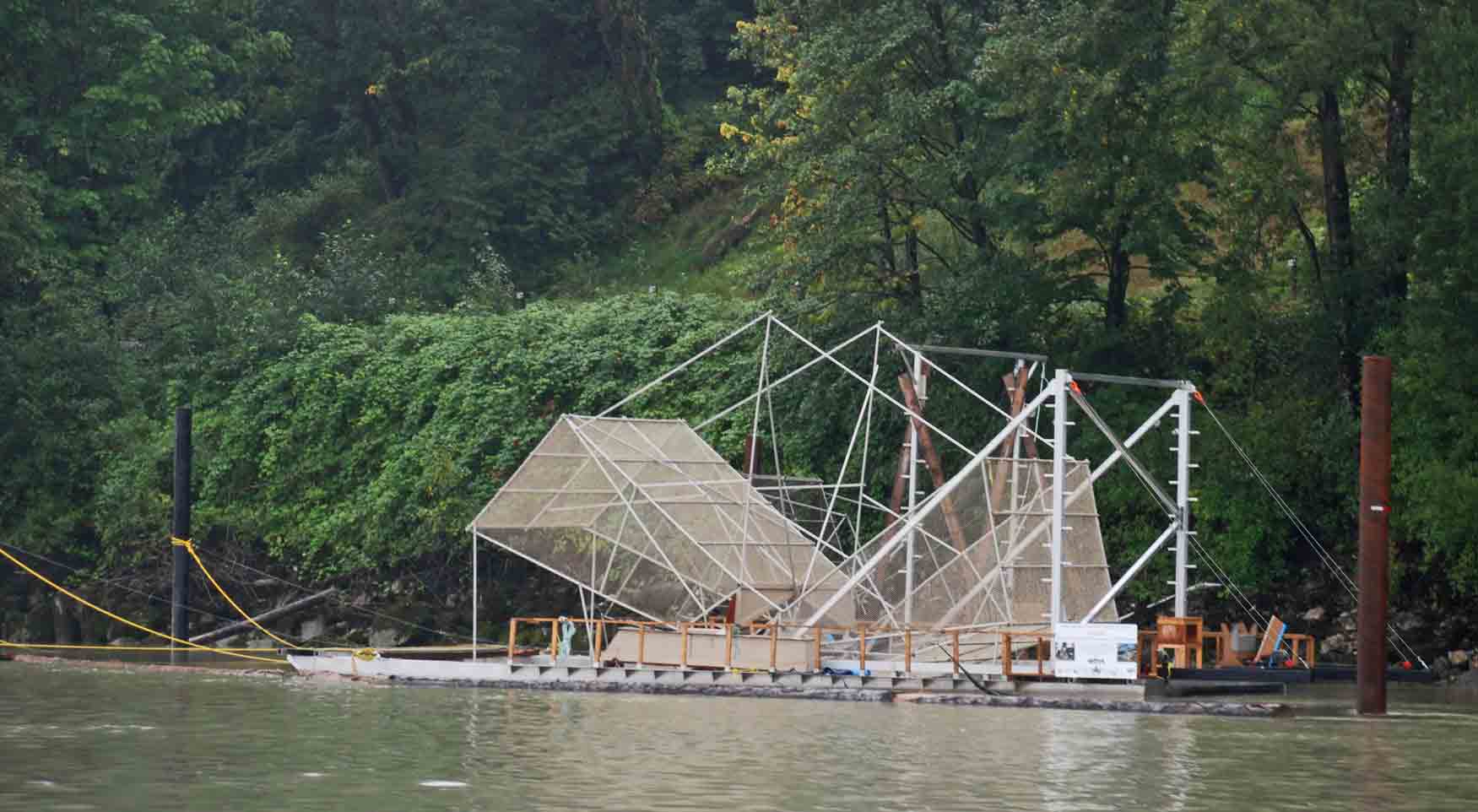
200th Ave Bridge Pier Under
Construction
Floating
Homes at Darby Reach, Langley
Fish
Counter
1830 Home Port Ceremonial
Kissing of the Dock Safe
without Incident
|
The weather was grey and wet with a socked in sky. It looked as gloomy as I felt. The return home was slow as the tide was not in our favor. We maintained a five knot speed most of the way.
As we passed River Road in Ladner, my oldest son, Peter, called us on his cell phone to say he was watching us from the dyke. He had pulled over in his truck to make a phone call and there we were! It was nice to not only hear from him but see him as well.
Once past the Port Mann Bridge in Coquitlam the commercial traffic on the river is greatly reduced. There are tugs towing logs or barges but not any of the large freighters or car carriers that can be encountered down river from this bridge. The travel is peaceful and the scenery is lovely, even in the rain. You must keep your eyes peeled for dead heads, however. We have not hit a dead head in the six years we have been traveling up the river but we do see them from time to time.
We took several pictures of the new bridge being constructed over 200th Street in Langley. This bridge will replace the shuttle service at Albion provided free for car traffic by BC Ferries. This ferry has very long line-ups and many sailing waits but reduces the driving time by forty minutes for many travelers. The long awaited 200th Street bridge will be welcomed but not the toll that must be paid to use it. |
||


