|
Sea
Foam Anniversary Cruise VI – Leg 3 June 27 – September 8, 2009 |
||
|
|
||
|
|
|
|
|
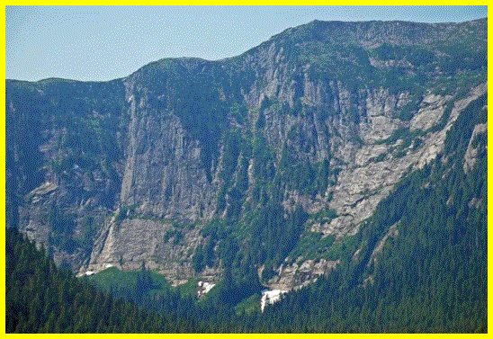
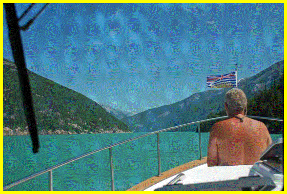
Leaving Hartley Bay with full water tanks and fuel we moved north to explore Verney Passage and the remarkable scenery found there. On both sides of the channel the mountains appear polished with glacier-carved “bowls” call cirques, in the mountains 3400 feet above. Kona needed an emergency pit stop so I circled in the boat while Rick took her to shore on a seldom seen rock beach in the area. |
||
|
|
|
|
|
Weewanie Hot Springs – First of three we plan to visit in this area. Kitimat Aquanauts Scuba club is responsible for the construction of the building and now Parks Canada maintains it. Captain Rick enjoys a soak but was disappointed that the whole thing was closed in and there was no easy way to enjoy the outdoors and the views. |
||
|
|
|
|
|
Trail leading to the hot springs if the tide is low and not easy to climb the rocks. We were lucky to arrive at high tide and could bring our tender right to shore and the building was right there. The folks in the other boat were leaving when we arrive so we had the place to ourselves. |
||
|
|
|
|
|
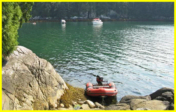
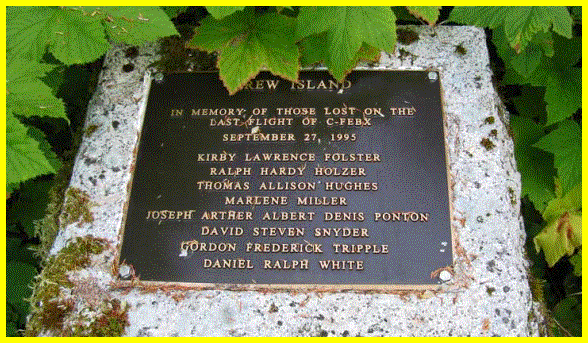
After soaking in the tub awhile we headed to our anchorage for the night in protected Triumph Bay. The bays are long and deep here and it is difficult to find a spot to put your anchor down that isn’t too deep. If you get close to the streams or rivers that are at the end of the bays you run the risk of swinging into the mud flats while you sleep as the tide goes down. One minute you are in 30 feet of water and the next you are in 6. It shoals up really fast. This area was once a logging camp and we are speculating that this monument we found on the islet we anchor near was for a float plane that went down while dropping off several people to the logging camp. |
||
|
|
|
|
|
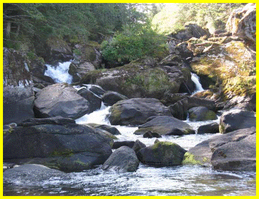
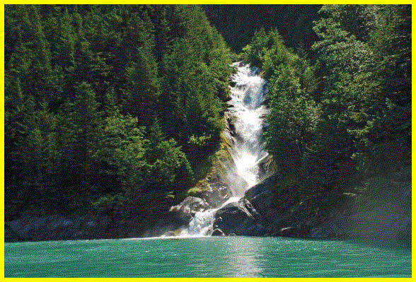
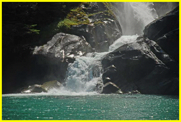
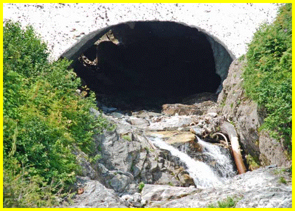
This was a little waterfall at the head of the flats where we anchored. You can see the Sea Foam in the distance in the top right corner of the picture above. |
||
|
|
||
|
This is the chart of the area we ventured into after being told by a couple from Kitimat that it was beautiful and the water was green and milky from all the fresh water that empties from the two large rivers, Kemano and Kitlope, near the end of the inlet and all the waterfalls. There is about a 2-4 foot layer of fresh water on top of the seawater. Rick took a swim in the water at the below hot springs and couldn’t taste salt at all. |
||
|
|
|
|
|
The second hot spring was at Shearwater but the locals call in Europa Bay. It was initially put together in 1983 but a landslide took it out and last year they rebuilt the structure with a picnic area above. We liked this one the best because you can see out over the water and the ferns around the pools were nice. Roofs over them keep the plant life out and the bits of stuff from the trees. |
||
|
|
|
|
|
We anchored in Europa Bay and spent a half an hour in the hot springs with a family from Smithers. This area is close to Kitimat so lots of people are around in their boats. It was very hot here, like it was in Vancouver but the sea breeze helped a lot. |
||
|
|
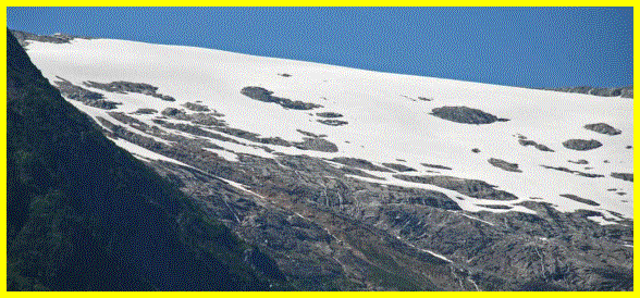
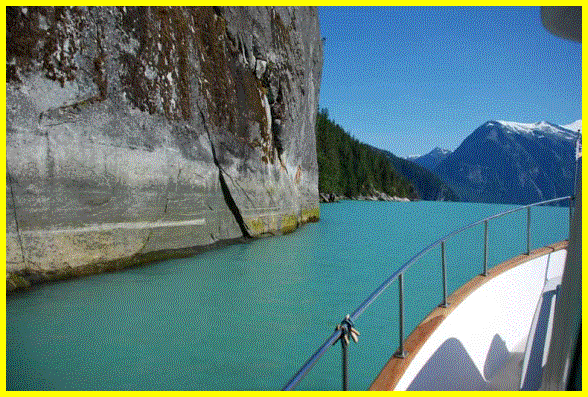
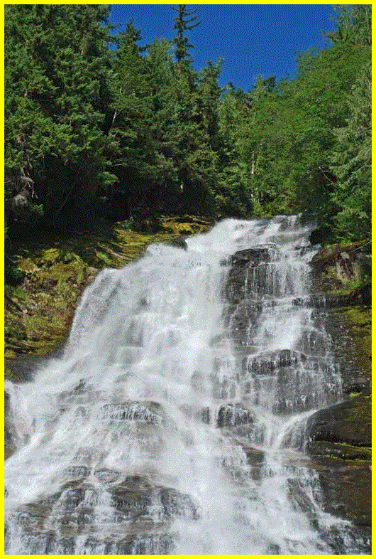
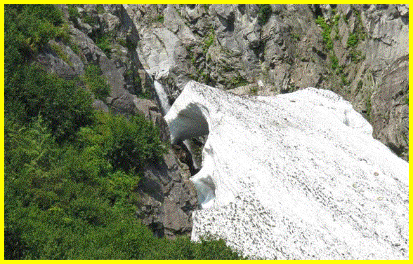
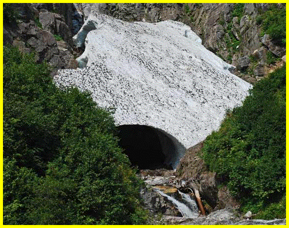
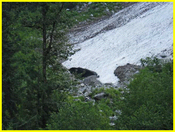
As we headed further into Gardner Canal you can see how the water is a very different color. It was a good time to wash the boat as the water is more fresh then salt at the top. We would visit three anchorages before getting to the very end of the inlet at Kitlope River. There were waterfalls every quarter mile or so and towards the end of the inlet many large areas with snow covering even at the waterline where they have either not completely melted yet or have been pushed down by avalanches or landslides. The water was deep right up to the shore line. The whole while we were in the inlet – 3 days – we did not see one other boat. There is no radio reception in the area because the mountains are so tall and steep so it made me feel a bit vulnerable to be 150 miles away from the ocean and no way to call in. We do have our SPOT satellite transmitter if there was an emergency but it was still a little eerie. The beauty of the scenery helped to keep my mind off of it. |
|
|
|
|
|
|
|
|
|
|
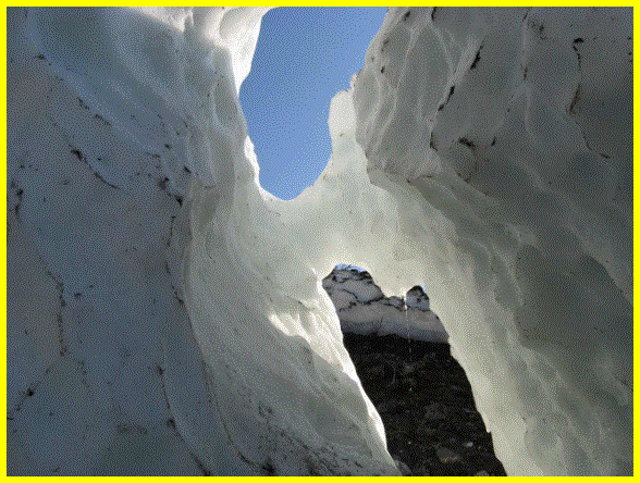
The mountains from the inside of the pilot house look like they were right on top of us. The snow and ice, snowcaves, waterfalls and rock formations throughout the canal were awesome to see. |
||
|
|
|
|
|
|
|
|
|
|
|
|
|
|
||
|
|
|
|
|
|
|
|
|
|
|
|
|
|
|
|
|
Chief Mathews Bay Anchorage |
|
|
|
|
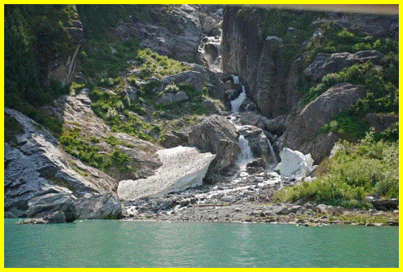
Ice and snow were down at the waterline in the anchorage and we were able to get out and play around in it with our tender. |
|
|
|
|
|
|
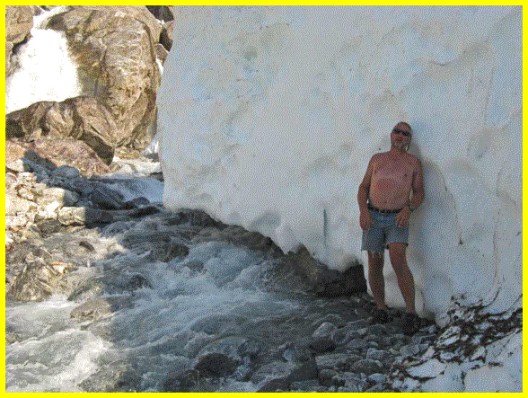
While we heard folks were suffering from the heat in the city Rick was cooling his back on a large hunk of ice in Chief Mathews Bay. |
|
|
|
|
CA chill’n out on a hunk of snow. |
|
|
|
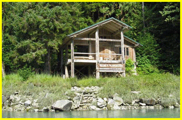
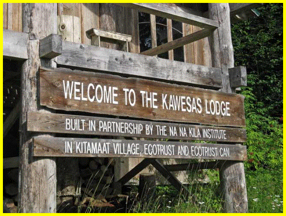
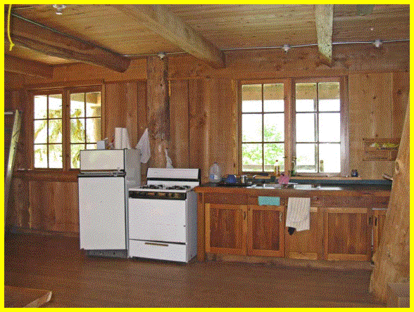
A well built cabin on the banks of the Kowesas River at the head of Chief Mathews Bay. |
|
|
|
|
|
|
|
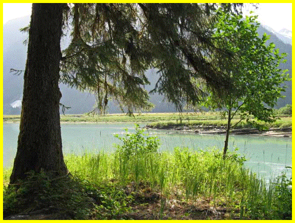
View over the river from the cabin. |
|
|
|
|
|
|
|
|
|
|
Rick in the kitchen on the steps that lead to the large loft upstairs. Beds and foam were there for sleep over guests. |
A large area where the kitchen and a huge table surround the wood stove. The porch is large and covered. |
|
|
|
Another beautiful waterfall across from our boat in Chief Mathews Bay. Water, water everywhere! |
|
|
|
|
|
|
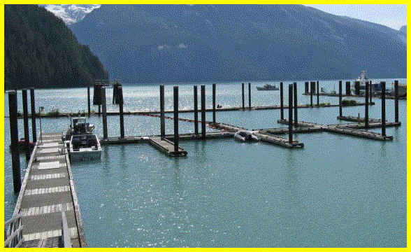
We went to the end of the inlet and had to turn around at the Kitlope River. We passed Kemano Bay on our return and took Kona to shore using the docks there. The Alcan boat, Nechako, was tied to their private dock. There was no one to be seen in the area but apparently there is a watchman up the road seven miles. |
|
|
|
|
|
|
|
Owyacumish Bay where we anchored for the night. The waterfall there was remarkable and we could here it rushing all through the night from our boat. I was up all night as the wind picked up and I was afraid we would be either blown into the shallows of the Brim River (where this cabin is located) or blown off our anchor and into deep water. At 4:30 in the morning the wind was blowing so hard outside the anchorage in Barrie Reach that the waves from there were coming into our anchorage. The Captain said, “Let’s do some night travel.” We weighed anchor and headed out of there. When we got out of the anchorage the waves were six feet high right on our side so we were glad to get out of there and away down the inlet. As we turned the next corner of the canal the wind and waves were behind us. We weren’t long in the dark and the moon was out. We motored on into Kitsaway anchorage, dropped our anchor and slept for most of the day. |
||
|
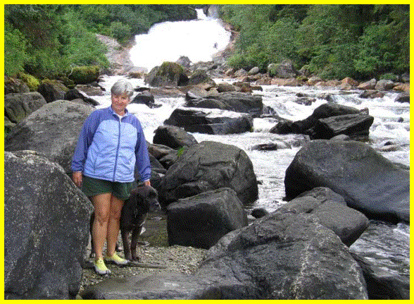
Rick posing at the waterfall in Owyacumish Bay. |
Wow Ridge just outside of Owyacumish Bay |
|
|
|
|
|
|
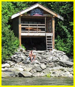
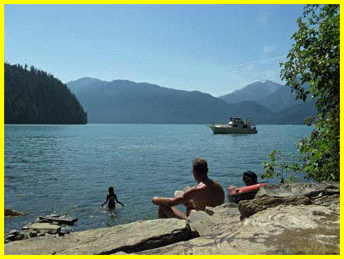
After we had rested well we moved on to the third hotsprings location at Bishop Bay. There is a dock there that we were lucky to find space on because, again, the bay is very deep with poor anchoring for large boats. We were told that the building was rebuilt last year and the boardwalks from the dock to the hotsprings are very sturdy. There is a spot for kayakers to camp with three wooden platforms for their tents. |
||
|
|
|
|
|
Captain Rick soaks in Bishop Bay hotsprings. |
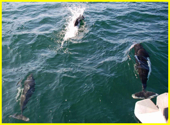
We were buzzed by three Dalls Porpoises in Finlayson Channel. Kona alerted us to them as we sat in the pilot house. She was outside walking around the decks and started whining and standing up on the cap rail. She thinks we’re under attack when porpoises or dolphins ride our bow wave. These guys look like miniature killer whales with white markings on their sides and tail. It’s very hard to get a good picture of them because they move so fast. |
|
|
|
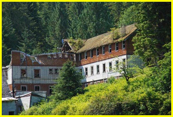
The old cannery at Butedale. What a shame to see all these buildings going to ruin. An old fellow lives here and still welcomes folks to the dilapidated docks. I’m afraid he is fighting a losing battle here. Apparently several groups of people have tried to restore the site over the years as it is a good spot for boaters to stay the night but each group has given up. |
|
|
|
|
|
|
|
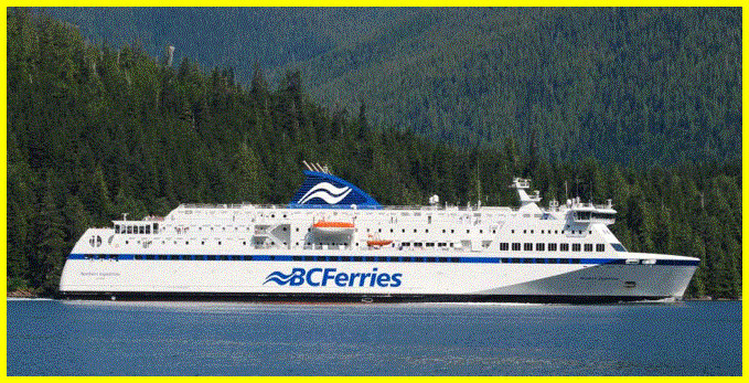
The Northern Explorer that will take you from Port Hardy to Prince Rupert to experience the Inside Passage. |
|
|
After a quick drive by at Butedale we continued on down Finlayson Channel to our intended anchorage in Bottleneck Inlet. We hit a wind against current situation and had steep 5-6 foot waves on our bow as we meandered down Finlayson. We had a bit of a break from the waves at Hiekish Narrows were it was relatively calm. We were glad of it because there is current and reefs to negotiate in the narrows and we didn’t need waves on top of that to complicate things. When we got to the junction at Sheep Pass where you can turn to port and into Fiordland, we hit more wind and waves and were very glad to turn into the narrow entrance at Bottleneck Inlet and find a very sheltered and peaceful anchorage for the night. The next morning was a whole new day and the wind was gone and Finlayson was quiet for us. We made our way to Klemtu to get some groceries and water and make use of their cell phone reception to update the website and call friends and family. |
||
|
|
|
|
|
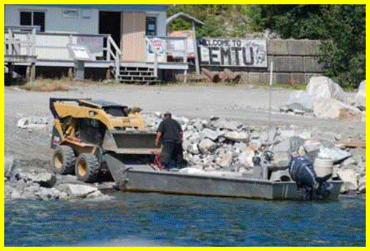
A Klemtu resident making arrangements to haul his boat out of the water for some quick repairs. |
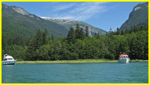
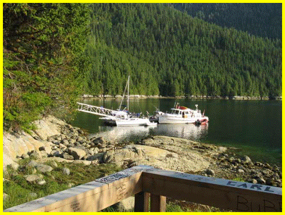
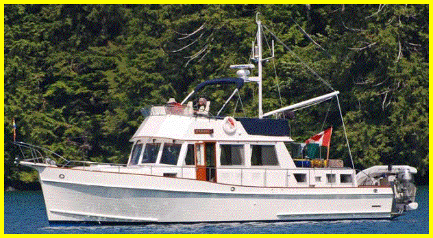
We met up with friends from Saltspring, Brian and Anne on the Sterling (above) and Jim and Joy Eastman aboad the Kimje. We all met later in the afternoon for happy hour in Rescue Bay after traveling through Jackson Narrows Marine Park. We hadn’t seen Brian and Anne for 3 years but did see Jim and Joy last year. |
|
|
|
|
|
|
Our next anchorage was down the channel just east from Shearwater offGunboat Pass at Gunboat Lagoon Cove. The anchorage is unmarked on the chart but is endorsed by the Waggoner Cruising Guide and the Douglass’. It was a very nice anchorage and we took a trip in our tender into the lagoon at the back at high water. These two pictures show the different between the same location at high water and low water. There is an outer lagoon that is the same height as the cove. However, the inner lagoon is four to five feet higher than the cove level. As you can see, at low tide the water from the back of the lagoon pours over the rocks on an ebb tide. It is also interesting to notice the amount of water that covers the rock on the left at high tide compared to low tide on the right. Low tide also, unfortunately, beached a very large blubber jellyfish and Kona stepped on it with her right foot when she went to shore just before we went to sleep. She was stung badly by the tentacles and came back to the boat with Rick just frantic trying to understand what was hurting her so much. Luckily we were still able to get internet reception from the Bella Bella tower for our cell phone and we looked up the first aid for such stings. We put her foot in apple cider vinegar and some water, didn’t rub it, later slathered on a paste made from baking soda and water and iced it. She had Advil that night and also the next day. We were lucky she didn’t have any allergic reactions to the poison or we would have been in much bigger trouble. Next morning we headed out for Shearwater to tie up at the dock and do laundry and buy their fresh fruit and produce that arrives on Sundays. The store is closed from 11-3 and when it reopens there is a line-up at the check-out of locals and the tourists alike stocking up on supplies. We bought some more fishing tackle and bait and headed for Ocean Falls the next morning. |
||
|
|
|
|
|
|
|
|
|
|
|
|
|
|
|
|
|
|
|
|